
Geographischen Institutes Weimar

Geographisches Institut, Weimar (fl. 1804 - c. 1903) was a German map and globe publishing house and geographical research institute based in Weimar. The organization primarily focused on republishing and improving upon the works of earlier cartographers, including Kitchin, Jefferys, Carey, and others. In general, its publications are known for their fine engraving, attention to detail, historical accuracy, and overall high quality. The firm was founded in 1804 by Friedrich Justin Bertuch (???? - c. 1845) and, on his death, passed to his son Robert Froreip (???? - 1855), then to Louis Denicks of Luneberg, then in 1859 to Voigt & Günther, in 1883 to F. Arnd, from 1890 - 1893 to Julius Kettler, and in 1903 to Max Wedekind. During the institute's height in the early 19th century, most of its cartographic publication was overseen by Carl Ferdinand Weiland (1782 - 1847). The firm also employed the cartographers Franz Xaver von Zach, Adam Christian Gaspari, Heinrich Kiepert, Karl (or Carl) and Adolf Graef, Julius Kettler, Carl Riemer and Karl Christian Bruhns. Weimar was a logical place for a collective like the Geographisches Institut to arise; it was a cultural mecca in the German-speaking world in the late 18th and 19th centuries because of its liberal atmosphere and associations with figures like Schiller, Herder, and, above all, Goethe, who spent most of his adult life in the city.
British ascendence in South and Southeast Asia.
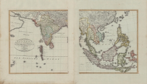
Charte von Ostindien diesseits und jenseits des Ganges.
$600.00
Acquire
- Digital Map Information
- Suitable for large format printing
- Full resolution TIFF file
- ICC color profile embedded
- Delivered instantly via download link
A beautiful 1804 German-language two-sheet map of the East Indies by J. C. M. Reinecke. It depicts the region as British power was ascendant, displacing both indigenous kingdoms and European rivals. (more details)
French mapping of a major British port during the Napoleonic Wars.
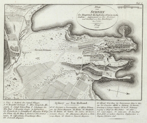
Plan von Sydney der Hauptstadt der Englischen Colonien in Australien. Aufgenommen von Hrn. Lesueur; und berichtigt von Hrn Boullanger i. J. 1802.
$950.00
Acquire
- Digital Map Information
- Suitable for large format printing
- File Size: 3.92 MB
- File Type: ZIP / TIFF
- ICC color profile embedded
- Delivered instantly via download link
One of the earliest obtainable maps of the city of Sydney, Australia, this is an 1815 German edition of an 1802 manuscript map by Charles-Alexandre Lesueur. (more details)
Das Land der Freien.
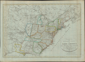
Charte von den Vereinigten Staaten von Nord-America nebst Louisiana und Florida : nach Murdochischer Projection und den neuesten astronomischen Ortsbestim[m]ungen
$950.00
Acquire
- Digital Map Information
- Suitable for large format printing
- Full resolution TIFF file
- ICC color profile embedded
- Delivered instantly via download link
This is an 1817 Franz Ludwig Güssefeld German-language map of the United States of America that appeared in Gaspari's Grosser Hand-Atlas, published by the Geographisches Institute in Weimar. It provides a fascinating glimpse into the dissemination of knowledge to a European audience about the young republic across the Atlantic. (more details)
Presaging the Republic of Texas.
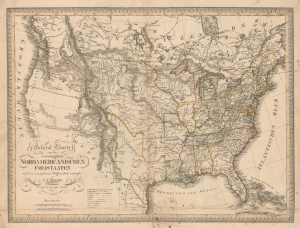
General Charte von den vereinigten Nordamericanischen Freistaaten nach den vorzüglichsten Hülfsmitteln entworfen.
$3,500.00
Acquire
- Digital Map Information
- Suitable for large format printing
- Full resolution TIFF file
- ICC color profile embedded
- Delivered instantly via download link
This is a rare 1821 C. F. Weiland map of the United States, including the ephemeral Mexican state of Texas. The map is graphically suggestive of either an independent Texas or a Texas as part of the United States, thus presaging the Texan Revolution, the borders claimed by the Republic of Texas, and the Mexican-American War. It illustrates Texas's brief period of semi-provincehood following Mexican Independence but before the 1824 ratification of the Mexican Constitution, which merged Texas with Coahuila. This is thus one of the first maps, if not the first, to present a modern, recognizable Texas. This is also one of the few maps to name the ephemeral Bonapartist colony of Champ d'Asile (Champ d'Asyle; 1818 - 1819), located in South Texas on the Trinity River. (more details)
A scarce 19th century map od Denmark.
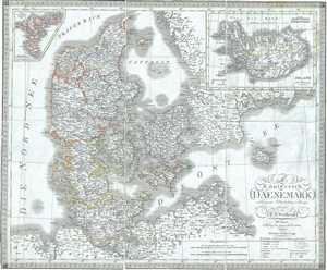
Das Konigreich Daenemark nebst seinen Nebenlaendern in Europa.
$250.00
Acquire
- Digital Map Information
- Suitable for large format printing
- Full resolution TIFF file
- ICC color profile embedded
- Delivered instantly via download link
This is a scarce separate-issue example of the 1825 C. F. Weiland map of Denmark. The map covers all of Denmark inclusive of the Duchy of Holstein. An inset in the top right quadrant features a map of Iceland, which has been fairly well mapped since the late 16th ... (more details)
Beautiful map of France noting its various departments.
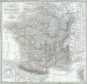
Charte von Frankreich.
$250.00
Acquire
- Digital Map Information
- Suitable for large format printing
- Full resolution TIFF file
- ICC color profile embedded
- Delivered instantly via download link
This is a scarce separate-issue 1826 C. F. Weiland map of France. It covers the Kingdom of France showing its various military divisions and departments. Corsica is included in the lower right quadrant. A list of French Departments appears along the right ... (more details)
Map depicting the dominions of the Ottoman Empire in Asia.
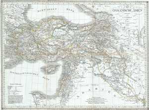
Das Osmanische Asien.
$250.00
Acquire
- Digital Map Information
- Suitable for large format printing
- Full resolution TIFF file
- ICC color profile embedded
- Delivered instantly via download link
This is a scarce separate-issue 1826 map of Turkey or Asia Minor by C. F. Weiland. Centered on Turkey, it covers from the Black Sea south to the Nile Delta, depicting the colonies under the Ottoman Empire, including Cyprus, Turkey, Cyprus, Lebanon, Holy ... (more details)
Translating geographic knowledge in Humboldt's wake.
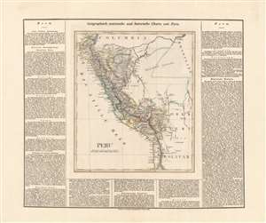
Peru.
$550.00
Acquire
- Digital Map Information
- Suitable for large format printing
- DPI: 600
- File Size: 57.42 MB
- File Type: ZIP / TIFF
- ICC color profile embedded
- Delivered instantly via download link
This is an 1827 German edition of Matthew Carey and Isaac Lea's map of Peru, published in Weimar by the Geographischen Instituts. It is an early map, among the first in German, of Peru following its independence, which had only been secured the previous year. (more details)
Scarce map of European Russia during the early 19th century.
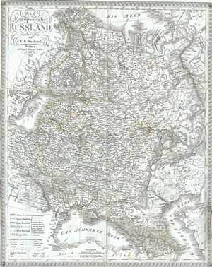
Das Europaeische Russland.
$250.00
Acquire
- Digital Map Information
- Suitable for large format printing
- Full resolution TIFF file
- ICC color profile embedded
- Delivered instantly via download link
A scarce separate-issue 1827 map of European Russia by C. F. Weiland. It covers from Lapland to the Caspian Sea and from the Baltic Sea to the Ural Mountains. Various, important rivers, islands, cities and other topographical details are noted. In ... (more details)
Attractive early 19th century map of Spain and Portugal.
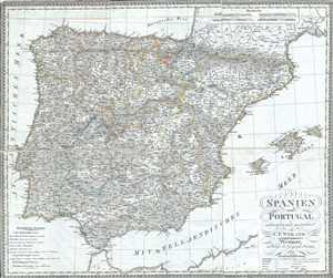
Spanien und Portugal.
$250.00
Acquire
- Digital Map Information
- Suitable for large format printing
- Full resolution TIFF file
- ICC color profile embedded
- Delivered instantly via download link
This is a scarce separate-issue 1827 map of Spain and Portugal by C. F. Weiland. It covers the Iberian Peninsula from the Bay of Biscay in the north to the Strait of Gibraltar in the south and from the Atlantic Ocean to Catalonia in the east. The ... (more details)
Attractive map of the Americas backed by linen.
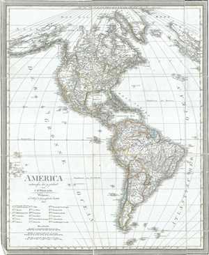
America.
$450.00
Acquire
- Digital Map Information
- Suitable for large format printing
- Full resolution TIFF file
- ICC color profile embedded
- Delivered instantly via download link
This is a scarce separate-issue 1828 map of North America and South America by C. F. Weiland. It covers the entire western hemisphere in its entirety from the Arctic south to Cape Horn, including the West Indies and the Falkland and South Shetland ... (more details)
Attractive map of Prussia backed on linen.
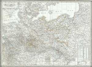
General Charte von dem Preussischen Staate.
$250.00
Acquire
- Digital Map Information
- Suitable for large format printing
- Full resolution TIFF file
- ICC color profile embedded
- Delivered instantly via download link
This is a scarce separate-issue 1828 map of Prussia by C. F. Weiland. Covering parts of the modern day nations of Poland, Lithuania and Germany, Prussia stretches across the map from Lower Rhine moving eastward, including Brandenburg and Saxony, ... (more details)
Beautiful map of Switzerland on linen.
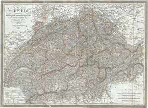
Die Schweiz oder Helvetische Eidgenossenschaft.
$200.00
Acquire
- Digital Map Information
- Suitable for large format printing
- Full resolution TIFF file
- ICC color profile embedded
- Delivered instantly via download link
A scarce separate-issue 1828 C. F. Weiland map of the Helvetic Confederation of Switzerland. It covers the entirety of Switzerland divided into Cantons. With its unique blend of dramatic mountains and stunning vistas, Switzerland is considered ... (more details)
Multiethnic Heartland of the Habsburg Realm.
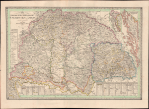
Charte von den Kaiserlich Oesterreichischen Ungarischen Ländern.
$950.00
Acquire
- Digital Map Information
- Suitable for large format printing
- File Size: 50.41 MB
- File Type: ZIP / TIFF
- ICC color profile embedded
- Delivered instantly via download link
This is Friedrich Wilhelm Streit's rare 1830 map of the Kingdom of Hungary and associated territories, published by the Geographisches Institut, Weimar. It displays the Lands of the Hungarian Crown, including Transylvania, Slovakia, and much of today's Croatia, in the wake of the Napoleonic Wars (1803 - 1815) as the Habsburgs adjusted to a changed political landscape. (more details)
The Pirate Coast.
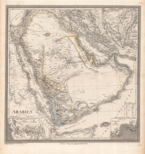
Arabien.
$1,500.00
Acquire
- Digital Map Information
- Suitable for large format printing
- Full resolution TIFF file
- ICC color profile embedded
- Delivered instantly via download link
This is an 1848 Heinrich Kiepert map of the Arabian Peninsula. It displays the region, only poorly understood by Europeans, in impressive detail. Of note is the controversial term 'Pirate Coast' (roughly the UAE), and the route of Finnish Arabist George August Wallin. (more details)
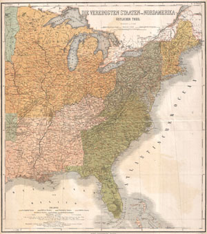
Die Vereinigten Staaten von NordAmerika (Ostlicher Theil)
$400.00
Acquire
- Digital Map Information
- Suitable for large format printing
- File Size: 19.11 MB
- File Type: ZIP / TIFF
- ICC color profile embedded
- Delivered instantly via download link
This is a rare 1886 example of C. Graf's map of the United States of America. The map covers the eastern part of the United States from eastern Texas to the Atlantic, extending northward as far as Lake Superior, and southward to the Florida ... (more details)