
Hansard, Luke (sold)
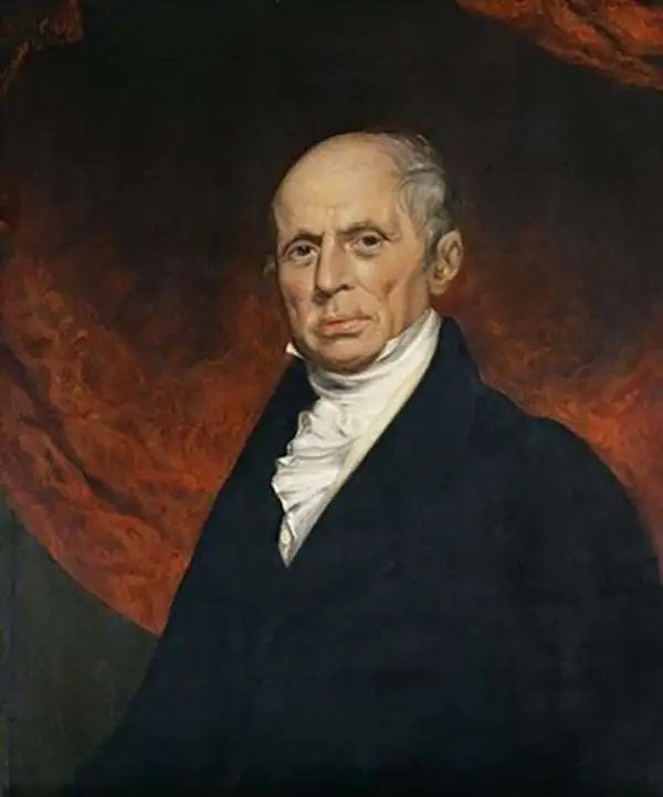
Luke Hansard (July 5, 1752 - October 29, 1828) was an English printer active in London during the early late 18th and early 19th century. Hansard was born in St. Mary's Parish, Norwich and attended Kirton Grammar School in Lincolnshire. Following grammar school, he apprenticed with Stephen White, a printer in Norwich. At the end of his apprenticeship he relocated to London where he took work with John Hughes (1703-1771), a printer for the House of Commons. Hard work and good relationship with the Hughes family led to Hansard being made partner in 1774 and by 1800, the he held full ownership of the Hughes firm, which he renamed Luke Hansard and Sons. The firm continued to publish books and maps for the House of Commons, including the Journals of the House of Commons. The business was mostly taken over by his son James and Luke Graves Hansard. Another son, Thomas Curson Hansard (November 6, 1776 - May 5, 1833), ran another separate press from about 1803, is known for printing Parliamentary Debates. The firm, Hansard, continues to publish to this day.
Rare map of the Virgin Islands with slave trade content, shipwrecks, and Necker Island!
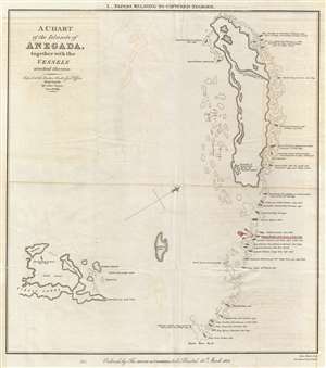
A Chart of the Island of Anegada, together with the Vessels wrecked thereon.
sold
- Digital Map Information
- Suitable for large format printing
- DPI: 300
- File Size: 4.13 MB
- File Type: ZIP / TIFF
- ICC color profile embedded
- Delivered instantly via download link
This is a rare 1825 map of Anegada Island, the northernmost of the British Virgin Islands, illustrating shipwrecks occurring between 1799 and 1823. This map was specifically prepared to illustrate the wreck of the Donna Paula , which is highlighted in red, a slave ... (more details)
The earliest obtainable map of Wellington, capital of New Zealand. Shows Maori land grants.
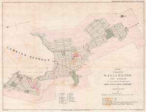
Plan of the City of Wellington Port Nicholson the First and Principal Settlement of the New Zealand Company.
sold
- Digital Map Information
- Suitable for large format printing
- DPI: 300
- File Size: 9.17 MB
- File Type: ZIP / TIFF
- ICC color profile embedded
- Delivered instantly via download link
This rare 1841 map of Wellington is one of the earliest obtainable plans of the modern-day capital of New Zealand. The map was surveyed on behalf of the New Zealand Land Company in 1840 by the first Surveyor-General of New Zealand, Felton Mathew. Mathew laid out the new city's road and grid system in precise detail. The street grid shown here is still reflected in the modern city. This map was issued in 1842 for the House of Commons, probably in conjunction with the Spain Commission, and based upon Mathew's 1840 manuscript survey. (more details)