
Heather, William (sold)
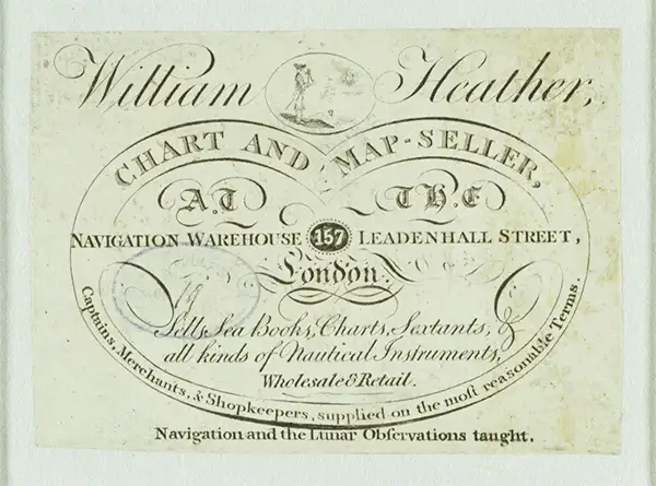
William Heather (1793 – 1812) was a British nautical chart engraver and publisher active in the late 18th and early 19th centuries. Heather was born in Lambeth but shortly after relocated with his family to the parish of Christ Church, Southwark. He was apprenticed to George Michell, a London stationer. Heather reached his maturity and became a member of the Stationers Company in 1789. His earliest known cartographic work appeared in conjunction with the offices of John Hamilton Moore, with whom he was employed. Around 1793 Heather started his own competing nautical chart business at 157 Ledenhall Street, London. This office remained the home of his firm for an astounding 85 years. Heather soon took on the Scotsman John William Norie as an apprentice Norie eventually inherited Heather's business and map plates, beginning his own long career as a maker of English blueback charts.
Scarce nautical chart of the eastern Mediterranean Sea by William Heather.
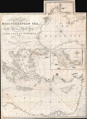
A Chart of the Mediterranean Sea, Including the Gulf of Venice and Black Sea.
sold
- Digital Map Information
- Suitable for large format printing
- Full resolution TIFF file
- ICC color profile embedded
- Delivered instantly via download link
A dramatic 1822 nautical chart of the eastern part of the Mediterranean Sea by William Heather and John Norie. This map was first issued by William Heather's Navigation Warehouse and Naval Academy in 1812. The original map covered the entire Mediterranean on three sheets, of which this is the easternmost panel. The panel's were intended to be joined, or as here used as stand-alone charts. The present example covers from the Ionian Islands to modern day Israel and from the Crimea to the Nile Delta, encapsulating all of modern-day Greece, the western Black Sea, Cyprus, much of modern day Turkey, the Balkans, Israel and Lebanon, and northern Egypt. A detachable flap extends coverage of the Black Sea northwards as far as Odessa. An inset map details the harbor of Smyrna, or modern-day Izmir, Turkey. (more details)
Beautiful, rare, and important, this blueback chart of Jamaica was issued in the year of the Great Jamaican Slave Revolt or Baptist War.
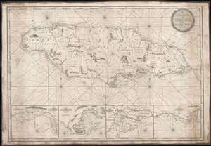
The Island of Jamaica, by W. Heather.
sold
- Digital Map Information
- Suitable for large format printing
- Full resolution TIFF file
- ICC color profile embedded
- Delivered instantly via download link
This is a rare and stunning 1832 blueback nautical chart or map of Jamaica by William Heather and John W. Norie. As a working chart, it bears all of the hallmarks of a shipboard chart and a life at sea. The map details all of Jamaica with four inset detail harbor maps along the bottom, from left: Savanna, Portland Point, Kingston, Morant. Sounding along the south coast, and in the insets, in fathoms.
Unlike many British blueback charts, the present map actually offers considerable inland detail. Here Jamaica is divided into three counties (Cornwall, Middlesex and Surry), each of which is in turn subdivided into Parishes. The chart includes significant topographical detail, including roads, rivers, mountains, towns, churches, military camps, and more. (more details)
Unlike many British blueback charts, the present map actually offers considerable inland detail. Here Jamaica is divided into three counties (Cornwall, Middlesex and Surry), each of which is in turn subdivided into Parishes. The chart includes significant topographical detail, including roads, rivers, mountains, towns, churches, military camps, and more. (more details)
Extremely rare nautical chart of the Kattegat and Baltic Seas.
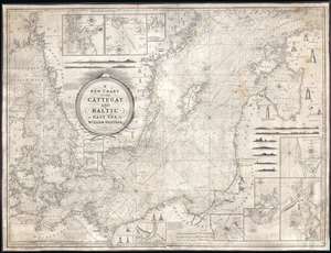
A New Chart of the Cattegat and Baltic or East Sea.
sold
- Digital Map Information
- Suitable for large format printing
- DPI: 300
- File Size: 45.15 MB
- File Type: ZIP / TIFF
- ICC color profile embedded
- Delivered instantly via download link
This is an extremely rare and extraordinarily beautiful 1837 William Heather and John William Norie blueback nautical chart or maritime map of the Kattegat and Baltic Seas. The map depicts the region from Norway and Denmark (Jutland) to the Baltic States of Estonia and Latvia (Eastland, Livonia, Courland) and from Norway and the Gulf of Finland to northern Europe. The map is highly detailed with numerous cities are labeled, including Copenhagen, Stockholm (Christiana), Gdańsk (Danzig), Talinn (Revel), and Riga. Myriad depth soundings are indicated, particularly in the Kattegat Sea and along the coastlines. Numerous inset maps are included along three of the four sides. Along the top border, three inset maps situated and illustrate the entrances to Gothenburg, the principal entrance to Stockholm, and the harbor of Sleete or Slitehamn, on the island of Gottland. Along the right side and bottom border, inset maps depict the entrance to Klaipėda (Memel), Lithuania, Riga, Rogerwyck, the entrance to Szczecin (Stettin), Poland, Baltiysk, Poland, and a second inset map illustrating the entrance to Szczecin. Manuscript notations in yellow ink throughout the map mark the locations of lighthouses and other lights used for navigation. Twenty-eight different lighthouses are illustrated in profile, along with notes concerning others. One such note, located on the Jutland Peninsula, informs the viewer that a striped flag is hoisted from the Scaw lighthouse if ice in the Kattegat impedes navigation. Other notes inform the viewer on improvements to harbors, or when the lighthouses in certain parts of the region are lit. Several coastal views are also illustrated, allowing a mariner to have a better understanding of what they should be seeing when passing a given stretch of coastline. An extremely decorative title cartouche is situated slightly to the left of center. (more details)