
Holland, Samuel (sold)
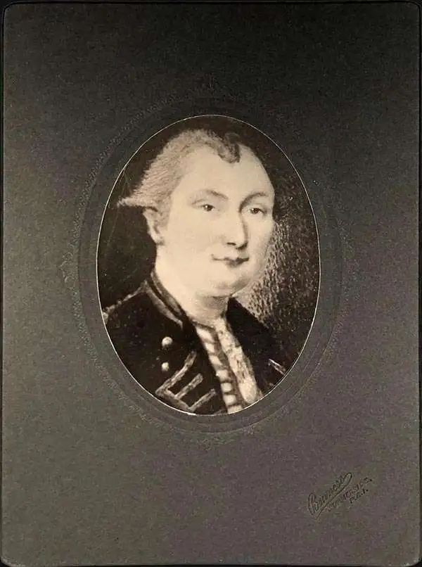
Samuel Holland (1728 - December 28, 1801) was a surveyor and cartographer of extraordinary skill and dedication. Holland was born in the Netherlands in 1728 and, at 17, joined the Dutch Army where he attained the rank of Lieutenant. Around 1754 Holland emigrated to England where he joined the newly forming Royal American Regiment. His skills as a cartographer and surveyor brought him to the attention of his superiors who offered him steady promotions. In 1760 he prepared an important survey of the St. Lawrence River system. It was during this survey that Holland met a young James Cook, who he mentored in the art of surveying. Cook, best known for his exploration of the Pacific, developed many of his own revolutionary nautical surveying techniques based the systems he learnt from Holland. In 1762 Holland caught the attention of the Commission of Trade and Plantations, who governed the British Crown Colonies in America. Under the umbrella of the Trade Commission Holland prepared surveys of the Hudson River Valley and other New York properties. In 1764 he was named Surveyor General for the Northern District, the position in which he did much of his most important work. Holland is also known for surveying done in an attempt to sort out the New York - New Jersey border conflict. Following his work in New York Holland relocated to Canada where, with his new wife of just 21 years, he sired seven children. Like many early surveyors working for colonial governments, Holland was poorly compensated and is known to have supplemented his income by selling the results of his surveys, and those of other surveyors to which he had privileged access, to private publishers, among them the London firm of Laurie and Whittle, who published his work under the pseudonym of 'Captain N. Holland.' Samuel Holland died in Quebec in 1801.
The rarest and earliest state of a seminal map.
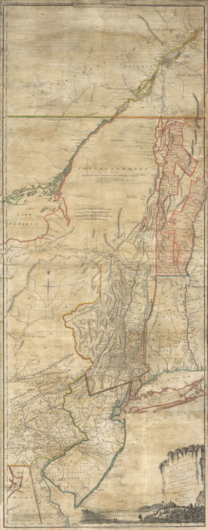
The Provinces of NEW YORK and NEW JERSEY with part of PENSILVANIA, and the Governments of TROIS RIVIERES, and MONTREAL: drawn by Capt. Holland. / A Chorographical Map of the Country between Albany, Oswego, Fort Frontenac, and Les Trois Rivieres; Exhibing all the Grands made by the French Governors on Lake Champlain; & between that Lake & Montreal.
sold
- Digital Map Information
- Suitable for large format printing
- Full resolution TIFF file
- ICC color profile embedded
- Delivered instantly via download link
A first issue first edition example of a seminal map. This is a rare and unusual version of the 1768 first edition of Holland and Jefferys seminal map of New York and New Jersey. Depicts the important trade corridor between New York and Montreal, specifically ... (more details)
New York, New Jersey, and the Hudson Valley on the brink of the American Revolutionary War.
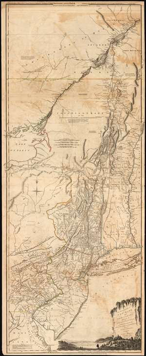
The Provinces of NEW YORK, and NEW JERSEY; with part of PENSILVANIA, and the Governments of TROIS RIVIERES, and MONTREAL: drawn by Capt. Holland. / A Chorographical Map of the Country between Albany, Oswego, Fort Frontenac, and Les Trois Rivieres; Exhibiting all the Grants made by the French Governors on Lake Champlain; and between that Lake and Montreal.
sold
- Digital Map Information
- Suitable for large format printing
- DPI: 300
- File Size: 32.59 MB
- File Type: ZIP / TIFF
- ICC color profile embedded
- Delivered instantly via download link
One of the most important, influential, and comprehensive American Revolutionary War Era maps of New York, New Jersey, Vermont, and the Hudson Valley corridor, this is an early 1775 edition of Capt. Samuel Holland and Thomas Jeffrey's Provinces of New York and New Jersey… Holland's map illustrates the important strategic and trade corridor between New York and Montreal, specifically detailing from Delaware Bay northward including parts of eastern Pennsylvania, New Jersey, Long Island, New York, Connecticut, Massachusetts and Vermont as well as the Iroquois League, the Trois Rivieres territories, and Montreal, as far as Lac St. Pierre in modern-day Quebec. In the lower right, a scenic cartouche illustrates the wide and easily navigable expanse of the Hudson River - surely an enticement to the region. (more details)
Premier general chart of New England at the outbreak of the Revolutionary War.
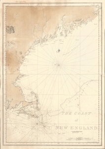
The Coast of New England.
sold
- Digital Map Information
- Suitable for large format printing
- File Size: 47.49 MB
- File Type: ZIP / TIFF
- ICC color profile embedded
- Delivered instantly via download link
This is J. F. W. Des Barres' 1776 nautical map of New England. This was the best and most accurate general chart of New England issued at the outbreak of the American Revolutionary War (1775 - 1783). (more details)
Scarce final issue of the important Holland-Jefferys Map New York, New Jersey, and the Hudson Valley on the brink of the American Revolutionary War. The best obtainable Revolutionary War Era map of this region.
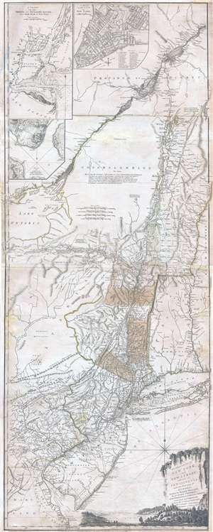
The Provinces of NEW YORK, and NEW JERSEY; with part of PENSILVANIA, and the Governments of TROIS RIVIERES, and MONTREAL: drawn by Major Holland, Surveyor General, of the Norther District in America. / A Chorographical Map of the Country between Albany, Oswego, Fort Frontenac, and Les Trois Rivieres; Exhibiting all the Grants made by the French Governors on Lake Champlain; & between that Lake & Montreal.
sold
- Digital Map Information
- Suitable for large format printing
- DPI: 300
- File Size: 26.6 MB
- File Type: ZIP / TIFF
- ICC color profile embedded
- Delivered instantly via download link
One of the most important, influential, and comprehensive American Revolutionary War Era map of New York, New Jersey, Vermont, and the Hudson Valley corridor, this is an final 1776 state of Major Samuel Holland and Thomas Jeffrey's Provinces of New York and New ... (more details)
One month after the Declaration of Independence.
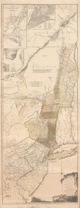
The Provinces of NEW YORK, and NEW JERSEY; with part of PENSILVANIA, and the Governments of TROIS RIVIERES, and MONTREAL: drawn by Capt. Holland. / A Chorographical Map of the Country between Albany, Oswego, Fort Frontenac, and Les Trois Rivieres; Exhibiting all the Grants made by the French Governors on Lake Champlain; and between that Lake and Montreal.
sold
- Digital Map Information
- Suitable for large format printing
- File Size: 55.63 MB
- File Type: ZIP / TIFF
- ICC color profile embedded
- Delivered instantly via download link
This is one of the most important, influential, and comprehensive American Revolutionary War Era maps of New York, New Jersey, Vermont, and the Hudson Valley corridor. It was issued a little over one month after the adoption of the Declaration of Independence and represents the most contested theaters of the American Revolutionary War (1775 - 1783). (more details)
Revolutionary War Map for the Hessian Market.
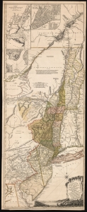
The Provinces of NEW YORK, and NEW JERSEY; with part of PENSILVANIA, and the Province of Quebec. Drawn by Major Holland, Surveyor General, of the Northern District in America. Corrected and Improved, from the Original Materials, By Governr. Pownall, Member of Parliament. Published by Harry Lodowick Broenner, Book-seller to Franckfort upon the Mayn. 1777.
sold
- Digital Map Information
- Suitable for large format printing
- DPI: 600
- File Size: 162.27 MB
- File Type: ZIP / TIFF
- ICC color profile embedded
- Delivered instantly via download link
This is a rare, separately issued German edition of the best-informed map available focusing on the northern theatre of the American Revolution: Samuel Holland's 1775 map of The Provinces of New York and New Jersey, in its final version corrected by Governor Thomas Pownall. This map was published by the heirs of Harry Lodowick Broenner, a Frankfurt-am-Main bookseller, whose forays into cartography were characterized by the swift reproduction of up-to-date maps, topically relevant to Frankfurter interests. As the Holland-Pownall map provided the best available view of the American war zone in which Hessian mercenaries were expected to be active, it would have been an apt target for the Broenners. (more details)
Extraordinary and rare blueback nautical chart of the East Coast.
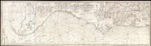
Chart of the Coast of America, from New York and Philadelphia, to the Strait or Gulf of Florida, and from thence to the Mississippi.
sold
- Digital Map Information
- Suitable for large format printing
- Full resolution TIFF file
- ICC color profile embedded
- Delivered instantly via download link
An utterly spectacular and sprawling 1850 John Williams Norie blueback nautical chart or maritime map depicting the North American coastline from New York to the Florida Keys. The map is oriented to the west, as a navigator from Europe would approach the ... (more details)