
Japanese Imperial Land Survey (sold) (陸地測量部)

Japanese Imperial Land Survey (陸地測量部; 1888 - present) was a Japanese governmental mapping agency established in 1888 to map the home islands. By 1925 the Land Survey had completed a 1: 50000 scale map of the home islands. Then expansionist, the Imperial Japanese were keenly aware that, like railroads, telegraphs, and guns, maps were tools of empire indispensable to governance, surveillance, commerce, and countless other imperial initiatives, the very lifeblood the state. As Japan expanded into Korea, Taiwan, the Philippines, and elsewhere, imperial cartographers followed closely behind imperial soldiers. Their work was of the highest caliber and incorporated the most modern and sophisticated survey techniques - resulting in mappings that exceeded all previous work in their respective regions for both thoroughness and accuracy. After World War II, the Japanese Imperial Land Survey was folded into civic administration, but still functions as part of the Japanese government.
AKA: 陸地測量部
A huge map of Tokyo, to match the city's ambitions.
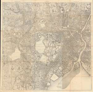
東京 / [Tokyo].
sold
- Digital Map Information
- Suitable for large format printing
- File Size: 253.96 MB
- File Type: ZIP / TIFF
- ICC color profile embedded
- Delivered instantly via download link
This enormous meticulously detailed 1894 (Meiji 27) Japanese Imperial Land Survey map of Tokyo is among the first truly modern maps of the city - the result of a monumental survey effort in the Early Meiji - and captures the city on the cusp of its transformation into a modern world capital. It is oriented to the north with the Imperial Palace at center and presents the city during a transformation from the old Tokugawa capital of Edo to the modernized capital of Imperial Japan. Given the size of this map and its production by the Imperial Land Survey, it very likely was used in a government office dealing with urban planning. (more details)
Aviation chart of the Philippines shortly before the Japanese conquest.
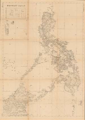
The Philippines - Northern Borneo. / フィリピンーボルネオ北部
sold
- Digital Map Information
- Suitable for large format printing
- File Size: 50.23 MB
- File Type: ZIP / TIFF
- ICC color profile embedded
- Delivered instantly via download link
A rare large-format World War II era 1941 Japanese map of the Philippines and Northern Borneo issued just months before the Japanese invasion (December 7, 1941). The map was issued by the General Staff Headquarters (参謀本部) of the Japanese Imperial Land Survey Office (陸地測量部). Cartographically, the map's focus is on topography and transportation networks, noting roads, railroad routes, and shipping lanes while at the same time emphasizing the archipelago's rugged topography. The focus of the map is on aviation - which is why, other than transportation networks, the map is minimalist. (more details)
Issued shortly before Japanese invasion.
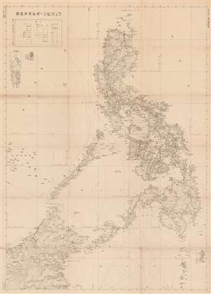
The Philippines - Northern Borneo. / フィリピンーボルネオ北部
sold
- Digital Map Information
- Suitable for large format printing
- File Size: 48.96 MB
- File Type: ZIP / TIFF
- ICC color profile embedded
- Delivered instantly via download link
A rare large-format 1941 Japanese General Staff Headquarters (参謀本部) World War II aviation map of the Philippines and Northern Borneo issued just months before the December 7, 1941 Japanese invasion. It offers critical insight into not only Japan's attack plan, but also its ambitious long-term goals for the Philippines. (more details)