
Johnston, Alexander Keith (sold)

Alexander Keith Johnston (December 28, 1804 - July 9, 1871) was a Scottish cartographer and map publisher active in the middle portion of the 19th century. Johnson was born at Kirkhill, near Edinburgh, Scotland. He studied at the University of Edinburgh where he apprenticed as an engraver. Around 1826, in partnership with his brother William, he founded a cartographic printing and engraving firm with the imprint "W. and A. K. Johnston." Johnston made a name for himself in educational geography, publishing numerous maps for use in schools. His brother, William Johnston, eventually left the firm to pursue a career in politics, eventually becoming the Lord Provost of Edinburgh. Alexander's son, who would bear the same name, became a geographer and explorer, suffering an untimely death on the Royal Geographical Society's 1879 expedition to Lake Nyasa.
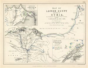
Map of Lower Egypt and Part of Syria. To Illustrate the Expedition to Egypt, and the Campaign of 1798-1801.
sold
- Digital Map Information
- Suitable for large format printing
- DPI: 300
- File Size: 1.71 MB
- File Type: ZIP / TIFF
- ICC color profile embedded
- Delivered instantly via download link
This is a fine example of Blackwood's 1852 map of Lower egypt and parts of Israel / Palestine (here labeled Syria). It covers the northern parts of egypt and the Nile Delta from the Mediterranean Sea to Upper egypt and includes parts of modern day Israel / ... (more details)
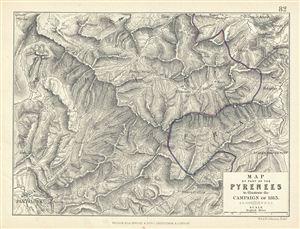
Map of Part of the Pyrenees to illustrate the Campaign of 1813.
sold
- Digital Map Information
- Suitable for large format printing
- DPI: 300
- File Size: 3.19 MB
- File Type: ZIP / TIFF
- ICC color profile embedded
- Delivered instantly via download link
This is a fine example of Blackwood's 1852 map showing part of the Pyrenees Mountain ranges illustrating the campaign of 1813. The boundary line between France and Spain is hand colored in blue and red. Various important forts and buildings are marked. ... (more details)
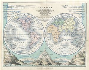
The World in Hemispheres.
sold
- Digital Map Information
- Suitable for large format printing
- DPI: 300
- File Size: 2.99 MB
- File Type: ZIP / TIFF
- ICC color profile embedded
- Delivered instantly via download link
This is a fine example of Blackwood's 1852 map of the world in hemispheres. It depicts the Western and eastern Hemispheres with countries named, but their borders not depicted. The bottom portion of the map depicts the comparative heights of the ... (more details)
The only commercial atlas map to specifically illustrate Nebraska territory at its ephemeral fullest.
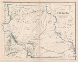
Territory of Nebraska.
sold
- Digital Map Information
- Suitable for large format printing
- File Size: 4.79 MB
- File Type: ZIP / TIFF
- ICC color profile embedded
- Delivered instantly via download link
This is a rare 1857 Henry Darwin Rogers map of the ephemeral Nebraska Territory at its fullest, extending from Kansas to the Canadian border. Few maps illustrate Nebraska in this form, and most of those only as part of a larger map. The ... (more details)
Greatest map of Tasmania - period.

This Map of Tasmania in 1859, Sir Henry Edward Fox Young Knight Companion of the Most Honorable Order of the Bath Being Governor in Chief, and teh Honble. Francis Smigh Attorney General being Premier is dedicated to his Excellency and the Parliament by James Sprent, Surveyor General.
sold
- Digital Map Information
- Suitable for large format printing
- File Size: 202.12 MB
- File Type: ZIP / TIFF
- ICC color profile embedded
- Delivered instantly via download link
The first, largest, and best colonial and settlement era map of Tasmania. This is the James Sprent / William Hogan 1859 map of Tasmania in its deluxe large-format presentation edition. It is the product of nearly 20 years of meticulous trigonometrical survey work and covers Tasmania with unprecedented precision. The map features manuscript annotation of several voyages dating to the 1920s, underscoring its enduring significance as the best reconnaissance of Tasmania more than 70 years after its issue. (more details)
India as the key to Asia and the theater of the Great Game.
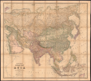
Stanford's Library Map of Asia.
sold
- Digital Map Information
- Suitable for large format printing
- File Size: 186.28 MB
- File Type: ZIP / TIFF
- ICC color profile embedded
- Delivered instantly via download link
This is an 1863 Edward Stanford and A. K. Johnston wall map of Asia. The map is designed to underscore British power and influence, both highlighting its colonial jewels and emphasizing the theaters of the Great Game in Central Asia. (more details)
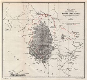
West Africa. The Vicinity of Mount Cameroons.
sold
- Digital Map Information
- Suitable for large format printing
- File Size: 2.65 MB
- File Type: ZIP / TIFF
- ICC color profile embedded
- Delivered instantly via download link
This is a fine example of the 1877 Stanford Map of Mount Cameroons and vicinity, West Africa. Centered over Mount Cameroon, the map covers from Rio del Rey to the Fernando Po (Bioko) Island. Based on the Drawing of Rev. T. J. Comber, a ... (more details)
Unusual early map from the Livingstone Mission.
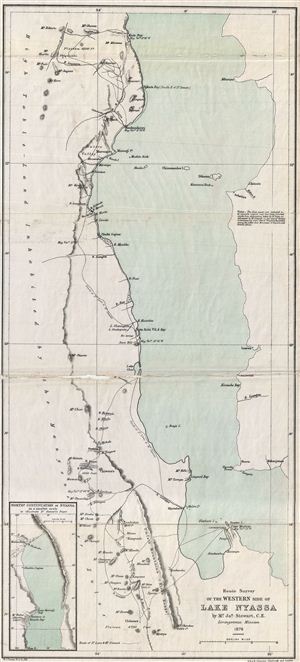
Route Survey of the Western Side of Lake Nyassa.
sold
- Digital Map Information
- Suitable for large format printing
- File Size: 5.32 MB
- File Type: ZIP / TIFF
- ICC color profile embedded
- Delivered instantly via download link
This is an uncommon example of the 1879 Stanford map of Lake Nyassa or Lake Malawi, Africa. This map focuses on the western part of the lake from Kuta Bay to Mt. Mpenya. Contains inset map of the northern part of Nyassa in lower left ... (more details)
Rare map of Turkmenistan and Iran illustrating Sir Rawlinson's reconnaissance of the Russian invasion of Central Asia.
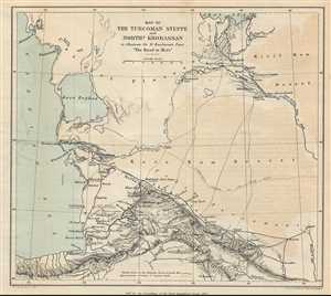
Map of the Turcoman Steppe and Northern Khorassan to illustrate Sir H. Rawlinson's paper 'The Road to Merv'
sold
- Digital Map Information
- Suitable for large format printing
- File Size: 1.71 MB
- File Type: ZIP / TIFF
- ICC color profile embedded
- Delivered instantly via download link
This is a rare 1879 Sir Henry Rawlinson map of Turkmenistan and Iran. The map shows from the eastern Caspian Sea to the western half of Turkmenistan, which the map calls the Turcoman Steppe and from the Aral Sea to the northern reaches ... (more details)
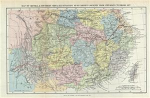
Map of Central & Southern China, Illustrating Mr. McCarth's Journey from Chin-Kiang to Bhamo 1877.
sold
- Digital Map Information
- Suitable for large format printing
- File Size: 6.41 MB
- File Type: ZIP / TIFF
- ICC color profile embedded
- Delivered instantly via download link
This is a fine example of the 1879 Johnston map of central and southern China. Illustrating the journeys of the missionary John McCarthy from Chin-Kiang to Bhamo in 1877, Johnsont's map covers all of China from the borders with Burma ... (more details)
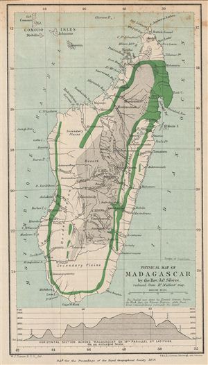
Physical Map of Madagascar.
sold
- Digital Map Information
- Suitable for large format printing
- File Size: 1.76 MB
- File Type: ZIP / TIFF
- ICC color profile embedded
- Delivered instantly via download link
This is a fine example of the 1879 Stanford physical map of Madagascar. Stanford's map covers the entire island country from Cape Amber to Cape St. Mary. It includes the Comoros Islands of Great Comoro (Grande Comore or Ngazidja), ... (more details)
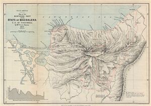
South America. Map of the Northern Part of the State of Magdalena U.S. of Colombia.
sold
- Digital Map Information
- Suitable for large format printing
- File Size: 4.8 MB
- File Type: ZIP / TIFF
- ICC color profile embedded
- Delivered instantly via download link
This is a fine example of the 1879 Stanford map of northern Magdalena, Colombia. The map covers the northern part of the State of Magdalena (now Department of Magdalena). A horizontal section between San Sebastian and Atanquez is ... (more details)
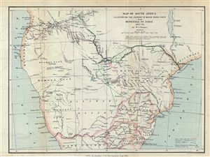
Map of South Africa Illustrating the Journey of Major Serpa Pinto from Benguella to Natal 1877-79.
sold
- Digital Map Information
- Suitable for large format printing
- File Size: 4.79 MB
- File Type: ZIP / TIFF
- ICC color profile embedded
- Delivered instantly via download link
This is an uncommon 1879 map of central Africa by A. K. Johnston. Illustrating the journey of the Portuguese explorer Major Serpa Pinto, this map covers from the Atlantic Ocean to the Indian Ocean and from Njambi to Cape Colony. ... (more details)
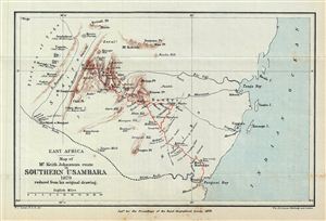
East Africa. Map of Mr. Keith Johnston's route in Southern Usambara 1879 reduced from his original drawing.
sold
- Digital Map Information
- Suitable for large format printing
- File Size: 1.91 MB
- File Type: ZIP / TIFF
- ICC color profile embedded
- Delivered instantly via download link
This is a fascinating example of the 1879 Stanford map of southern Usambara, Tanzania, east Africa. The map follows the route of the missionary Keith Johnston (1844-1879) and details the Usambara Mountains from Fuga to the Indian ... (more details)
Rare map illustrating indigenous footpaths across 19th century Tanzania.
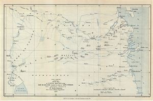
East Africa. Sketch Map of native Routes from Dar Es Salaam towards the head of Lake Nyassa.
sold
- Digital Map Information
- Suitable for large format printing
- File Size: 4.82 MB
- File Type: ZIP / TIFF
- ICC color profile embedded
- Delivered instantly via download link
This uncommon and fascinating 1879 A. K. Johnston map of central Africa illustrated the native African travel routes from Dar es Salaam to the head of Lake Nyasa (Lake Malawi). This map was is based upon the explorations of the ... (more details)
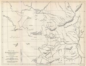
Map of the Bamangwato Country to Illustrate Captn. Patterson's Paper.
sold
- Digital Map Information
- Suitable for large format printing
- File Size: 2.8 MB
- File Type: ZIP / TIFF
- ICC color profile embedded
- Delivered instantly via download link
This is a fascinating example of the 1879 Stanford Map of the territory of the Bamangwato (BamaNgwato) people of Botswana, Southern Africa. Centered on the Makarikari Salt Lake, this map covers from Lake Ngami to Fura Mountain. ... (more details)
An award-winning map!
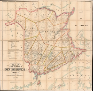
Map of the Province of New Brunswick, Canada.
sold
- Digital Map Information
- Suitable for large format printing
- File Size: 504.46 MB
- File Type: ZIP / TIFF
- ICC color profile embedded
- Delivered instantly via download link
A monumental piece, this is the 1885 Thomas Loggie wall map of New Brunswick, Canada. Awarded the bronze medal at the First International Forestry Exhibition (a world's fair held in Edinburgh in 1884), detail abounds with cities, towns, and villages labeled throughout the province. Several railways crisscross New Brunswick, including the Northern and Western Railway, the New Brunswick Railway, the Caraquette Railway, and the Intercolonial Railway. Major roads appear as well. Rivers, lakes, and other physical features are illustrated. Pale blue dotted and dashed lines labeled alphabetically delineate geological boundaries and correspond with an index along the left side above the title. (more details)
Follows the little-studied 1889 Pevtsov Expedition in Central Asia.
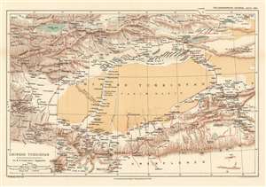
Chinese Turkistan Showing the Surveys and Routes of Col. M.B. Pevtsof and K.I. Bogdanovitch.
sold
- Digital Map Information
- Suitable for large format printing
- File Size: 11.36 MB
- File Type: ZIP / TIFF
- ICC color profile embedded
- Delivered instantly via download link
This is an 1893 Henry Sharbau map of Xijiang Province in China and Kyrgyzstan. The map depicts the movements of the 1889 Imperial Russian Geographical Society expedition to Central Asia led by Mikhail Vasilievich Pevtsov, which are traced by the thick red line. An impressive level of detail is present. Numerous towns and villages are identified, as are rivers and mountain peaks. Issyk Kul, the second largest salt water lake in the world, is situated in the upper left corner. (more details)
Uncle Sam stakes a claim to Cuba and the Pacific.
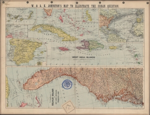
W. and A.K. Johnston's Map to illustrate the Cuban question.
sold
- Digital Map Information
- Suitable for large format printing
- File Size: 26.2 MB
- File Type: ZIP / TIFF
- ICC color profile embedded
- Delivered instantly via download link
A series of maps related to the Spanish-American War, this sheet was published by W. and A.K. Johnston in 1898 to illustrate the theater of conflict and related territories. It was produced in the wake of the USS Maine explosion and rising tensions between the U.S. and Spain. (more details)
Illustrates the first thorough survey by a Western explorer of part of Tibet and Xinjian, China.
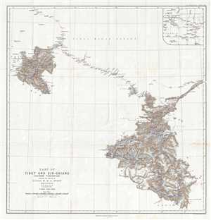
Part of Tibet and Sin-Chiang (Chinese Turkestan) Showing the Surveys of Captain H. H. P. Deasy.
sold
- Digital Map Information
- Suitable for large format printing
- File Size: 7.74 MB
- File Type: ZIP / TIFF
- ICC color profile embedded
- Delivered instantly via download link
This is a 1900 Henry Hugh Peter Deasy map of Tibet and Xinjian (Sin-Chiang), China illustrating Deasy's exploration in the region. The map depicts the region from the Taghdumbash Pamir to the Tolan Khoja River and from Kashgar, ... (more details)
By far the best map of Siam available to the public at the turn of the century' -H. Meinheit
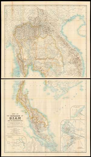
Map of the kingdom of Siam and its dependencies
sold
- Digital Map Information
- Suitable for large format printing
- File Size: 66.39 MB
- File Type: ZIP / TIFF
- ICC color profile embedded
- Delivered instantly via download link
This is James Fitzroy McCarthy’s 1900 Map of Thailand / Siam and the surrounding countries: it is the first complete, scientific map to present this region, produced at a time when French diplomat, explorer and surveyor August Pavie was surveying the same region. The two-sheet map shows all of Siam, eastern Burma, Laos, Cochinchina and the Malay Peninsula. There are inset plans of Bangkok, Chiang Mai, and Luang Prabang on the lower sheet. (more details)
A rare set of eight full-color early twentieth century anatomical charts.
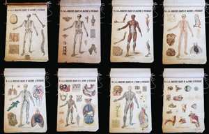
This is a set of eight c. 1903 William and Alexander Keith Johnston charts of human anatomy and physiology. Designed by renowned English anatomist Dr. William Turner, this set includes charts depicting the bones, ligaments, muscles, heart and arteries, veins and lungs, organs of digestion, nervous system, and organs of sense and voice. Each chart is charmingly illustrated with a human figure at center demonstrating how these systems fit together. Surrounding the central drawing are several smaller illustrations that relate to the subject of each chart. The eighth chart, concerning to organs of sense and voice, does not include the central human figure, but is a collection of fifteen smaller illustrations depicting the organs necessary for sight, smell, hearing, taste, and speech. (more details)
Stunning promotional map issued by the Gleneagles Hotel and London Midland and Scottish Railway Company.
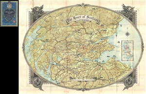
The Heart of Scotland Gleneagles.
sold
- Digital Map Information
- Suitable for large format printing
- File Size: 42.26 MB
- File Type: ZIP / TIFF
- ICC color profile embedded
- Delivered instantly via download link
A stunning large format 1930 case map of southern Scotland issued to jointly promote the luxurious Gleneagles Hotel and the London Midland and Scottish Railway Company. Centered on the Gleneagles Hotel, the map covers some ... (more details)