
Lizars (sold) (William Lizars)

William Home Lizars (May 4, 1788 - March 30, 1859) was a mapmaker, engraver, draughtsman, lithographer, copperplate printer, painter, and publisher active in Edinburgh, Scotland. Born in Edinburgh to Daniel Lizars (1754 - 1812) and his wife Margaret Home, William apprenticed to his father (an engraver and publisher) in 1802. Beginning in 1804, he began studying at the Trustees' Academy and began a career as a painter. After his father died in 1812, William took over the family business, abandoning his promising career as a painter. William worked in partnership with his brother Daniel Lizars (May 24, 1793 - March 14, 1875) from 1812 until the partnership was formally dissolved on October 21, 1819. William published a jigsaw puzzle in 1822 that may have been the first jigsaw puzzle produced in Scotland. After William's death, William and Alexander Keith Johnston acquired the firm, launching another great cartographic firm. William married Henrietta Wilson in 1820. After leaving the partnership, William's brother Daniel became a bookseller. In 1832, he went bankrupt and in 1833 emigrated to Canada. He died in Ontario in 1875.
AKA: William Lizars
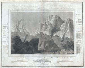
A Comparative View of the Heights of the Principal Mountains and other Elevations in the World.
sold
- Digital Map Information
- Suitable for large format printing
- DPI: 300
- File Size: 19.86 MB
- File Type: ZIP / TIFF
- ICC color profile embedded
- Delivered instantly via download link
This is one of the earliest and most interesting takes on the comparative heights of principal mountains theme by John Thomson. Comparative mountains charts first appeared in the late 18th and early 19th century. Initially these charts focused on Europe or even ... (more details)
One of the first and most interesting 19th century comparative elevation charts.
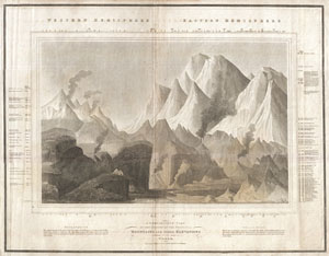
A Comparative View of the Heights of the Principal Mountains and other Elevations in the World.
sold
- Digital Map Information
- Suitable for large format printing
- DPI: 300
- File Size: 21.54 MB
- File Type: ZIP / TIFF
- ICC color profile embedded
- Delivered instantly via download link
This is one of the earliest and most interesting takes on the comparative heights of principal mountains theme. Comparative mountains charts first appeared in the late 18th and early 19th century. Initially these charts focused on Europe or even signal ... (more details)
Magnificent two panel wall map. One of the finest maps of Asia to appear in the early 19th century.
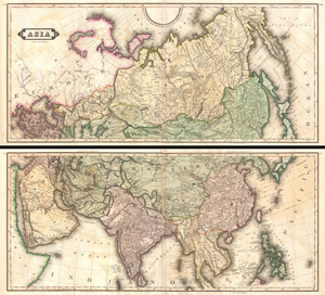
Asia.
sold
- Digital Map Information
- Suitable for large format printing
- DPI: 300
- File Size: 135.07 MB
- File Type: ZIP / TIFF
- ICC color profile embedded
- Delivered instantly via download link
An extremely appealing large format c. 1820 map of Asia rendered in two panels. Truly one of the most beautiful large format maps of Asia to appear in an early 19th century atlas. Drawn by Daniel Lizars this map covers from the Mediterranean to the Sea ... (more details)
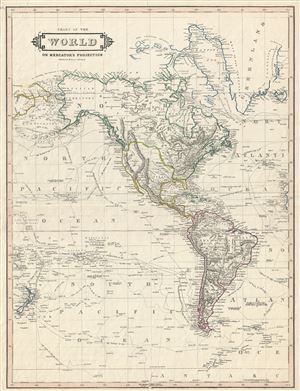
Chart of the World on Mercator's Projection.
sold
- Digital Map Information
- Suitable for large format printing
- DPI: 300
- File Size: 9.91 MB
- File Type: ZIP / TIFF
- ICC color profile embedded
- Delivered instantly via download link
An exceptional example of Daniel Lizars' 1831 map of North America and South America. The map, although titled 'The World,' depicts the western hemisphere including North America, South America, Greenland and New Zealand. The exploratory routes of ... (more details)
Shows the 'Fourth Partition of Poland' following the Napoleonic Wars.
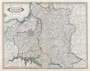
Poland and Lithuania.
sold
- Digital Map Information
- Suitable for large format printing
- Full resolution TIFF file
- ICC color profile embedded
- Delivered instantly via download link
An exceptional example of Daniel Lizars' 1831 map of Poland and Lithuania. Lizars' map covers Poland following Napoleonic Wars and the treaties of the 1815 Congress of Vienna. Twenty earlier, in 1795 The Polish-Lithuanian Commonwealth was ... (more details)
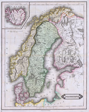
Scandinavia.
sold
- Digital Map Information
- Suitable for large format printing
- Full resolution TIFF file
- ICC color profile embedded
- Delivered instantly via download link
This beautiful hand colored map of Scandinavia was produced by Daniel Lizars in 1840. Depicts the whole of Scandinavia including Norway, Sweden, Finland and Denmark. Inset of Iceland in the upper left corner. One of the finest maps of ... (more details)
No longer a convict colony.
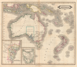
Australia etc.
sold
- Digital Map Information
- Suitable for large format printing
- DPI: 600
- File Size: 45.42 MB
- File Type: ZIP / TIFF
- ICC color profile embedded
- Delivered instantly via download link
This is an 1841 William Home Lizars map of Australia (New Holland), New Zealand, and Melanesia. The map captures the region at the end of its period as a 'convict colony' but ten years before the 1851 Australian Gold Rush, which transformed the national economy. (more details)