
Michel van Lochom (sold)

Michel van Lochom (April 28, 1601 - January 23, 1647) was a Calvinist Flemish engraver active in Antwerp and Paris during the first half of the 17th century. Van Lochom was born in Antwerp, the son of Hans van Lochom, also an engraver, and Clara Janssens. He mastered engraving under the tutelage of his father and in 1613 joined the Antwerp branch of the Guild of St. Luke (a artist and printers guild). As part of the guild he trained under Abraham van Merlen (1579-1660), a Flemish painter and engraver. Van Lochom became a master in the guild in 1621. Four years later, in 1625 he relocated to Paris where is established himself as a painter and engraver. He may have relocated to Paris in order to marry Marguerite Lenoir, the daughter of the prominent Paris bookseller Guillaume Lenoir, and sister-in-law to Pierre Mariette via her sister Geneviève Lenoir. Attaining some prominence engraving religious portraits, Van Lochom was awarded the title of Graveur et Imprimeur du Roy. His address, in 1836, was St Jacques à la Rose Blanche Couronnée, Paris. He remained in Paris until his death in 1647. After his death, his widow sold some 3000 pounds of printing plates to Balthasar Moncornet. His remaining stock went to Pierre Mariette who may have owned part of Lochom's business. Lochom is alternatively known as Lochum or Lochem.
Extremely rare and highly decorative 17th century map of the British Isles.
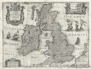
Novissima descriptio Angliae Scotiae et Hiberniae.
sold
- Digital Map Information
- Suitable for large format printing
- DPI: 300
- File Size: 12.04 MB
- File Type: ZIP / TIFF
- ICC color profile embedded
- Delivered instantly via download link
This is an extremely rare and unusual 1639 map of the British Isles by Michel van Lochom. Centered on the Irish Sea, the map extends to cover all of the British Isles, including England, Scotland, Wales, and Ireland. There is an inset map of the Orkney Islands in ... (more details)
Rare separate Issue map of America with ghosted Pacific Northwest illustrating cartographic ambiguity.
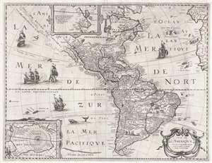
Carte de L'Amerique Corrigee et augmentee dessus toutes les autres cy devant faictes.
sold
- Digital Map Information
- Suitable for large format printing
- DPI: 300
- File Size: 11.77 MB
- File Type: ZIP / TIFF
- ICC color profile embedded
- Delivered instantly via download link
This is a rare and significant separately issued 1640 map of America by Petrus Bertius. The map covers all of North and South America, as well as Central America, the West Indies, and the surrounding areas, including adjacent parts of Spain, Portugal, and Africa. ... (more details)