
Ludlow, William (sold)
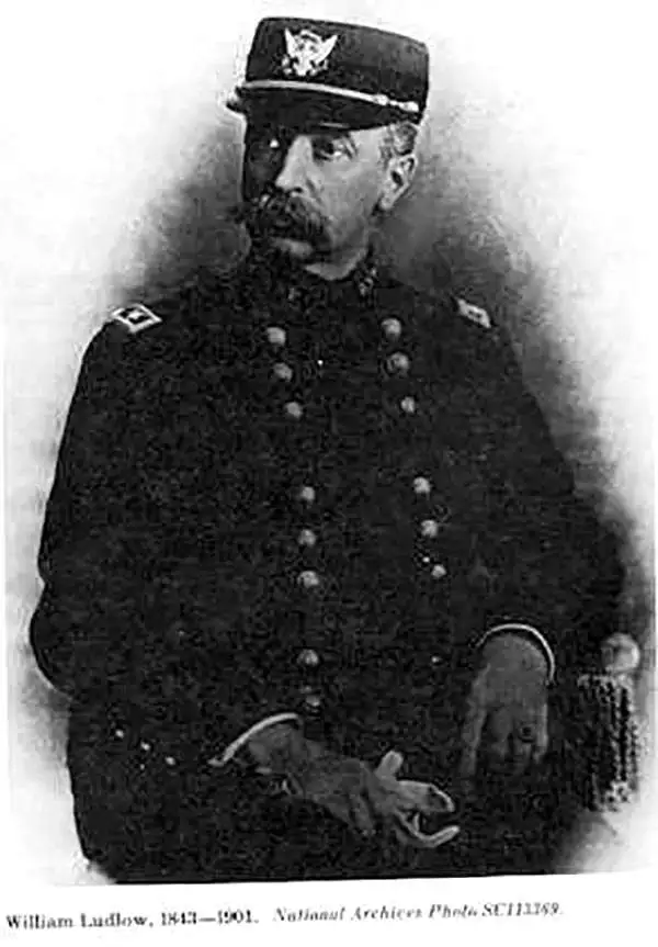
William Ludlow (November 27, 1843, - August 30, 1901) was an officer in the Corps of Engineers and a major general in the United States Army who served in the American Civil War, the Plains Indian Campaigns, the Spanish-American War, and led a scientific expedition examining the natural wonders of Yellowstone National Park. Ludlow was born in Islip, Long Island, and attended both the City University of New York and the United States Military Academy at West Point. Ludlow excelled at engineering and science and, upon graduation, was immediately assigned to the Army Corps of Engineers. During the American Civil War he served on the staff of General Sherman and participated in both Sherman's March and the Carolina Campaign. Following the Civil War, Ludlow was ordered to the staff of Lt. Col. George Armstrong Custer, who had been dispatched to the Black Hills of Dakota to search for gold. Unlike Custer, Ludlow survived the Black Hills and went on to a distinguished military career, serving in Cuba and in the Philippines before taking an honorable retirement. Ludlow retired to Convent, New Jersey, where he died at 56. He is buried in Arlington National Cemetery.
The map that precipitated the slaughter of Col. Custer at Little Big Horn.
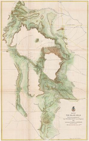
Map of the Black Hills From a reconnaissance by Capt. William Ludlow Corps of Engineers, 1874 And maps of Warren and Raynolds.
sold
- Digital Map Information
- Suitable for large format printing
- File Size: 28.49 MB
- File Type: ZIP / TIFF
- ICC color profile embedded
- Delivered instantly via download link
George Armstrong Custer and William Ludlow's seminal 1874 map of the Black Hills, Dakota Territory, covering from the Missouri to the Powder River and from the 47th to the 43rd parallel. In 1874 one thousand cavalrymen under the command of Lt. Col. George Armstrong ... (more details)
The map that precipitated the slaughter of Col. Custer at Little Big Horn. 'A most interesting map' - Wheat
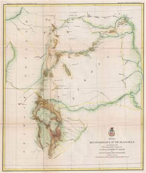
Map of a Reconnaissance of the Black Hills, July and August, 1874, with troops under the command of Lt. Col. G. A. Custer, 7th Cavalry.
sold
- Digital Map Information
- Suitable for large format printing
- File Size: 13.36 MB
- File Type: ZIP / TIFF
- ICC color profile embedded
- Delivered instantly via download link
George Armstrong Custer and William Ludlow's seminal 1874 map of the Black Hills, Dakota Territory, covering from the Missouri to the Powder River and from the 47th to the 43rd parallel. In 1874 one thousand cavalrymen under the command of Lt. Col. George Armstrong ... (more details)
The map that precipitated the slaughter of Col. Custer at Little Big Horn.
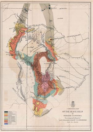
A Geological Map of the Black Hills.
sold
- Digital Map Information
- Suitable for large format printing
- File Size: 13.62 MB
- File Type: ZIP / TIFF
- ICC color profile embedded
- Delivered instantly via download link
This is a rare example of the 1875 geological map of the Black Hills, South Dakota prepared for the official report on the Custer expedition of 1874. Centered on Harney's Peak, the highest point in the Black Hills, the map covers from Slave Butte to the South Fork ... (more details)
Map of Ludlow and Custer's reconnaissance of South Dakota's Black Hills in search of Gold.

Map of a Reconnaissance of the Black Hills, July and August, 1874, With troops under command of Lt. Col. G. A. Custer, 7th Cavalry, by Capt. Wm Ludlow Corps of Engineers.
sold
- Digital Map Information
- Suitable for large format printing
- File Size: 10.41 MB
- File Type: ZIP / TIFF
- ICC color profile embedded
- Delivered instantly via download link
George Armstrong Custer and William Ludlow's seminal 1874 map of the Black Hills, Dakota Territory, covering from the Missouri to the Powder River and from the 47th to the 43rd parallel. In 1874 one thousand cavalrymen under the command of Lt. Col. George ... (more details)