
Miller, George Charles (sold)
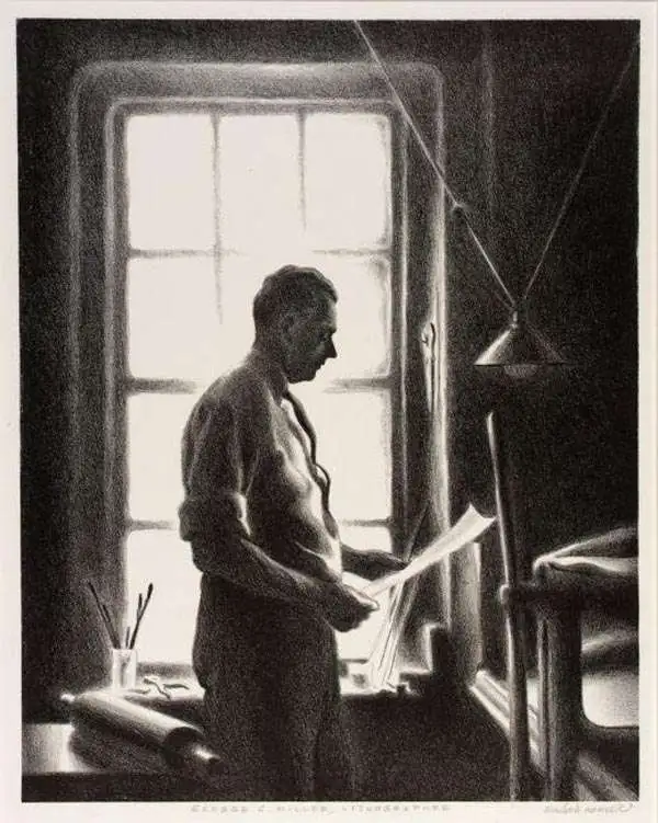
George Charles Miller (June 17, 1894 - October 21, 1965) was an American lithographer and publisher. He was born in New York City into a commercial printing family, and began his apprenticeship in the family business at 15. He completed his apprenticeship at the American Lithographic Company. Miller served in World War I. He is notable for having recognized early on the value of printing for artists, and would eventually print exclusively for artists: one of only a few American printers to do so. Not only did he print artists' work, but he also trained artists (Ruth Haviland Sutton among them) in the craft of lithography. He was married to Carrie Scharsmith Miller, and lived most of his life in Lynbrook, Long Island, New York. He also had a home in Burlington, Vermont, where he died of a heart attack in 1965. Miller's son, Burris G. Miller (1928 - 2017) took over the business, until retiring in 1994.
An exemplar. The true Miller-printed first edition in a rare large-format variant.
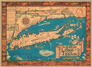
A Map of Long Island.
sold
- Digital Map Information
- Suitable for large format printing
- File Size: 62.98 MB
- File Type: ZIP / TIFF
- ICC color profile embedded
- Delivered instantly via download link
The exemplar example of Courtland Smith's 1933 pictorial map of Long Island - here in the first large-format George Miller edition. This is the first time in more than 25 years that we have seen this larger format variant of this iconic and much-reproduced map (all other known examples measure 20 x 27, this example is 26.5 x 36.5 inches). This historical map covers from New London in Connecticut and Fishers Island south as far as the Lower New York Bay and Staten Island. Long Island is depicted in its entirety from Brooklyn and Queens east to Montauk. Throughout, the map notes cities, towns, beaches, radio stations, parks, ferry lines, lighthouses and several other important landmarks, scenes, and activities. Several landmarks have been attractively illustrated, including the Montauk Point Light, Fire Island Light, Southampton, Coney Island, etc. Gardiner's Island - 'here Capt. Kidd buried loot' and 'Oyster Bay - Burial Place of Theodore Roosevelt' are noted. When Smith died, the mayor of Southampton remarked about this map:
That map has had a significant impact on the development of not only Southampton, but all the other towns on Long Island that it features.(more details)
Most spectacular pictorial map of Florida.
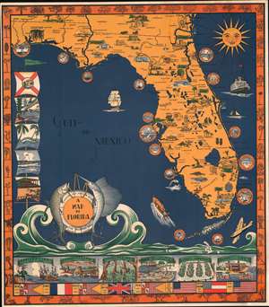
A Map of Florida.
sold
- Digital Map Information
- Suitable for large format printing
- File Size: 56.36 MB
- File Type: ZIP / TIFF
- ICC color profile embedded
- Delivered instantly via download link
A scarce 1935 Eleanore and Richard Foster chromolithograph map of Florida - the most spectacular pictorial map of Florida we have seen. The map is designed on a nautical theme: the sea splashes at the base of the map, forming a cartouche supported by fish and framed by a lifesaver. Coastal cities, including St. Augustine, Daytona Beach, Vero Beach, Palm Beach, St. Petersburg, Miami, Key West, and Fort Meyers, among others, are framed by ship portholes. Smiling from the upper right, the sun shines on the peninsula. Within Florida, both natural resources (pineapples, strawberries, etc.), resort fun (golfing, polo, baseball, sunbathing), and architectural wonders are illustrated. The Overseas Railroad, here in its last year of operation before being destroyed by the Labor Day Hurricane, steams towards Key West. Along the left, Flags illustrate Florida scenes, including alligators and palm trees. A limited breakdown of Florida history appears along the bottom. The border work, in orange, highlights Florida fauna. (more details)
Nantucket, as memorialized by a devoted, adoptive local artist.

This is a beautiful example of the 1964 edition of Ruth Haviland Sutton’s pictorial map of Nantucket, Massachusetts. This vivacious depiction of the island emphasizes its nautical history and character. Its execution reflects the love of place that led Sutton to relocate there for most of her adult life. The waters around the island are decorated with boats and ships – some native, some European, some afloat but many shipwrecked (these last have the dates). (more details)