
Mitchell, John (sold)

John Mitchell (April 13, 1711 – February 29, 1768) was and British-American mapmaker of great significance. He is known for one and only one map, the 'Mitchell Map', considered the most important map in 18th century American history. Mitchell was born in Lancaster County, Virginia, the son of a prosperous planter and merchant. Like many of his social peers, he was educated in Europe, at Scotland at Edinburgh University, where he studied medicine. Mitchell practiced medicine in Virginia for a short time prior to the French and Indian War. He was elected to the original American Philosophical Society in 1744. In 1745 Mitchell argued that a series of epidemics occurring in Virginia were due to unsanitary troop ships from Britain - at the time a revolutionary idea. He relocated to London in 1746 - presumably for the agreeable climate. Mitchell never practiced medicine in London, but was known to be an avid botanist, and was considered an exotic plant expert in London society circles. He was elected as a fellow of the Royal Society in November 1748, his candidature citation describing him as
A Gentleman of great merit and Learning, who Some time Since communicated to the Royal Society a very curious dissertation concerning the Colour of the skin in Negroes, and who from his long residence in Virginea, and from his great application to the Study of Natural history, especially Botany, is very well acquainted with the vegetable productions of North America, being desirous of being admitted a fellow of the Royal Society, is recommended by us from our personal knowledge of him as highly deserving the Honour he desires, as we believe he will be (if chosen) a usefull and valuable member of our Body.As an educated American adopted into British high society, Mitchell became the de facto expert on all matters North American. In 1749, during a time of ever-increasing political tensions between British and French interests in America, Lord Halifax contracted Mitchell to produce a large and detailed map of British and French dominions in America. While embracing the most advanced geographical data, Mitchell also advocated pro-British interpretation of political boundaries. The resulting map was thus geographically unimpeachable and reframed the cartographic perspective from French to British terms. The map proved significant and was used in most subsequent treaties. Michell issued 3 editions in his lifetime. He died in London in 1768.
Early Dutch edition of the Mitchell Map.
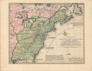
Nieuwe kaart van de Grootbrittannische volkplantingen in Noord America : waar in tevens de Fransche bezittingen en de Landen, tusschen die beide volken in geschil staande en de wederzydsche pretensien duidelyk aangewezen worden.
sold
- Digital Map Information
- Suitable for large format printing
- Full resolution TIFF file
- ICC color profile embedded
- Delivered instantly via download link
A very fine example of Issak Tirion's 1755 map of North America, a Dutch translation on a reduced scale of the famous 'Mitchell Map' published the same year. Tirion's adaptation is significant for highlighting the speed with which cartographic knowledge spread across Europe in the context of competition between global empires. (more details)
Italian edition of the Authoritative Mapping of the Southern British Colonies in North America.
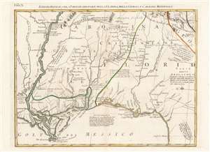
Luigiana Inglese, colla Parte Occidentale della Florida, della Giorgia, e Carolina Meridonale.
sold
- Digital Map Information
- Suitable for large format printing
- Full resolution TIFF file
- ICC color profile embedded
- Delivered instantly via download link
This is an attractive and fascinating 1778 Antonio Zatta map of the Gulf Coast from Louisiana to Florida, encompassing the region inclusive of modern-day Mississippi, Alabama and Georgia. The geography is drawn from John Mitchell's foundational 1755 A map of the British and French dominions in North America, the most important map of North America published in the 18th century. It remained so authoritative that it was used to draft the borders of the United States following Independence, and consulted for border disputes as recently as the 1980s. The present sheet hails from Zatta's Italian edition of the Mitchell, which faithfully copied the original in translation. (more details)
Border Disputes in Pennsylvania, New York, and New Jersey.
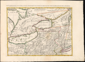
La Pensilvania, La Nuova York, Il Jersey Settentrio:le, con la Parte Occidentale del Connecticut, Massachusset-s-Bay e L' Irochesia.
sold
- Digital Map Information
- Suitable for large format printing
- File Size: 17.32 MB
- File Type: ZIP / TIFF
- ICC color profile embedded
- Delivered instantly via download link
This is Antonio Zatta's striking 1778 map of New York, Pennsylvania, and the eastern Great Lakes. While a separate issue, the map comprises sheet V of Zatta's 12-sheet Italian edition of John Mitchell's important c. 1775 map of eastern North America. Among other points of interest, the richly annotated map illustrates Pennsylvania's pre-1774 claims to what is today western New York as well as land disputes between New York and New Jersey. (more details)
Imperial frontier comprising a complex tapestry of Native American Nations.
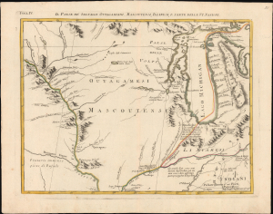
Il Paese de' Selvaggi Outagamiani, Mascoutensi, Illinesi, e Parte delle VI. Nazioni.
sold
- Digital Map Information
- Suitable for large format printing
- File Size: 12.94 MB
- File Type: ZIP / TIFF
- ICC color profile embedded
- Delivered instantly via download link
This is Antonio Zatta's striking 1778 map of Lake Michigan, Wisconsin, and Illinois, issued at the height of the American Revolutionary War (1775 - 1783). Although separately published, the sheet forms Plate IV of Zatta's 12-sheet Italian edition of John Mitchell's seminal map of eastern North America. The geography presented here corresponds to what would later become the Northwest Territory ('Old Northwest'), formally organized under the Northwest Ordinance of 1787. In 1778, however, this was still a volatile frontier world - its political future unsettled and its landscape shaped not by American institutions but by a dense and dynamic tapestry of Native nations, whose alliances, rivalries, and diplomacy defined the region on the eve of U.S. expansion. (more details)
An Attractive, Reduced Version of 'The Most Important Map in American History'.
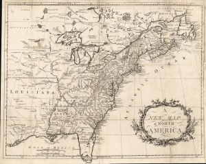
A New Map of North America.
sold
- Digital Map Information
- Suitable for large format printing
- Full resolution TIFF file
- ICC color profile embedded
- Delivered instantly via download link
This is an attractively engraved map (after Mitchell) of the British Colonies in North America, printed in Dublin by an anonymous printer to accompany a (plagiarized) history of the American Revolution. (more details)