
Mondhare, Louis-Joseph (sold)

Louis-Joseph Mondhare (1734 - August 21, 1796) was a French engraver and publisher of maps, prints and vues d'optique active in the second half of the 18th century. Mondhare was born in Bougy (Calvados) and moved to Paris on or before 1759. He began publishing around 1760 under the Chez Mondhare imprint. On June 7 of 1784, his son-in-law Pierre Jean (1754-1829) joined the business and they changed their imprint to Mondhare & Jean. The Mondhare firm maintained their office in Paris on Rue St. Jacques, at the Hôtel Saumar, a well-known location for print sellers near St. Severin. Later they relocated to 32 Rue Saint-Jean de Beauvais. The firm ceased operation around 1796. Mondhare died shortly afterward in 1799. His name variantly appears on some imprints as Mondar or Mondhard.
Magnificent 18th century wall map of Europe.
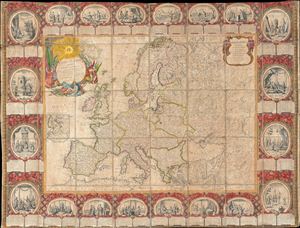
Carte D'Eurpe Divisee En ses Empires et Royaumes.
sold
- Digital Map Information
- Suitable for large format printing
- DPI: 300
- File Size: 77.43 MB
- File Type: ZIP / TIFF
- ICC color profile embedded
- Delivered instantly via download link
A large and impressively decorative 1776 case map or pocket map of europe by Jean Baptiste Louis Clouet. Clouet's map covers all of europe from Spain to the Ural Mountains and from Nova Zembla and the Arctic Ocean to North Africa, Turkey, and Persia. It includes ... (more details)
Important map of the British Colonies in North America at the outset of the American Revolutionary War.
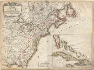
Carte des Possessions Angloises Dans L'Amerique Septentrional Pour Servir d'Intelligence á la Guerre presente Traduite de L'Anglois Par J. Leopold Imbert.
sold
- Digital Map Information
- Suitable for large format printing
- DPI: 300
- File Size: 15.9 MB
- File Type: ZIP / TIFF
- ICC color profile embedded
- Delivered instantly via download link
This is the rare 1777 separate issue, old color, first edition of J. Leopold Imbert's important map illustrating the theater of the American Revolutionary War (1775 - 1783). In addition to being a significant map in its own right, this Imbert map underlies its ... (more details)
First map to name the United States and a contemporaneous illustration of the American Revolutionary War.
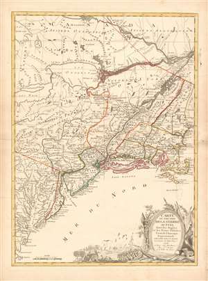
Carte du Théatre de la Guerre actuel entre les Anglais et les Trieze Colonies Unies de l'Amerique Septentrionale dressée par J. B. Eliot Ingénieurs des Etats Unis 1778.
sold
- Digital Map Information
- Suitable for large format printing
- DPI: 600
- File Size: 30.62 MB
- File Type: ZIP / TIFF
- ICC color profile embedded
- Delivered instantly via download link
A 1778 first edition American Revolutionary War era map of the northeastern United States by J. B. Elliot, considered to be of extreme significance. This is generally regarded as the earliest map to use the name 'United States', or in this case, 'Etats Unis'. Drawing on previously unused sources, Eliot's map illustrates the events of the Revolutionary War contemporaneously with the action, making it, essentially a living account of the War of Independence. Margaret Pritchard and Henry Taliaferro, published an essay on this map in Degrees of Latitude, Map 58, describing its significance in great detail, of which this is a short excerpt,
The map of the theater of war between Great Britain and America by J.B. Eliot is important because of its title, Les Treize Colonies Unies de l'Amerique Septentrionale, may include the first reference on a map to the United States. The cartographer was identified as Ingenieurs des Etats Unis. On November 15, 1777, the Continental Congress selected 'The United States of America,' as the name of the thirteen colonies that formed a government under the Articles of Confederation. One month later, French authorities learned of the victory at Saratoga and decided to recognize American independence. By January 8, French foreign minister, Charles Gravier, Comte de Vergennes, informed American envoys that France was ready to engage in an alliance. It is not surprising that the name United States was first mentioned on a map published in Paris in 1778.A decorative cartouche in the lower right incorporates a battle scene wherein British soldiers bombard a small town - possibly Valley Forge? (more details)
… It is also curious that he did not indicate on the map the general's 1777 winter headquarters at Valley Forge, misspelled Walay Forge. What Eliot did illustrate were the lines' march taken by the British and American forces during the campaign in 1777, including Lieutenant Colonel Barry St. Ledger's unsuccessful diversionary expedition down the Mohawk Valley, Burgoyne's march from Crown Point to Albany, and Howe's campaign to take Philadelphia.
… As was usually the case, Eliot appears to have borrowed from several sources in compiling the geography. Some areas were designated by French place-names while others are predominantly English, specifically in the northwestern territories that the French knew best. It is clear they were aware of the latest intelligence relating to the Revolutionary War.
Only map recognized by the Assemblée Nationale.
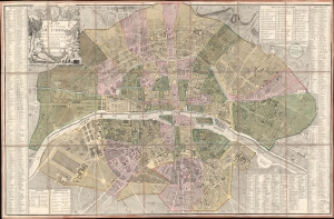
Plan de la Ville et Faubourg de Paris Divisé en ses 48 Sections Decreté par l'Assemblée Nationale le 22 Juin 1790 et Sanctionné par le Roi.
sold
- Digital Map Information
- Suitable for large format printing
- DPI: 600
- File Size: 80.24 MB
- File Type: ZIP / TIFF
- ICC color profile embedded
- Delivered instantly via download link
A stunning 1790 Louis-Joseph Mondhare and Pierre Jean Revolutionary-Era city map of Paris, France - this is the only map the Assemblée Nationale recognized to delineate its newly created sections within Paris. The map was printed by order of the Assemblée Nationale a year the Storming of the Bastille and the outset of the French Revolution (1789 - 1799). (more details)