
NEW ACQUISITIONS
Japanese invasion of Vietnam.
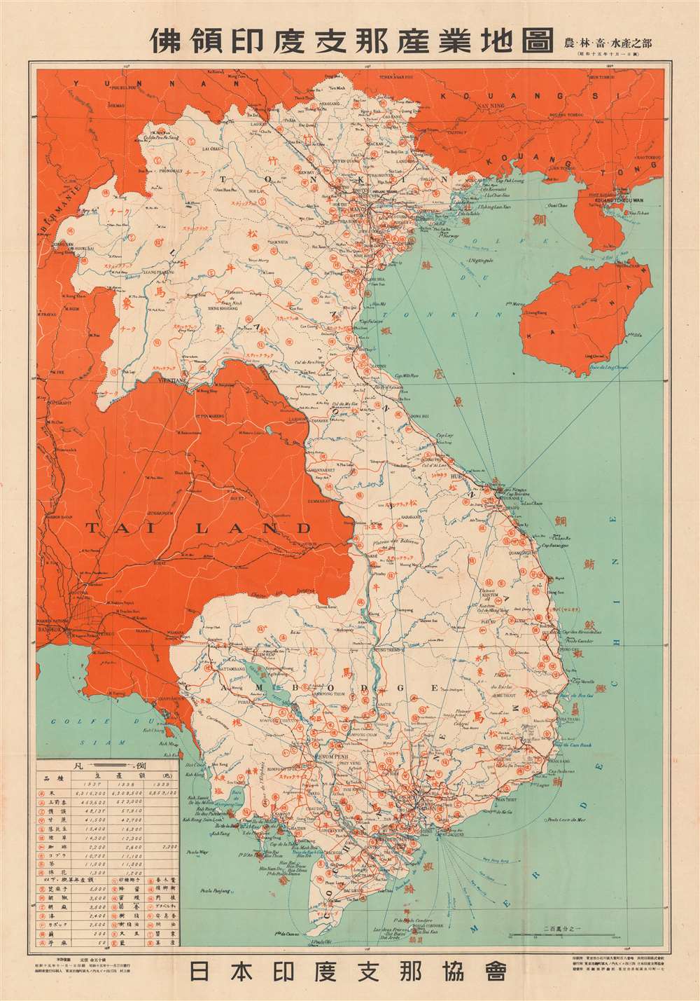
俳領印度支那産業地園. / Indochina Industrial Land.
$400.00
Acquire
- Digital Map Information
- Suitable for large format printing
- File Size: 48.16 MB
- File Type: ZIP / TIFF
- ICC color profile embedded
- Delivered instantly via download link
This is a 1940 or Showa 15 Japan Indochina Association map of French Indochina detailing agricultural production. At the time, French Indochina consisted of modern-day Vietnam, Laos, and Cambodia. Indochinese cities and villages, such as Hanoi, Haiphong, Saigon, Vientiane, and Phnom Penh, are labeled with either their Vietnamese name or their French name. Geographic locations throughout are labeled in the same manner, either in Vietnamese or French. A table in the lower left corner details different agricultural products, which includes rice, peanuts, and tobacco. Production figures for 1937, 1938, and 1939 are also provided. The Latin alphabet content underscores that this was a French map that was repurposed by the Japanese - who added extensive overprinting in this new revised issue. (more details)
Walrus hunting, anyone? ... anyone?
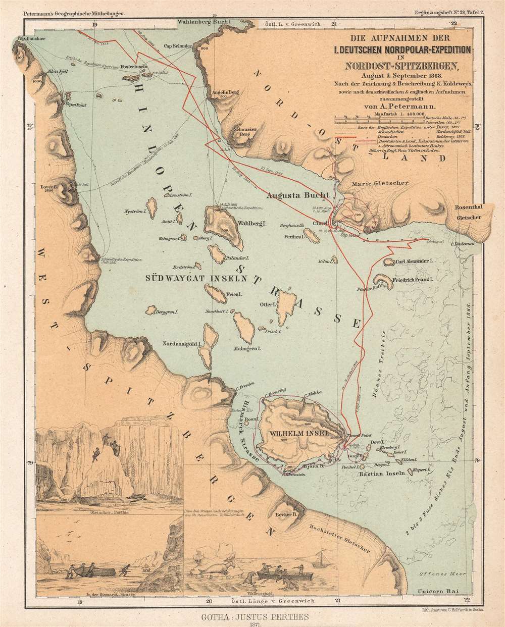
Die Aufnahmen der I. Deutschen Nordpolar-Expedition in Nordost-Spitzbergen, August und September 1868.
$350.00
Acquire
- Digital Map Information
- Suitable for large format printing
- File Size: 5.01 MB
- File Type: ZIP / TIFF
- ICC color profile embedded
- Delivered instantly via download link
This is an 1871 Augustus Petermann map of Hinlopen Strait in the Svalbard Archipelago. Hinlopen Strait separates Spitsbergen and Nordaustlandet. The map highlights the route of the First German North Polar Expedition through the strait, which is often impassable due ice. Dates, anchorages, and shore excursions are noted, along with a handful of depth soundings. The 1827 English expedition led by Sir William Edward Parry (1790 - 1855) and the 1861 Swedish expedition led by Nils Otto Gustaf Nordenskjöld (1869 - 1928) are also traced. Three views appear in the lower left corner illustrate shore excursions, among them a walrus hunt. (more details)
Treasure hidden in Louisiana?
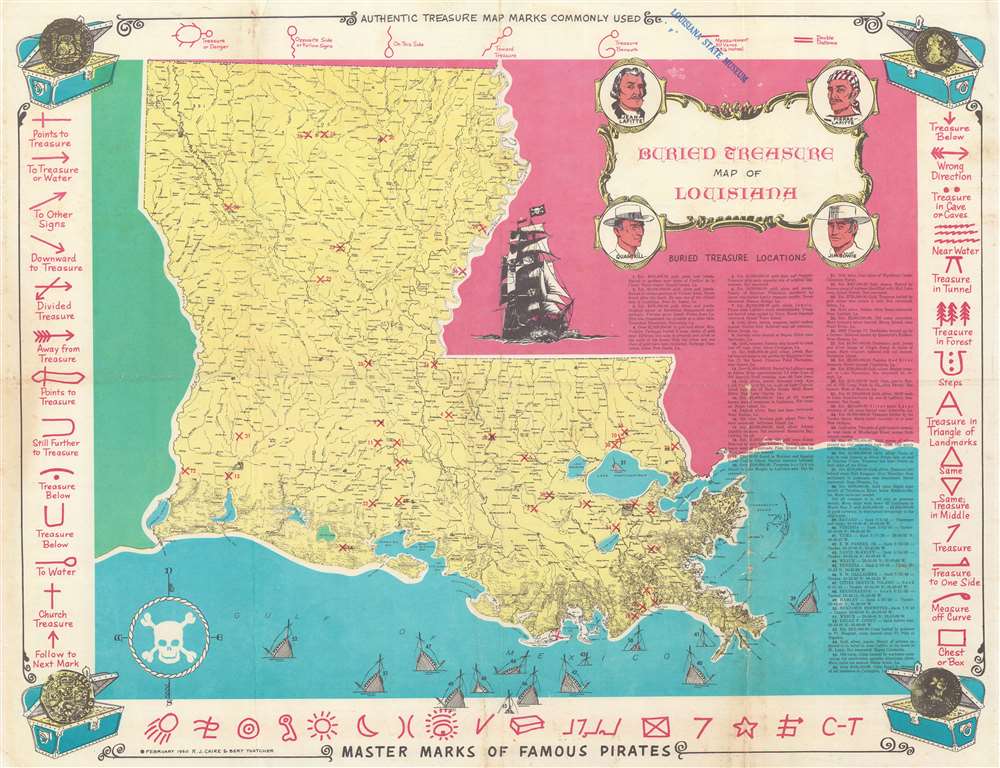
Buried Treasure Map of Louisiana.
$750.00
Acquire
This is a 1960 Robert J. Caire and Bert Thatcher buried treasure map of Louisiana. Magenta 'X's mark the spots where fifty-six fortunes were 'partially recovered' or were supposedly buried by pirates, thieves, and the wealthy, or were lost at sea after a shipwreck. Each 'X' is numbered and corresponds with a short description of the fortune in question (ranging from $20,000 to $4,000,000). (more details)
South Sumatra and the Sunda Strait.
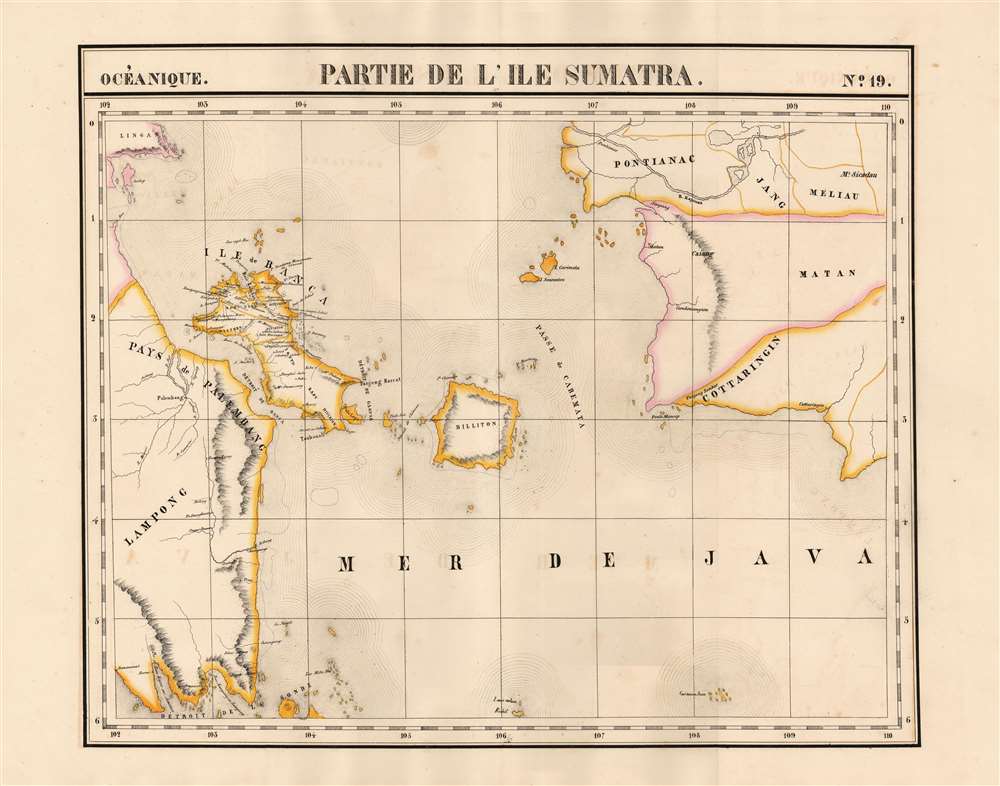
Partie de L'ile Sumatra. Oceanique no. 19.
$750.00
Acquire
- Digital Map Information
- Suitable for large format printing
- Full resolution TIFF file
- ICC color profile embedded
- Delivered instantly via download link
This is 1827 Vandermaelen map of Sumatra's east coast, the Caremata Straits, the Sunda Strait, and the western part of the Java Sea. It is the first map of the region produced by lithography. The map extends as far as the southwest coast of Borneo, and also shows the Bangka Belitung Islands, and the island of Belitung. The coast of Java only appears in the form of the mountainous peninsula north of Cilegon. The scattered, tiny islands north of Jakarta appear here as a largely imaginary archipelago labeled 'Les Milles Iles.' (more details)
The Americas crafted into a unique puzzle!

L'Amerique divisée en ses principaux états, assujetie aux observations astronomiques par le Sr. Janvier Geographe. A Paris.
$2,000.00
Acquire
This is Jean Janvier's 1760 rare, separately issued map of the western hemisphere, in its 1784 Paris edition. This map has, at an early date, been pasted down and hand-cut to form a simple jigsaw puzzle. Although the map does not name the new country, the colored national borders reflect the formation of the United States, which had been set according to the Treaty of Paris the year before this map was printed. The substance of the map is somewhat changed - dotted colonial borders have been burnished out and replaced with new ones, but the bulk of the engraving remains true to the 1760 edition. (more details)
By Cleveland's hometown cartographer.
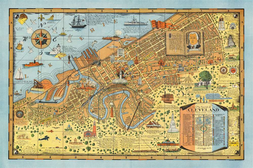
The Heart of Cleveland Ohio Forest City.
$950.00
Acquire
- Digital Map Information
- Suitable for large format printing
- File Size: 114.09 MB
- File Type: ZIP / TIFF
- ICC color profile embedded
- Delivered instantly via download link
This is a striking example of Arthur Suchy's 1928 pictorial map of Cleveland, Ohio - Suchy's hometown - accompanied by its original mailer envelope. The map covers from Cleveland's waterfront on Lake Erie south to the Cuyahoga River, beyond which, space is dedicated to historical vignettes and illustrations of local landmarks. Much emphasis is given to Cleveland's 'Forest City' qualities, with tree-filled residential blocks and parks noted. At the same time, skyscrapers and smoking factories underscore Cleveland's industrial might. Among the vignettes is an illustration of Moses Cleveland, the city's founder. (more details)
The first European expedition into the Tian Shan Mountains.
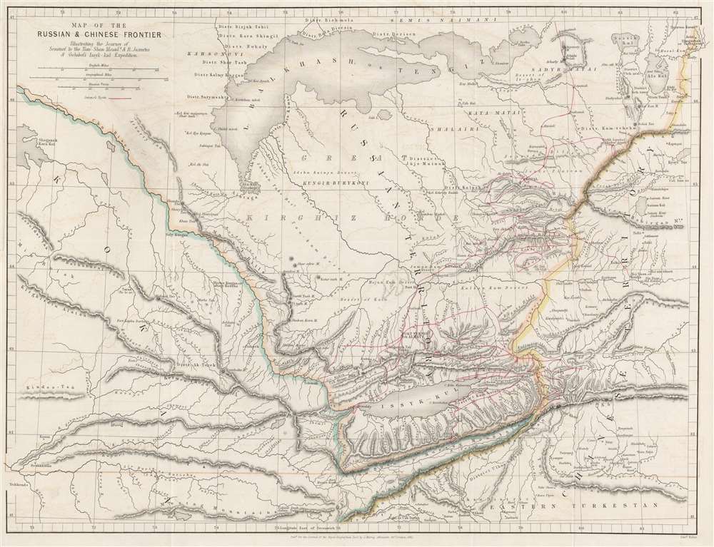
Map of Russian and Chinese Frontier Illustrating the Journey of Semenof to the Tian-Shan Mounts. and R. Jaxartes and Golubof's Issyk-kul Expedition.
$575.00
Acquire
- Digital Map Information
- Suitable for large format printing
- File Size: 12.88 MB
- File Type: ZIP / TIFF
- ICC color profile embedded
- Delivered instantly via download link
This is an 1861 John Murray map of Central Asia tracing Pyotr Semyonov's (1827 - 1914) first European ascent into the Tian Shan Mountains. The map depicts the region from Lake Balkash south to the Tian Shan Mountains, encompassing modern-day Kyrgyzstan, Kazakhstan, and western China - at the time considered one of the most remote and inaccessible parts of the world. (more details)
The Black Hills, stagecoaches, cowboys, and bison.
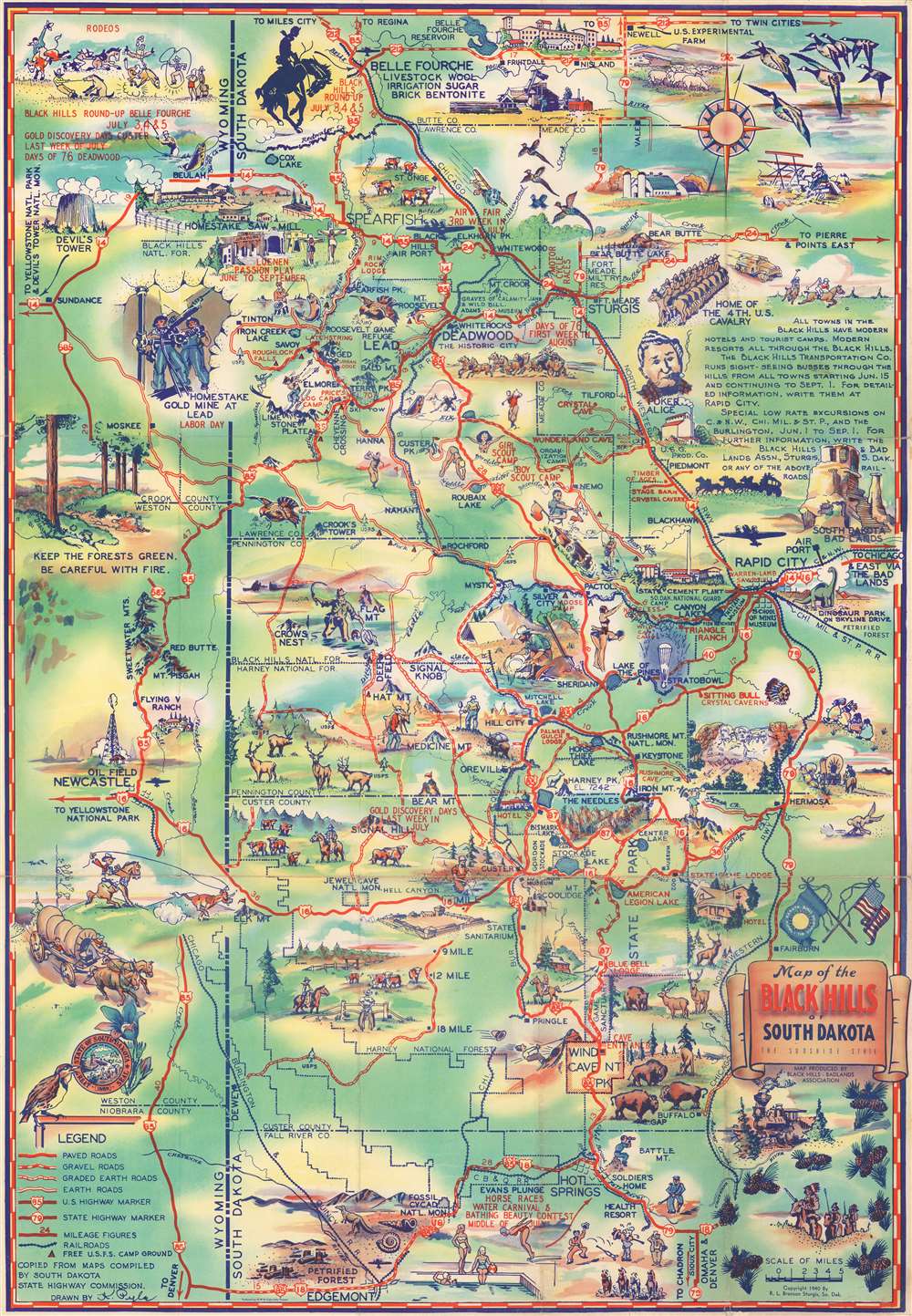
Souvenir Map of the Black Hills of South Dakota: The Sunshine State.
$250.00
Acquire
- Digital Map Information
- Suitable for large format printing
- Full resolution TIFF file
- ICC color profile embedded
- Delivered instantly via download link
This is a 1940 K. Pyle pictorial map of the Black Hills, covering South Dakota and eastern Wyoming. The map depicts the region from Sundance, Wyoming to Rapid City, South Dakota and from Belle Fourche, South Dakota to Edgemont, South Dakota. National parks, national forests, state parks, mountains, lakes, and other points of interest are illustrated. Vignettes throughout juxtapose the 'Old West' and the 'modern', placing Mt. Rushmore, cowboys, prospectors, and stagecoaches next to steam engines, airplanes, and race cars. Cities and towns labeled include Deadwood, Belle Fourche, Rapid City, and Sturgis, among others. Illustrations of wildlife include elk, bison, deer, and bears. (more details)
Archetypical Desert Island.
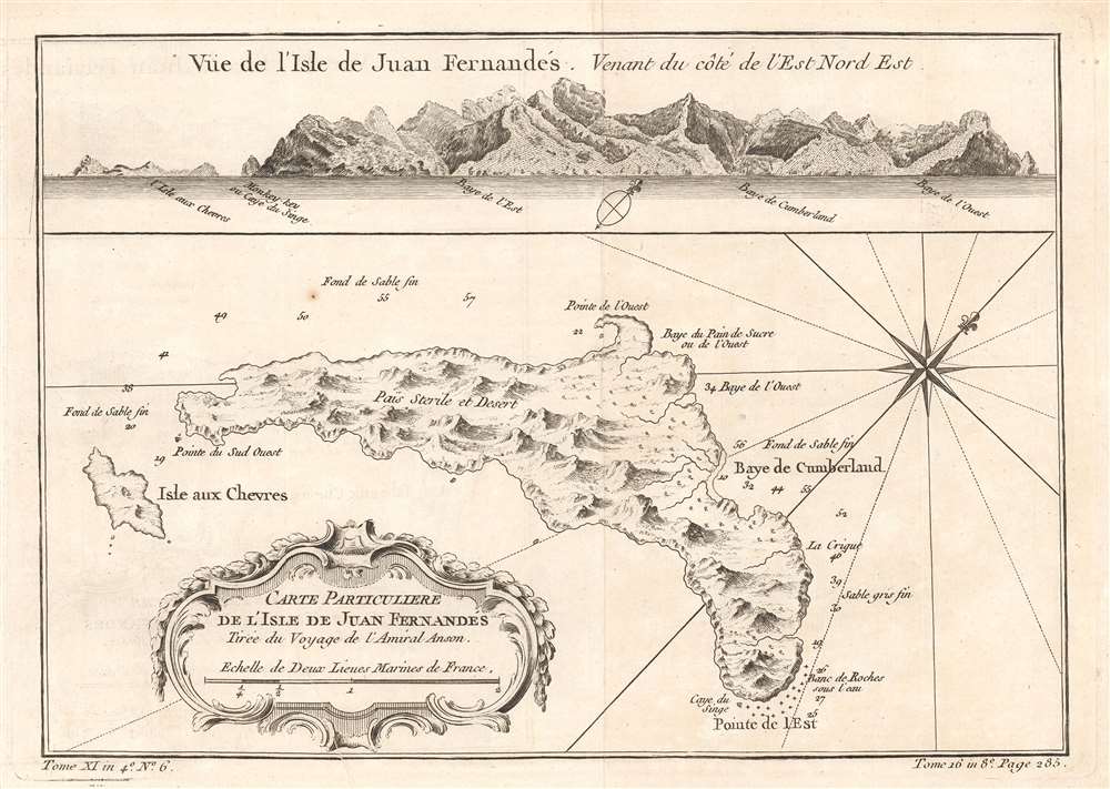
Carte Particulière de l'isle de Juan Fn.ernandés Tirée du voyage de l'Amiral Anson.
$250.00
Acquire
- Digital Map Information
- Suitable for large format printing
- Full resolution TIFF file
- ICC color profile embedded
- Delivered instantly via download link
This is a beautifully engraved 1780 map of Juan Fernández island, now officially known as Robinson Crusoe Island, formerly Más a Tierra. It is the second largest of the Juan Fernández Islands. The island was, from 1704 to 1709, home to the marooned sailor Alexander Selkirk, the inspiration for Defoe's Robinson Crusoe (despite the novel's Caribbean setting.) The island was originally named after Juan Fernández, the explorer who first landed there in 1574. The name 'Robinson Crusoe Island' was officially adopted by the Chilean government in the 1960s. Bellin's source for this map postdates Selkirk's ordeal: George Anson's 1740 expedition stopped at the island, resulting in a chart and view. (more details)
Treasures of India.
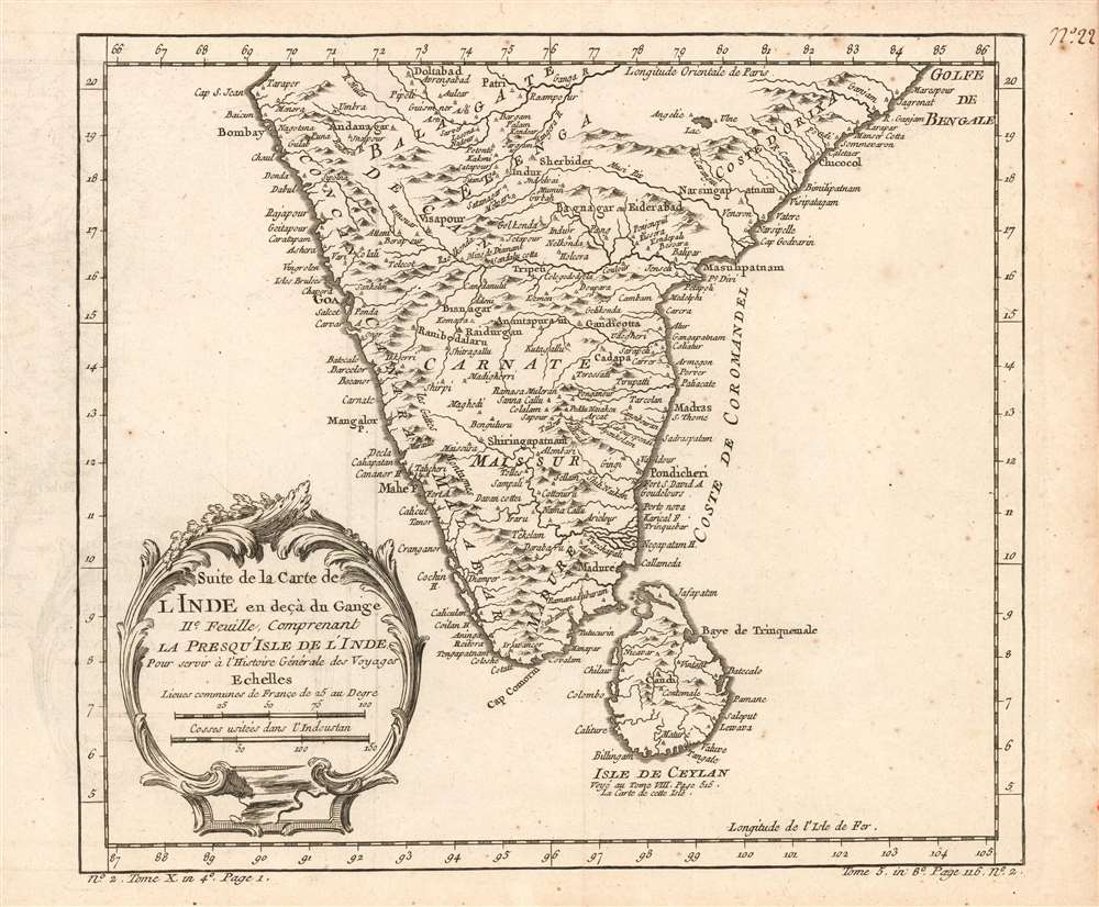
Suite de la carte de l'Inde en deçà du Gange IIe. feuille, comprenant la Presqu' Isle de l'Ind pour servir à l'Histoire générale des voyages.
$200.00
Acquire
- Digital Map Information
- Suitable for large format printing
- Full resolution TIFF file
- ICC color profile embedded
- Delivered instantly via download link
This is a 1780 Bellin map of India and Sri Lanka. Unlike many of Bellin's smaller works, this is strictly a map, as opposed to a nautical chart: the focus of the map is on the interior, particularly between areas of French influence on the Coromandel Coast such as Pondicheri, and the old Mogul Empire to the northwest. (more details)
Exploration of Mozambique and Malawi.
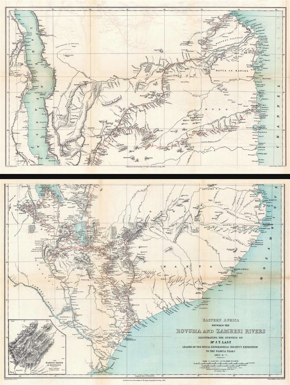
Eastern Africa Between the Rovuma and Zambesi Rivers Illustrating the Surveys of Mr. J.T. Last Leader of the Royal Geographical Society's Expedition to the Namuli Peaks 1885 - 6 - 7.
$950.00
Acquire
- Digital Map Information
- Suitable for large format printing
- Full resolution TIFF file
- ICC color profile embedded
- Delivered instantly via download link
This is an 1890 William Shawe map of southeastern Africa detailing the expedition of Joseph Thomas Last to Portuguese East Africa. Printed on two sheets, the map depicts the region from Lake Nyasa to the Mozambique Channel and from the mouth of the Lindi River south to the mouths of the Zambezi River. In modern terms, this map covers Malawi and Mozambique from Lake Malawi (Nyasa) eastward to the Indian Ocean (Mozambique Channel). This region was at the time Portuguese Mozambique (Portuguese East Africa / África Oriental Portuguesa). Although the British never made a serious play for Portuguese East Africa, the cartographic work here can be best understood as reconnaissance for potential British colonial annexation. (more details)
Scarce Turkish map of North America.
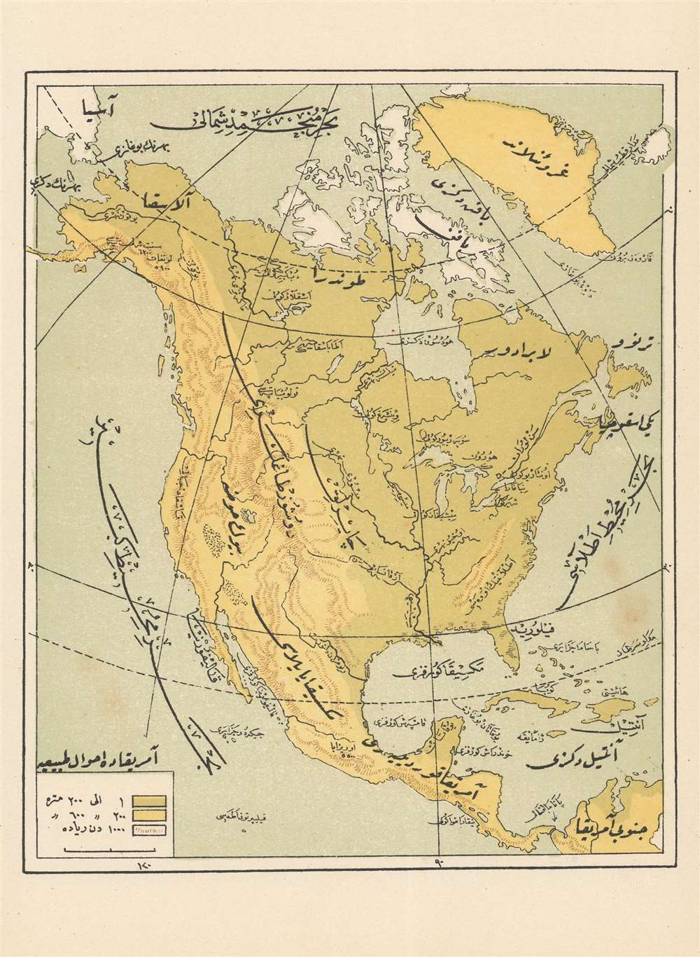
[North America]
$350.00
Acquire
- Digital Map Information
- Suitable for large format printing
- File Size: 2.19 MB
- File Type: ZIP / TIFF
- ICC color profile embedded
- Delivered instantly via download link
This is a color lithograph map of North America, probably printed in Istanbul in the first decades of the 20th century for inclusion in a Ottoman-Turkish student atlas. A combination of color and hachure is used to indicate mountain ranges. Rivers, mountains and ... (more details)
Scarce, attractive English Map of Spain.
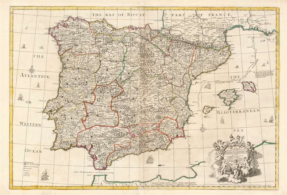
A Correct Map of Spain and Portugal According to the newest observations and discoveries comunicated to the Royal Society at London and the Royal Academy at Paris.
$850.00
Acquire
- Digital Map Information
- Suitable for large format printing
- Full resolution TIFF file
- ICC color profile embedded
- Delivered instantly via download link
This beautiful, large engraving is John Senex’s 1708 map of Spain and Portugal, covering the entire Iberian Peninsula, including the south of France, part of the north coast of Africa, the Strait of Gibraltar and the Balearic Islands of Ibiza, Majorca, and Minorca. It is attractively engraved, with decorative sailing ships and a baroque-inspired cartouche featuring a half-dozen putti wearing the classical iconography of the Greco-Roman gods (with a martial Mars front-and-center, and a commercial Mercury at top.) (more details)
Two leashed cheetahs - enough said!
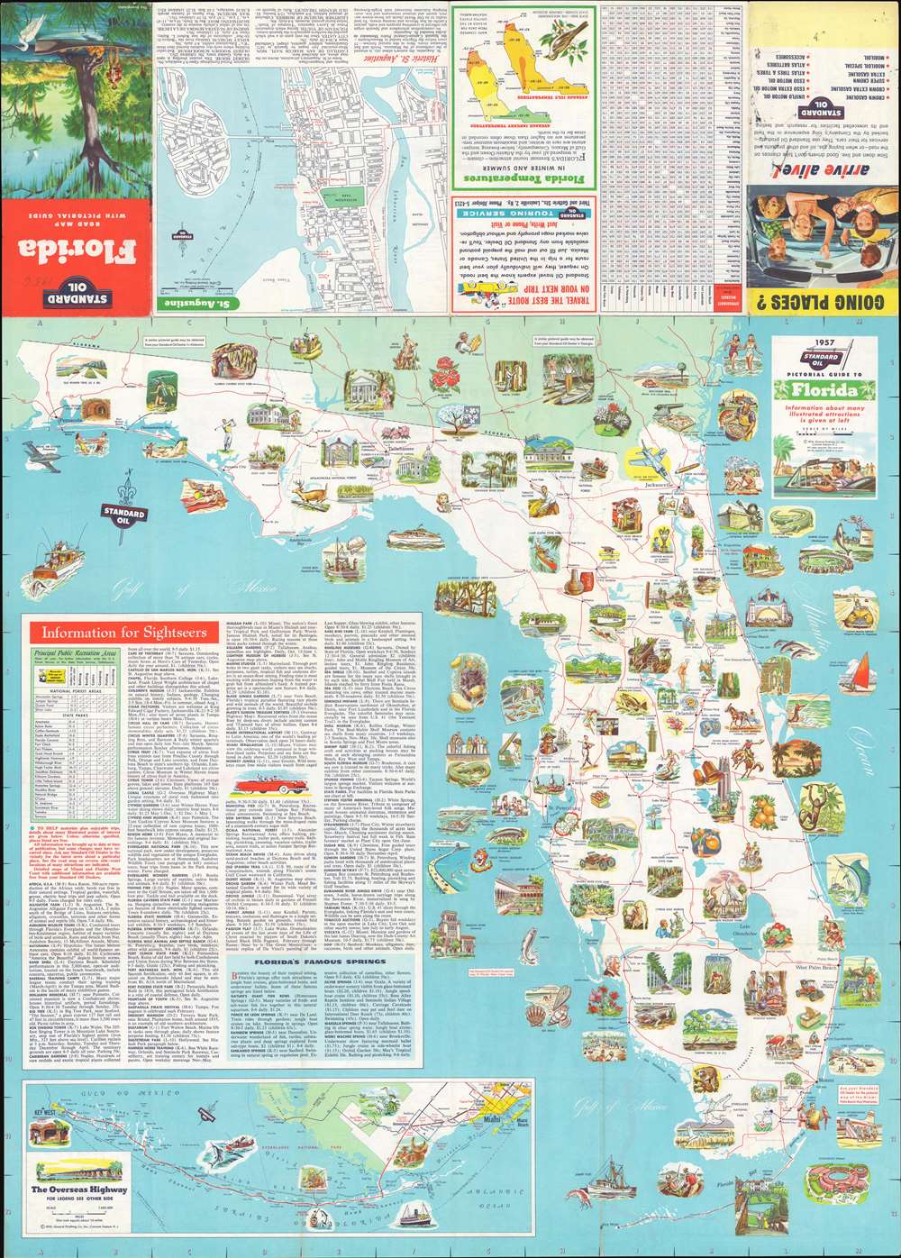
Florida. Road Map with Pictorial Guide.
$375.00
Acquire
This is a 1956 General Drafting Corporation pictorial map of Florida. Wonderfully colored vignettes promote tourist attractions, such as Silver Springs, the McKee Jungle Gardens, the Ringling Museum of Art, the South Florida Museum, and the Bok Singing Tower. Tourist activities, including deep-sea fishing and waterskiing, are also highlighted. The most-eye-catching (and head-scratching) of these promotes Africa U.S.A., a defunct safari-themed park outside Boca Raton, presenting a young woman with two leashed cheetahs. Other vignettes illustrate Florida's universities, its beaches, and wildlife. Sightseeing information dominates the lower left and includes short summaries of attractions and other activities. An inset focusing on the Overseas Highway from Miami to Key West is situated in the lower-left. (more details)
Mountainous Switzerland.
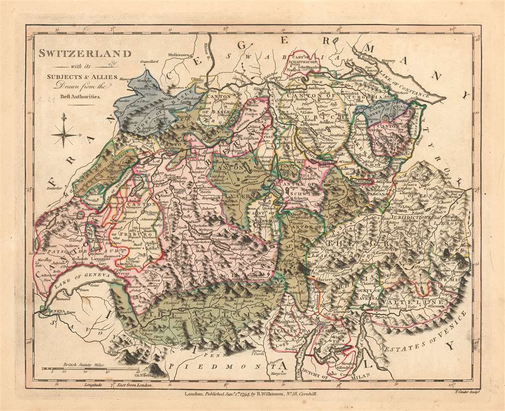
Switzerland with its Subjects and Allies Drawn from the Best Authorities.
$175.00
Acquire
- Digital Map Information
- Suitable for large format printing
- Full resolution TIFF file
- ICC color profile embedded
- Delivered instantly via download link
This is Robert Wilkinson's lovely, first edition 1794 map of Switzerland. The map shows the country and its neighbors on the eve of Napoleonic invasion of 1798. The French tried to centralize authority in Switzerland by forming the Helvetic Republic (1798 – 1803). Until then, the area consisted of independent cantons united by a loose military alliance. Facing widespread resistance, the Republic would last only five years. The exquisite, pictorially-rendered Alps and fine coloring make this the most attractive European maps in Wilkinson's atlas. (more details)
Sun and palm.
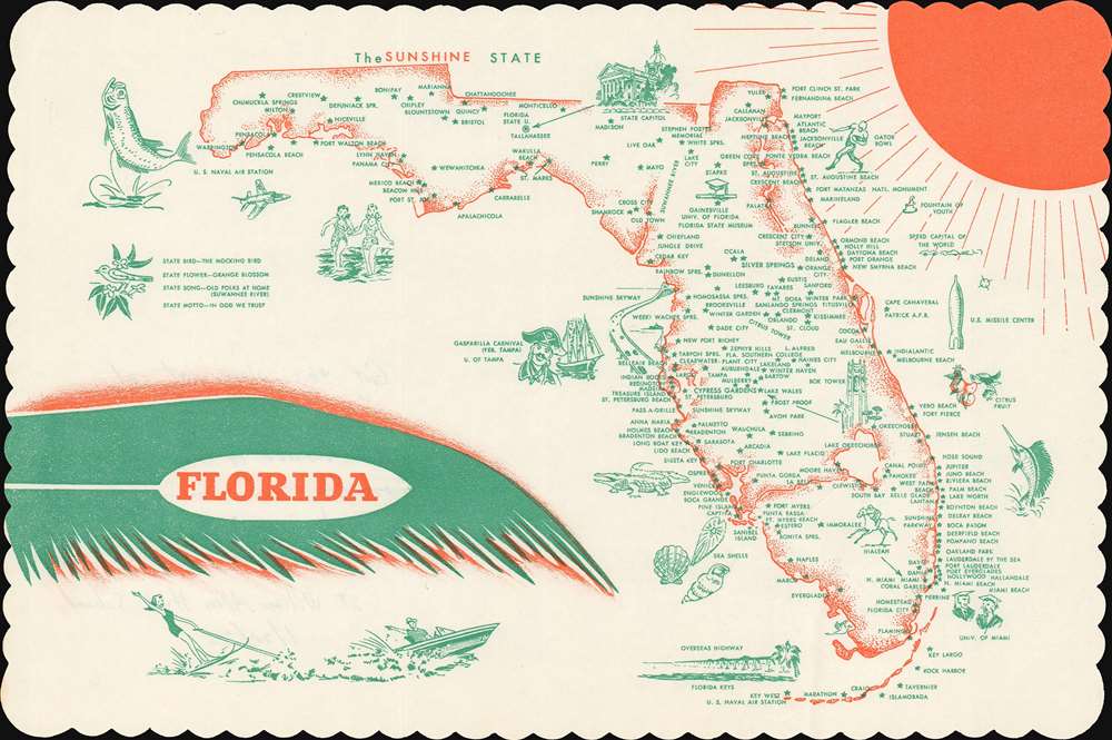
Florida.
$150.00
Acquire
This is a 1973 pictorial placemat map of Florida. Depicting the entire state, cities, and towns are marked by stars, with the highest concentration along the Atlantic coast. Pictorial vignettes promote Florida's tourist activities, including deep-sea fishing, the beach, waterskiing, and college football, in the form of the Gator Bowl. Students in graduation regalia mark the University of Miami and the University of Florida. Other vignettes illustrate the State Capitol Building, the U.S. Naval Air Station at Pensacola, and the U.S. Missile Center at Cape Canaveral. The Sun occupies the upper right corner, perhaps evoking Florida's nickname, 'The Sunshine State,' and the map's title is set on top of a palm frond. (more details)
Administering the new Hawaii Territory.
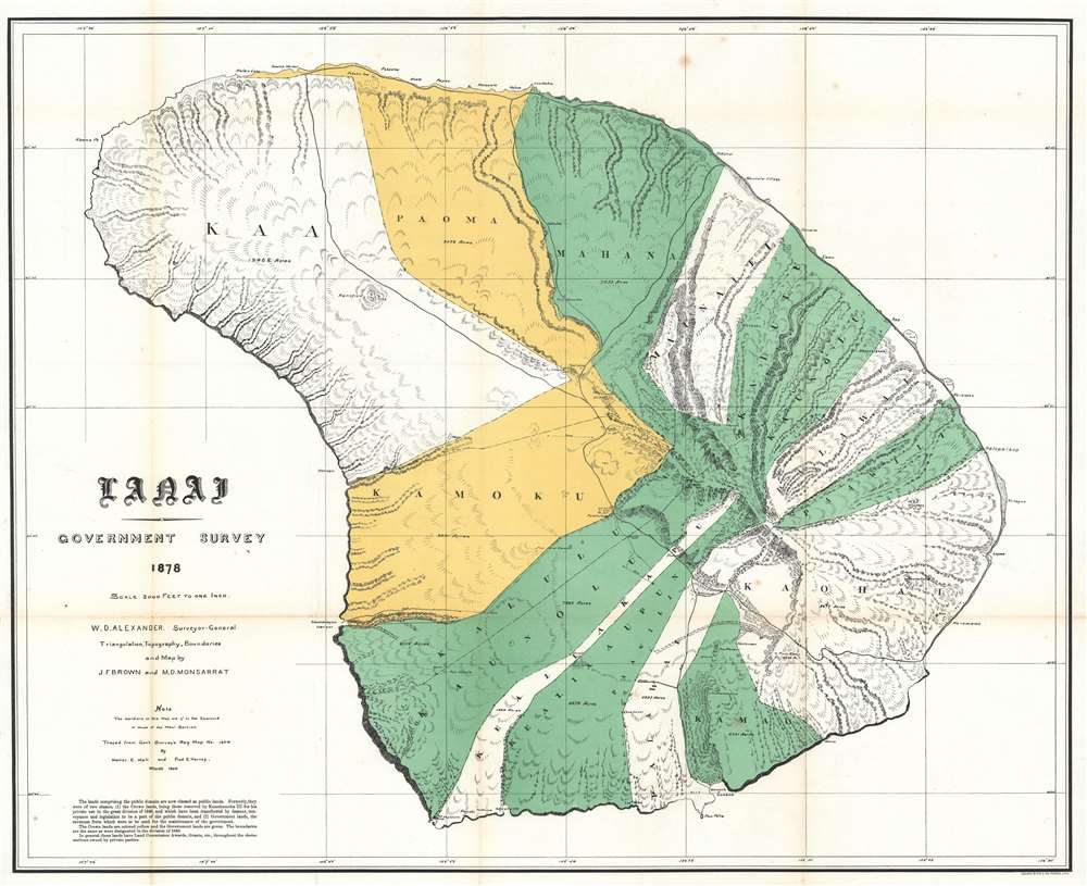
Lanai Government Survey.
$750.00
Acquire
- Digital Map Information
- Suitable for large format printing
- File Size: 37.18 MB
- File Type: ZIP / TIFF
- ICC color profile embedded
- Delivered instantly via download link
This is an exceptional 1878 map of the island of Lanai, in the Hawaiian Islands, prepared for the 1900 Report of the Governor of the Territory of Hawaii to the Secretary of the Interior. Although the cartographic work that produced this map was started in 1878, during the Hawaiian Monarchy, the map itself, and the report that contained it, was issued following the U.S. Government's 1898 annexation of the Hawaiian Republic. The Report was an attempt to assess and examine the newly created Hawaiian Territory's potential for Americanized administration and development. Consequently, the map focuses on Public Lands, Homestead Settlement Tracts, Grazing Lands, Pineapple Lands, Sugar Plantations, Forest Reserves, Forest Lands, Wet Lands, etc. It also features both practical and topographic details for use in administering the region. The governor at this time was George R. Carter. (more details)
Real estate in Florida, Then and Now.
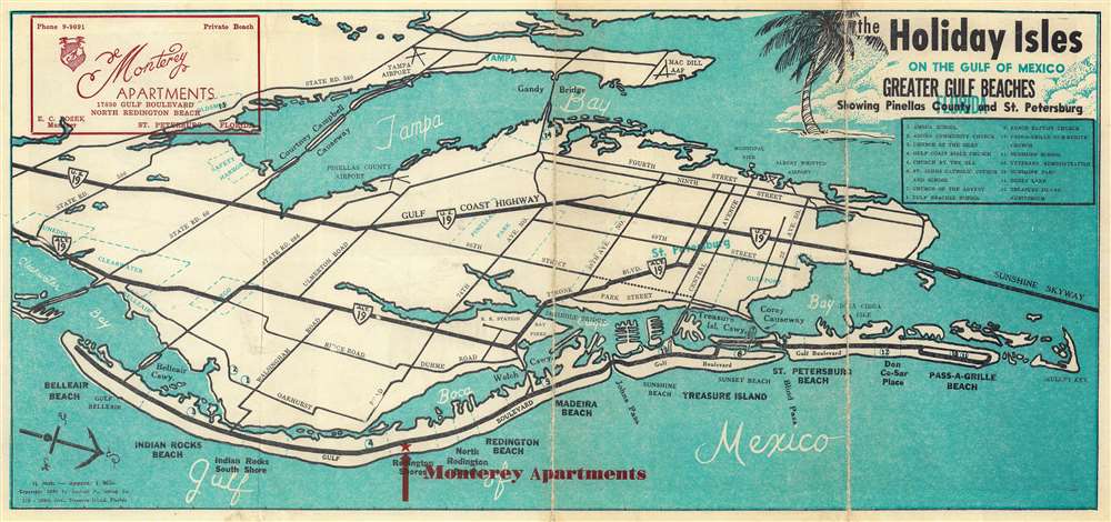
The Holiday Isles on the Gulf of Mexico Greater Gulf Beaches Showing Pinellas County and St. Petersburg.
$150.00
Acquire
This is an uncommon 1955 perspective map of Tampa By and St. Petersburg Florida. The map is oriented to the east and presented in a semi-view form to highlight Sand Key and the developments there - specifically the Monterey Apartments on Redington Shores. The verso features illustrations of the Monterey Apartments courtyard filled with sunbathing beauties. The Monterey still exists on Sand Key, and looks much the same now as then, but today is billed as a vacation rental. (more details)
China Survey from the Second Opium War.
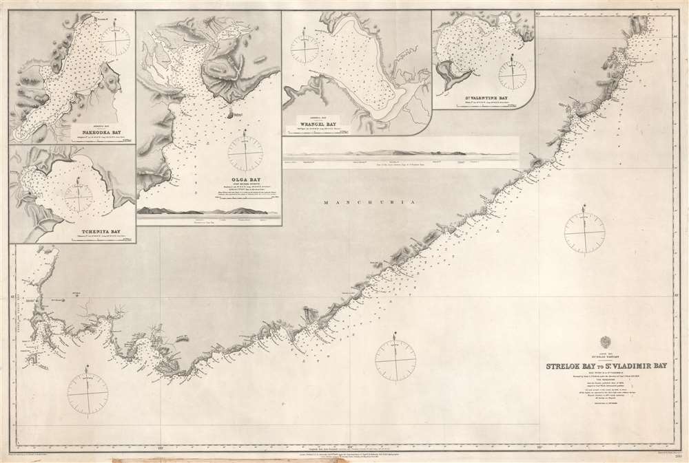
Strelok Bay to St. Vladimir Bay.
$150.00
Acquire
- Digital Map Information
- Suitable for large format printing
- File Size: 55.74 MB
- File Type: ZIP / TIFF
- ICC color profile embedded
- Delivered instantly via download link
This is a rare 1868 Admiralty nautical chart or maritime map of the Pacific coast of Russian Manchuria, just east of Valdivostok. The map is the result of detailed surveys conducted during the Second Opium War Second Opium War (1856 - 1860). The map depicts the coastline in great detail from Nakhodka to St. Vladimir Bay (Zaliv Vladimira). Numerous coastal locations are labeled including several points, islands, rivers, and smaller bays. Depth soundings are noted all along the coast, with the highest concentration around St. Vladimir Bay and America Bay. Four inset maps are situated in the upper left, depicting Tcheniya Bay, Nakhodka Bay, Olga Bay, and Wrangel Bay. Each of these inset maps include numerous depth soundings along with several identified locations. A profile view of the coastline between Olga Bay and St. Vladimir Bay is also illustrated. (more details)
Comparative cartography.
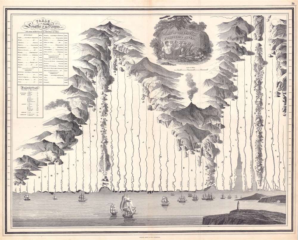
Plan of the Principal Rivers throughout the World.
$1,250.00
Acquire
- Digital Map Information
- Suitable for large format printing
- Full resolution TIFF file
- ICC color profile embedded
- Delivered instantly via download link
This is a c. 1830 George Philip and Son comparative chart of the world's rivers. Divided geographically, the world's rivers fall into four groups: European, Asian, American, and African. Philip employs boulders, ridges, forests, and mountain ranges to divide the groups. The rivers originate in fantasy mountain ranges. All the rivers empty into a sea along the bottom of the chart. Here, it is worth noting that Philip also pays close attention to the mouths of the rivers and illustrates their deltas in some detail. Among these are the Rhine, Volga, Indus, Niger, and Nile. The mouths of the Amazon and the Rio de la Plata receive exceptional treatment. Numerous sailing ships ply the waters of this vast imaginary sea and a lighthouse occupies a point of land in the foreground on the right. A table situated in the upper left provides the length of each river in miles. A smaller table compares the length of the Thames (an English reader's likely point of reference) with that of other world rivers and states that the Amazon is over fifteen times as long. (more details)