
Owen, Frederick D. (sold)

Frederick D. Owen (1871 - January 28, 1931) was an American cartographer, engineer, and architect active in Washington D.C. in the late 19th and early 20th centuries. Owen was born in Connecticut, Owen was a civilian contractor with the U.S. Bureau of Topographical Engineers. He worked with the First Lady Caroline Harrison (1832 - 1892), wife of President Benjamin Harrison, to plan an ambitious expansion of the White House, but it was never realized. Seven of his maps are located in the Library of Congress. He created the maps that hung in the ‘War Room’ at the White House during the Spanish-American War (‘Frank Leslie’s Popular Monthly’, Vol. L, No. 2, 113.). Later, Owen worked for the Washington D.C. Parks department.
One of the earliest mappings of the ruins of the Ancient Puebloans - includes Mesa Verde and Chaco Canyon!
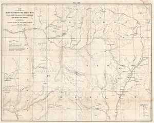
Map of the Region Occupied by the Ancient Ruins in Southern Colorado, Utah and Northern New Mexico and Arizona. Also Showing the Location of Most of the Modern Pueblos.
sold
- Digital Map Information
- Suitable for large format printing
- File Size: 8.36 MB
- File Type: ZIP / TIFF
- ICC color profile embedded
- Delivered instantly via download link
This is an 1876 F. D. Owen map of the ancient Native American ruins in the American Southwest. The map depicts the Four Corners region from southern Utah and Arizona to Colorado and New Mexico. Ruins are present throughout the region, with the largest concentration ... (more details)
Illustrates the many renovations undertaken during President Theodore Roosevelt's first term.
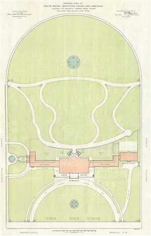
General Plan of the White House, Executive Office and Grounds Showing the Exterior Changes Made During the Fiscal Year Ending June 30th, 1903.
sold
- Digital Map Information
- Suitable for large format printing
- File Size: 8.14 MB
- File Type: ZIP / TIFF
- ICC color profile embedded
- Delivered instantly via download link
This is a 1903 F. D. Owen map or plan of the White House and renovations undertaken by request of President Theodore Roosevelt, including the newly-constructed Executive Office (which would become the West Wing) and East Wing, Roosevelt's entrance for formal and ... (more details)
Evolution of the National Mall.
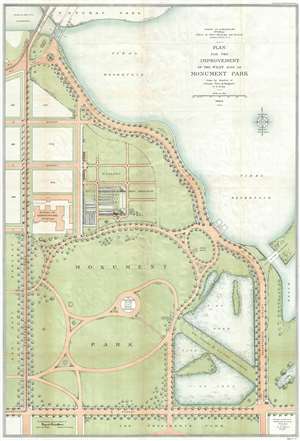
Plan for the Improvement of the West Side of Monument Park.
sold
- Digital Map Information
- Suitable for large format printing
- File Size: 17.94 MB
- File Type: ZIP / TIFF
- ICC color profile embedded
- Delivered instantly via download link
This is a 1902-04 U.S. Army Corps of Engineers map of Monument Park, the National Mall, Washington D.C. This map was issued to address draining issues of drainage - note the large fishponds in the lower right. Centered on the Washington Monument and oriented to the south, with north at the bottom, the map depicts from the President's Park at the bottom to the tidal reservoir, the Maryland Avenue Bridge and Potomac Park at the top, and from Fourteenth Street to Seventeenth Street and the tidal basin on the right. Above Memorial Park and the Washington Monument, B, C, and D Streets are depicted as well as several city blocks. The Bureau of Engraving and Printing is identified, as well as the Nursery of the Office of Public Buildings and Grounds. To the right of Monument Park, two fishponds are illustrated, which, per the map, were part of the U.S. Fish Commission. To the left of Monument Park, across Fourteenth Street, lies the grounds of the Agriculture Department. (more details)