
Stars and Stripes, Pacific Editions (sold)

Stars and Stripes, Pacific Editions (1945-1963) began publishing the week of VE Day in May, 1945 in Honolulu, Hawaii. Later that year editions were published in China and Japan as well. When the war ended, the newspaper’s readership and staff both fell, although it was still published for occupational forces and other armed forces still employed. In 1951, during the Korean War, a Korean edition was published.
Printed by the Army publication Stars and Stripes in the middle of the Korean War.
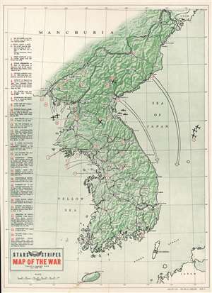
Map of the War.
sold
- Digital Map Information
- Suitable for large format printing
- File Size: 27.55 MB
- File Type: ZIP / TIFF
- ICC color profile embedded
- Delivered instantly via download link
This is a 1952 Pacific Stars and Stripes map of the Korean War. The map depicts the region from Manchuria to Japan and from the Yellow Sea to the Sea of Japan. Tracing events from the North Korean invasion of South Korea on June 25, 1950 through Operation Strangle launched, a sustained attack on North Korean communication and supply lines in late August 1951. Twenty-five different locations are numerically identified, these include U.N. attacks, North Korean or Chinese counterattacks, air strikes, 'Heartbreak Ridge', U.N. and Communist POW camps, and the site of the first ceasefire talks at Kaesong. Each action or location corresponds with an index along the left border. Major cities throughout both North and South Korea are labeled, as is the Yalu River (the border between North Korea and China). The 38th parallel, the border the North Koreans crossed to start the war, is highlighted by a solid black line. (more details)
Height of the Korean War.
Map of the War.
sold
- Digital Map Information
- Suitable for large format printing
- Full resolution TIFF file
- ICC color profile embedded
- Delivered instantly via download link
This is a 1952 Pacific Stars and Stripes map of the Korean War. It traces events from the North Korean invasion of South Korea on June 25, 1950, through Operation Strangle, a sustained attack on North Korean communication and supply lines in late August 1951. (more details)
Printed by the Army publication Stars and Stripes in the middle of the Korean War.
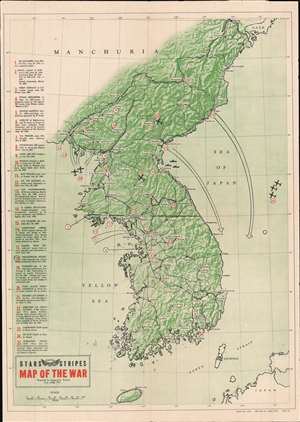
Map of the War.
sold
- Digital Map Information
- Suitable for large format printing
- File Size: 24.62 MB
- File Type: ZIP / TIFF
- ICC color profile embedded
- Delivered instantly via download link
This is a 1952 Pacific Stars and Stripes map of the Korean War. The map depicts the region from Manchuria to Japan and from the Yellow Sea to the Sea of Japan. Tracing events from the North Korean invasion of South Korea on June 25, 1950 through Operation Strangle, a sustained attack on North Korean communication and supply lines in late August 1951. Twenty-five different locations are numerically identified, these include U.N. attacks, North Korean or Chinese counterattacks, air strikes, 'Heartbreak Ridge', U.N. and Communist POW camps, and the site of the first ceasefire talks at Kaesong. Each action or location corresponds with an index along the left border. Major cities throughout both North and South Korea are labeled, as is the Yalu River (the border between North Korea and China). The 38th parallel, the border the North Koreans crossed to start the war, is highlighted by a solid black line. (more details)
Detailed map of the Korean War - labels several key engagements.
Pacific Stars and Stripes Map of the War.
sold
- Digital Map Information
- Suitable for large format printing
- File Size: 10.89 MB
- File Type: ZIP / TIFF
- ICC color profile embedded
- Delivered instantly via download link
This is a 1953 Pacific Stars and Stripes map of the Korean War. The map depicts the Korean peninsula from the Yalu River and the Tumen River to the Korea Strait and from the Yellow Sea to the Sea of Japan. Twenty-five different events in the history of the Korean ... (more details)
Patriotic map of the Korean War.
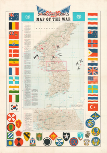
Pacific Stars and Stripes Map of the War.
sold
- Digital Map Information
- Suitable for large format printing
- Full resolution TIFF file
- ICC color profile embedded
- Delivered instantly via download link
This is a 1953 Pacific Stars and Stripes map of the Korean War (1950 - 1953). It depicts the Korean Peninsula near the 'end' of the conflict, which had reached a stalemate and resulted in a ceasefire in July 1953, three years and one month after North Korea's initial invasion of the South. (more details)
Detailed and gorgeous map of the Korean War - with unit insignia, manuscript notations, and a signature!
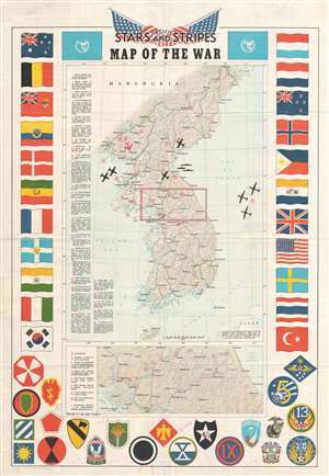
Pacific Stars and Stripes Map of the War.
sold
- Digital Map Information
- Suitable for large format printing
- File Size: 10.78 MB
- File Type: ZIP / TIFF
- ICC color profile embedded
- Delivered instantly via download link
This is a 1953 Pacific Stars and Stripes map of the Korean War. The map depicts the Korean peninsula from the Yalu River and the Tumen River to the Korea Strait and from the Yellow Sea to the Sea of Japan. Twenty-five different events in the history of the Korean ... (more details)
Detailed and gorgeous map of the Korean War - with unit insignia, manuscript notations, and a signature!
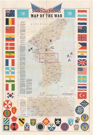
Pacific Stars and Stripes Map of the War.
sold
- Digital Map Information
- Suitable for large format printing
- File Size: 11.7 MB
- File Type: ZIP / TIFF
- ICC color profile embedded
- Delivered instantly via download link
This is a 1953 Pacific Stars and Stripes map of the Korean War. The map depicts the Korean peninsula from the Yalu River and the Tumen River to the Korea Strait and from the Yellow Sea to the Sea of Japan. Twenty-five different events in the history of the Korean ... (more details)
Patriotic map of the Korean War.
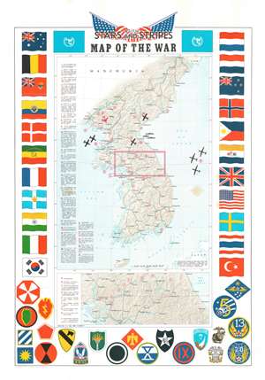
Pacific Stars and Stripes Map of the War.
sold
- Digital Map Information
- Suitable for large format printing
- File Size: 29.66 MB
- File Type: ZIP / TIFF
- ICC color profile embedded
- Delivered instantly via download link
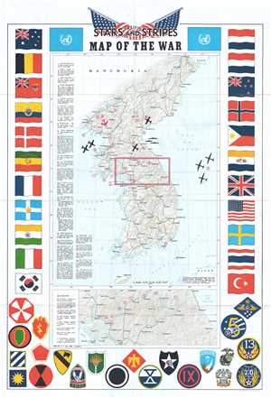
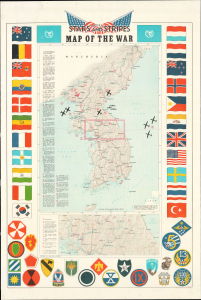
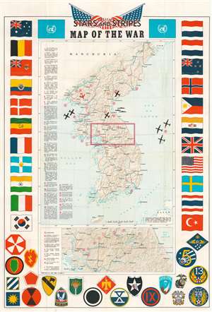
This is a 1953 Pacific Stars and Stripes map of the Korean War. The map depicts the Korean peninsula from the Yalu River and the Tumen River to the Korea Strait and from the Yellow Sea to the Sea of Japan. Twenty-five different events in the history of the Korean War are numerically identified, with explanations appearing along the left border. Several silhouettes of aircraft are depicted, including what appears to be the Grumman F9F Panther, a squadron of large four-engine bombers over the Sea of Japan, and a MiG-15 illustrated in red. An inset map, situated below the central map of the Korean peninsula, details the area in the box in the larger map, along the 38th parallel from Yonan and P'anmunjom to Kansong. Several different hills and ridges that played major roles in battles are labeled, including the area of the Punchbowl, Bloody Ridge, Heartbreak Ridge, and Christmas Hill, along with the Iron Triangle. The map is bordered on three sides by the flags of the United Nations and the insignia of numerous American combat units are included along the bottom border. (more details)
Includes the published index!
Pacific Stars and Stripes Map of the War.
sold
- Digital Map Information
- Suitable for large format printing
- Full resolution TIFF file
- ICC color profile embedded
- Delivered instantly via download link
This is a 1953 Pacific Stars and Stripes map of the Korean War (1950 - 1953). It depicts the Korean Peninsula near the 'end' of the conflict, which had reached a stalemate and resulted in a ceasefire in July 1953, three years and one month after North Korea's initial invasion of the South. The present example is accompanied by the fourteen-page pamphlet it was issued with, containing an index to the map itself and a historical gloss of the war in question. (more details)
Features manuscript notations likely written by a Korean War veteran.
Pacific Stars and Stripes Map of the War.
sold
- Digital Map Information
- Suitable for large format printing
- Full resolution TIFF file
- ICC color profile embedded
- Delivered instantly via download link
This is a 1953 Pacific Stars and Stripes map of the Korean War. Twenty-five different events in the history of the Korean War are numerically identified, with explanations appearing along the left border. Several silhouettes of aircraft are depicted, including what appears to be a Grumman F9F Panther, a squadron of large four-engine bombers over the Sea of Japan, and a MiG-15 illustrated in red. An inset map, situated below the central map of the Korean peninsula, details the area in the box in the larger map, along the 38th parallel from Yonan and P'anmunjom to Kansong. Several different hills and ridges that played major roles in battles are labeled, including the area of the Punchbowl, Bloody Ridge, Heartbreak Ridge, and Christmas Hill, along with the Iron Triangle. The map is bordered on three sides by the flags of the United Nations and the insignia of numerous American combat units are included along the bottom border. (more details)