
Schropp, Simon (sold)

Simon Schropp (fl. c. 1742 - present) was a German cartographer and bookseller active in Berlin during the 18th and 19th centuries. In April of 1742 Schropp received permission from the Prussian King Frederick II to make and sell maps in Berlin. Frederick was keenly aware of the lack of accurate cartographic knowledge regarding his kingdom and promoted both public and private cartographic efforts accordingly. By the late 18th century Schropp had become Berlin's most prominent publisher of maps and atlases. Schropp's royal mandate and allowed him access to some of Prussia's leading cartographic figures, including Daniel Sotzmann, the Royal Geographer, among other. His maps thus contained the most updated cartographic knowledge and were considered to be of the highest caliber. Despite wars, French occupation of Berlin, Schropp thrived. Schropp and Company remains alive and well today. Their original location Konigsstrasse and Heilige Geiststrasse was destroyed in a bomb during the final days of World War II, but their new location on Hardenbergstr, 9a, is a thriving business catering to the travel and tourism literature market.
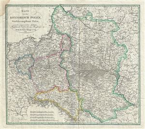
Karte von dem Konigreich Polen, Grossherzogthum Posen, und den angrenzenden Gebieten Russlands, Oestreichs, und Preussens.
sold
- Digital Map Information
- Suitable for large format printing
- DPI: 300
- File Size: 14.34 MB
- File Type: ZIP / TIFF
- ICC color profile embedded
- Delivered instantly via download link
This is a beautiful example of Simon Schropp's 1831 map of Poland and Lithuania. The map depicts the Kingdom of Poland (Congress Poland), the Grand Duchy of Posen and neighboring territories of Austria, Russia and Prussia. It covers the modern day countries of ... (more details)
Most authoritative Map of Armenia, Kurdistan and Azerbaijan of the 19th Century.
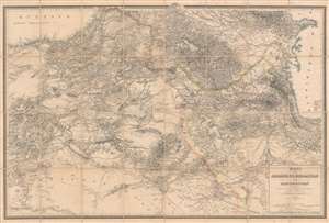
Karte von Armenien, Kurdistan und Azerbeidschan in vier blatt im Anschluss an die IV westlichen und mittleren Blätter der Karte von Klein-Asien, entworfen und bearbeitet 1852-55.
sold
- Digital Map Information
- Suitable for large format printing
- File Size: 93.53 MB
- File Type: ZIP / TIFF
- ICC color profile embedded
- Delivered instantly via download link
A seminal production, this is Heinrich Kiepert's 1858 map of Armenia, Kurdistan, and Azerbaijan, the definitive map of the region for more than 50 years. This map was used for treaty negotiation, military activity, and administration. In order to create it, Kiepert travelled the region many times - constantly sketching maps. His own observations were supplemented by diligent scholarship, resulting in a deep understanding local exploratory history and earlier survey work - note how throughout are noted, and dated, the tracks of earlier voyagers. The result is the finest area map available for most of the second half of the 19h century. The dense hachuring testifies to the areas daunting topography, underscoring the greatness of Kiepert's achievement. (more details)