
Sharbau, Henry (sold)

Henry Sharbau, (fl. 1870-1906) was a lithographer active in London and Edinburgh. While nothing is known of his early training, it is likely that his early years were spent with the navy: his earliest known works of the 1870s were on charts produced by the Hydrographic Department. The 1880s saw the beginning of a long association with the Royal Geographic Society, and then with the mapmaking firm of W. and A.K. Johnston. Over a hundred works appear in OCLC with Sharbau’s imprint. Interestingly, the British Naval Lists reveal a Frederic Henry Sharbau (1867-1963!!!) working as a cartographer and draughtsman starting about 1907 and lasting into the 20s. Perhaps this Methuselah is a son?
Follows the little-studied 1889 Pevtsov Expedition in Central Asia.
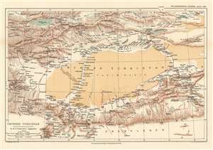
Chinese Turkistan Showing the Surveys and Routes of Col. M.B. Pevtsof and K.I. Bogdanovitch.
sold
- Digital Map Information
- Suitable for large format printing
- File Size: 11.36 MB
- File Type: ZIP / TIFF
- ICC color profile embedded
- Delivered instantly via download link
This is an 1893 Henry Sharbau map of Xijiang Province in China and Kyrgyzstan. The map depicts the movements of the 1889 Imperial Russian Geographical Society expedition to Central Asia led by Mikhail Vasilievich Pevtsov, which are traced by the thick red line. An impressive level of detail is present. Numerous towns and villages are identified, as are rivers and mountain peaks. Issyk Kul, the second largest salt water lake in the world, is situated in the upper left corner. (more details)
By far the best map of Siam available to the public at the turn of the century' -H. Meinheit
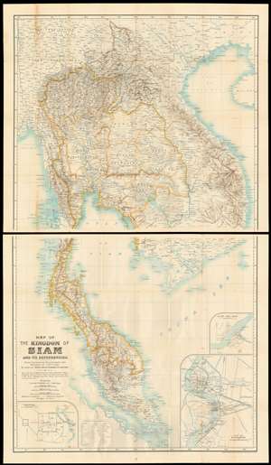
Map of the kingdom of Siam and its dependencies
sold
- Digital Map Information
- Suitable for large format printing
- File Size: 66.39 MB
- File Type: ZIP / TIFF
- ICC color profile embedded
- Delivered instantly via download link
This is James Fitzroy McCarthy’s 1900 Map of Thailand / Siam and the surrounding countries: it is the first complete, scientific map to present this region, produced at a time when French diplomat, explorer and surveyor August Pavie was surveying the same region. The two-sheet map shows all of Siam, eastern Burma, Laos, Cochinchina and the Malay Peninsula. There are inset plans of Bangkok, Chiang Mai, and Luang Prabang on the lower sheet. (more details)