
Shurtleff, Elizabeth (sold)

Elizabeth Shurtleff (September 3, 1890 - December 7, 1968), or Elizabeth Cate, was an American painter and artist active in the middle part of the 20th century. She was born in Concord, New Hampshire and attended the Boston Museum School of Fine Arts. Shurtleff is known for a small but significant corpus of pictorial maps issued alone and in collaboration with others between 1926 and 1930. She frequently collaborated with Wellesley graduates and pictorial mapmakers Helen F. McMillin, Elizabeth L. McMillin, and Alva Bennett Scott. These women were at the forefront of a new generation of female mapmakers emerging in the mid-20th century. Together with Helen F. McMillin, Shurtleff headed the Boston based Graphic History Association Publishers of Historical Maps. Elizabeth was married to Carroll L. Cate of Montreal. She died in Montreal in 1968.
Early work by important women cartographers.
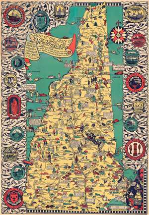
Map of the State of New Hampshire.
sold
- Digital Map Information
- Suitable for large format printing
- File Size: 109.37 MB
- File Type: ZIP / TIFF
- ICC color profile embedded
- Delivered instantly via download link
This is a 1926 Elizabeth Shurtleff and Helen F. McMillin pictorial map of New Hampshire. Shurtleff and McMillin were among the most prominent of the pioneering female artists who influenced the Golden Age of American Pictorial Cartography - from the 1920s - 1940s. Shurtleff was a New Hampshire native, and this map represents some of her earliest formative work - and as such offers both scarcity and significance. (more details)
Stunning pictorial map by one of the great female pictorial cartographers.
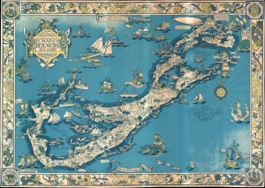
The Sommer Ilands. A map of the Bermuda Islands. Ya des Demonios, Isles of the Devils.
sold
- Digital Map Information
- Suitable for large format printing
- File Size: 64.22 MB
- File Type: ZIP / TIFF
- ICC color profile embedded
- Delivered instantly via download link
A stunning large format pictorial map of Bermuda issued in 1930 by a trio of female mapmakers based in Boston: Elizabeth Shurtleff, Helen F. McMillin, and her niece Elizabeth L. McMillin. The map covers all of Bermuda including the adjacent islands. Pictorial vignettes illustrating island flora, fauna, and social life fill the island and the whole is surrounded by a coral reef motif border. (more details)
Made by one of the great female pioneers of pictorial cartography.
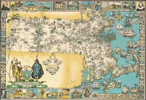
Map of Massachusetts The Old Bay State.
sold
- Digital Map Information
- Suitable for large format printing
- File Size: 57.37 MB
- File Type: ZIP / TIFF
- ICC color profile embedded
- Delivered instantly via download link
An uncommon 1930 pictorial map of Massachusetts issued by Tudor Press and Elizabeth Shurtleff, one of the most prominent female pictorial mapmakers. The map covers all of Massachusetts with vignette cartoon illustrations of various towns. Considerable focus is placed on industry, and many towns are highlighted with factory and/or mill illustrations. Indications of the merchandise produced there are also noted, including knit goods, shoes, jewelry, optical goods, textiles, etc. Other illustrations reference events of the American Revolutionary War. Surrounding the map are decorative armorial crests celebrating the many distinguished institutions of learning located throughout Massachusetts. Among them are Harvard, the Roxbury Latin School, Williams, Phillips Andover, the Bradford Academy, Amherst, Wheaton, the Abbot Academy, Mount Holyoke, Holy Cross, Tufts, MIT, Boston College, St. Marks, and Boston University. (more details)