
Stark, James Henry (sold)
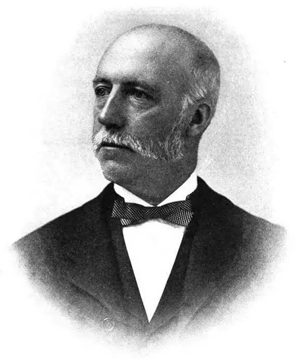
James Henry Stark (July 6, 1846 - August 30, 1919) was an American publisher active in the late 19th and early 20th centuries. Stark was born in Mutcham, Surrey, England. As a young man in England he was raised by Thomas Cook, the famous English travel agent. He moved to the United States in 1856, when he was 9 or 10. In the United States, he studied at Hawes Grammar School in South Boston, and later attended the Lincoln School and the Boston Latin School. He began studying printing, particularly stereotyping and electrotyping, in 1864. In 1870 he established himself as a printer at the corner of Water and Congress Streets. He prospered until the Great Boston Fire of 1872, when his establishment burnt to the ground. After the fire, he turned his attention to yachting, suggesting access to considerable wealth, and sailed from Boston to the Caribbean and to South America, where he prospected for and discovered gold in Dutch Giana. He eventually returned to Boston, where he once again went into the printing business, establishing a stereotype and electrotype foundry at 1717 Devonshire Street. Stark partnered with William H. Mumler (1832 - 1884) in 1877 to found the Photo-Electrotype Company, one of the earliest American photolithography companies. Stark sold his shares of the company in 1900 and turned to Real Estate. Through his interest in Yachting and Caribbean travel, and possibly influenced by his connected to Thomas Cook, Start also had a successful business composing and writing guidebooks for various West India Islands. He also issued the Stranger's Guide to Boston.
A rare plan of Boston bordered by advertisements - including one for a piano shop.
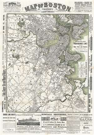
Map of Boston and Vicinity from the Latest Surveys.
sold
- Digital Map Information
- Suitable for large format printing
- Full resolution TIFF file
- ICC color profile embedded
- Delivered instantly via download link
This is a c. 1880 Photo-Electrotype Company city plan or map of Boston and vicinity. The map depicts the region from Newton to East Boston and from Medford and Chelsea to Milton, Hyde Park, and Dedham. Innumerable streets are illustrated and add to the incredible amount of detail presented. Railroad tracks, bridges, parks, and wharves represent Boston's economic importance. The 'urban sprawl' spreading out from the historic center of town underscores the city's growth and prosperity. Advertisements for pianos, alcohol and ginger ale, ferries between New York and Boston, carriages, and printers occupy the borders. A smaller map of central Boston and a bird's-eye view of Boston Harbor are printed on the verso, along with more advertisements. (more details)
Railroads to Magnificent Mountains.
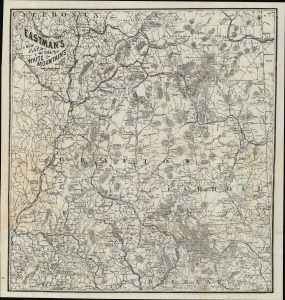
Eastman's New Map of the White Mountains.
sold
- Digital Map Information
- Suitable for large format printing
- File Size: 17.99 MB
- File Type: ZIP / TIFF
- ICC color profile embedded
- Delivered instantly via download link
A fascinating c. 1885 Edison Eastman pocket map of the White Mountains, New Hampshire. Among other features, it represents the spread of passenger railroads throughout the region, leading to posh hotels designed above all as rural getaways for well-heeled New Yorkers and Bostonians. (more details)
Fine 19th century tourist map of Bermuda.
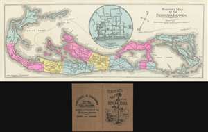
Tourist's Map of the Bermuda Islands.
sold
- Digital Map Information
- Suitable for large format printing
- File Size: 19.72 MB
- File Type: ZIP / TIFF
- ICC color profile embedded
- Delivered instantly via download link
A rare c. 1890 tourist map of Bermuda by James Henry Stark. The map is oriented to the Northwest and covers all of Bermuda. A large inset at center details Hamilton, Bermuda's cosmopolitan capital. A dotted line identifies steamer routes around the island. Additional, the map identifies much that would be of interest to tourists, including hotels, roads, bridges, museums, churches, and of course, both the old and new Lunatic Asylums. (more details)
A charming city plan of Nassau in the Bahamas.
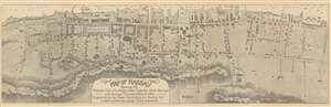
Map of Nassau Showing the Principal Public Buildings, made from the latest Surveys in the Surveyor General's Office to 1891.
sold
- Digital Map Information
- Suitable for large format printing
- File Size: 13.31 MB
- File Type: ZIP / TIFF
- ICC color profile embedded
- Delivered instantly via download link
This is an 1891 James Henry Stark city map or plan of Nassau, The Bahamas. The map depicts the city from Nassau Street to Armstrong Street and from the harbor to Fort Fincastle and Meeting Street. Highly detailed, myriad buildings throughout the city are illustrated, with two barracks, the ordnance yard, the navy yard, the cathedral, the library, and the Royal Victoria Hotel among those identified. Potter's Cemetery, the French consulate, the Government House, and the statue of Columbus are also noted. Every street is labeled, as is the parade ground. Depth soundings are noted in the harbor. (more details)