
Þorláksson, Guðbrandur (sold)
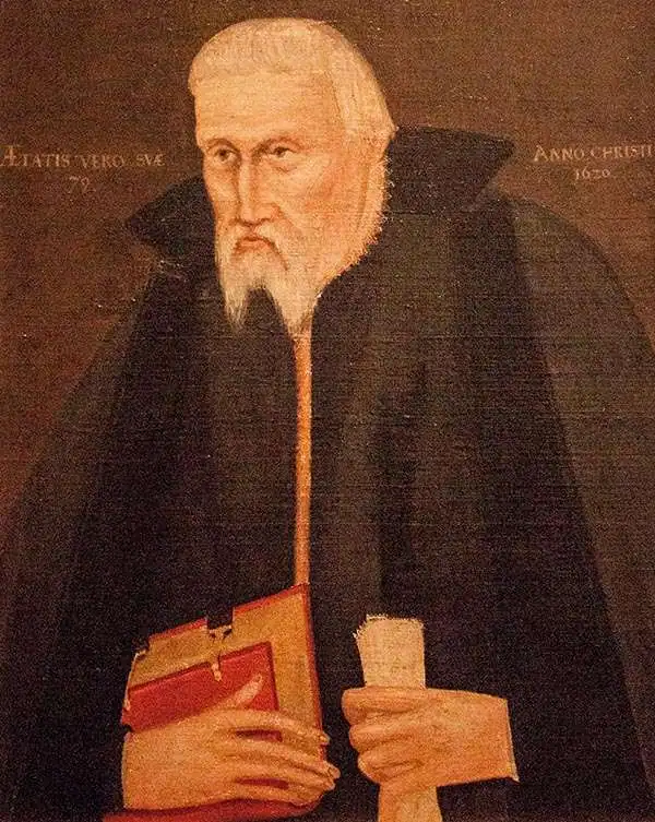
Guðbrandur Þorláksson or Gudbrand Thorlakssøn (c. 1542 - July 20 1627) was bishop of Hólar, Iceland from April 1571 until his death. He was the longest-serving bishop in Iceland. He is known for printing the first complete Icelandic translation of the Bible, and for providing the data for the first accurate maps of Iceland, printed at the end of the sixteenth century by Ortelius and Mercator. He was the son of the priest Þorláks Hallgrímssonar, and Helga Jónsdóttir, daughter of the lawyer Jón Sigmundsson. He studied at Hólar College from 1553 to 1559 before studying theology and logic at the University of Copenhagen: Guðbrandur was one of the first Icelanders to study in Denmark instead of in Germany. He returned to Iceland in 1564 to serve as rector of the Skálholt School before becoming a priest. In 1571 he was named Bishop of Hólar by the Danish King Frederick II; he would serve as bishop of Hólar for 56 years.
As bishop, Guðbrandur focused on printing religious works - including hymns, and the Bible - in Icelandic. He printed nearly 100 books - many of which he wrote and translated himself. In addition to cementing the Reformation firmly in Iceland, his efforts to accurately translate these works are credited with fundamentally strengthening the Icelandic language overall.
A well-rounded scholar, Guðbrandur maintained interests in natural history, astronomy, and surveying. He is credited with the drafting of at least one new map of Iceland, upon which the first printed maps of the Island by Abraham Ortelius and Gerard Mercator were based.
A well-rounded scholar, Guðbrandur maintained interests in natural history, astronomy, and surveying. He is credited with the drafting of at least one new map of Iceland, upon which the first printed maps of the Island by Abraham Ortelius and Gerard Mercator were based.
One of the most desirable printed maps of any part of the world.
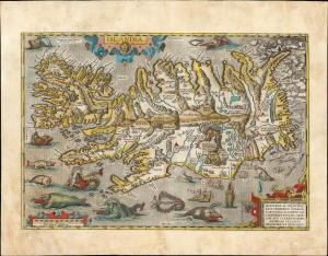
Islandia.
sold
- Digital Map Information
- Suitable for large format printing
- Full resolution TIFF file
- ICC color profile embedded
- Delivered instantly via download link
This is an attractive example of Abraham Ortelius' 1587 map of Iceland. Ortelius' Islandia is arguably the most famous decorative map, being the 'monster map' par excellence, presenting a menagerie of the sea monsters typically found on early maps. The map is geographically important as well. Beyond strongly evoking Iceland's astonishing terrain with its vigorously engraved mountains, it is remarkably accurate since it is the first map of Iceland derived from the contemporaneous work of an Icelander, Gudbrandur Thorlaksson (Guðbrandur Þorláksson; c. 1542 - 1627). (more details)
One of the most desirable maps of any part of the world, ever printed.
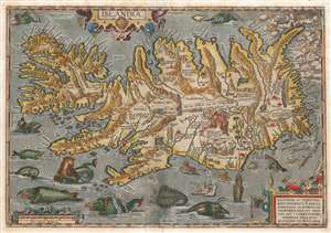
Islandia.
sold
- Digital Map Information
- Suitable for large format printing
- Full resolution TIFF file
- ICC color profile embedded
- Delivered instantly via download link
This is a beautiful example of the Vrients issue of Abraham Ortelius' 1587 map of Iceland. Ortelius' Islandia is arguably the most famous decorative map, being the 'monster map' par excellence, as it presents a menagerie of sea monsters typically found on early maps. The map is geographically important as well. It strongly evokes Iceland's astonishing terrain with its vigorously engraved mountains, and it is remarkably accurate since it is the first map of Iceland based on reports of an Icelander, Gudbrandur Thorlaksson (Guðbrandur Þorláksson; c. 1542 0 1627). (more details)
One of the most desirable printed maps of any part of the world, in original color.
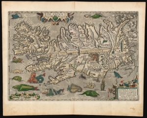
Islandia.
sold
- Digital Map Information
- Suitable for large format printing
- Full resolution TIFF file
- ICC color profile embedded
- Delivered instantly via download link
This is a superb example of Abraham Ortelius' 1587 map of Iceland, in a desirable 1603 Vrients edition with original color. Ortelius' Islandia is arguably the most famous decorative map, being the 'monster map' par excellence, as it presents a menagerie of the sea monsters typically found on early maps. The map is geographically important as well. Beyond strongly evoking Iceland's astonishing terrain with its vigorously engraved mountains, it is remarkably accurate since it is the first map of Iceland derived from the contemporaneous work of an Icelander, Gudbrandur Thorlaksson (Guðbrandur Þorláksson; c. 1542 - 1627). (more details)
One of the most desirable maps of any part of the world, ever printed.
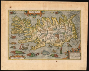
Islandia.
sold
- Digital Map Information
- Suitable for large format printing
- Full resolution TIFF file
- ICC color profile embedded
- Delivered instantly via download link
This is a handsome example of Abraham Ortelius' 1587 map of Iceland, in its 1612 Italian text edition. Ortelius' Islandia is arguably the most famous decorative map, being the 'monster map' par excellence, as it presents a menagerie of sea monsters typically found on early maps. The map is geographically important as well. Beyond strongly evoking Iceland's astonishing terrain with its vigorously engraved mountains, it is remarkably accurate since it is the first map of Iceland derived from the work of an Icelander, Gudbrandur Thorlaksson (Guðbrandur Þorláksson; c. 1542 - 1627). (more details)
First edition of the the second map of Iceland based on local information.
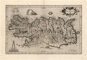
Islandia.
sold
- Digital Map Information
- Suitable for large format printing
- Full resolution TIFF file
- ICC color profile embedded
- Delivered instantly via download link
This is a beautiful strike of Gerhard Mercator's map of Iceland, in a beautiful 1595 first edition example. It is the second map of Iceland to appear in a modern atlas, and the second map overall of Iceland based on data originating from an Icelander, placing it among the first accurate maps of the island. Mercator's map first appeared in 1595, only five years after Abraham Ortelius' famous map; both maps shared the same ultimate source: Guðbrandur Þorláksson, Bishop of Holar. (more details)
One of the earliest maps of Iceland based on local information.
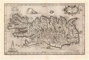
Islandia.
sold
- Digital Map Information
- Suitable for large format printing
- Full resolution TIFF file
- ICC color profile embedded
- Delivered instantly via download link
This is a beautiful strike of Gerhard Mercator's map of Iceland, included by Jodocus Hondius and his heirs in their Atlas sive Cosmographicae. It is the second map of Iceland to appear in a modern atlas, and the second map overall of Iceland based on data originating from an Icelander, placing it among the first accurate maps of the island. Mercator's map first appeared in 1595, only five years after Abraham Ortelius' famous map; both maps shared the same ultimate source: Guðbrandur Þorláksson, Bishop of Holar. (more details)
Dominant 17th-century map of Iceland.
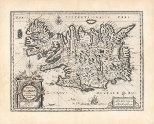
Tabula Islandiae Auctore Georgio Carolo Flandro.
sold
- Digital Map Information
- Suitable for large format printing
- DPI: 600
- File Size: 56.08 MB
- File Type: ZIP / TIFF
- ICC color profile embedded
- Delivered instantly via download link
This is Willem and Joan Blaeu's 1644 map of Iceland, among the most influential and widely copied 17th-century maps of the island. (more details)
Stunning example of the dominant 17th century map of Iceland.
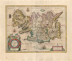
Tabula Islandiae Auctore Georgio Carolo Flandro.
sold
- Digital Map Information
- Suitable for large format printing
- Full resolution TIFF file
- ICC color profile embedded
- Delivered instantly via download link
This is a superb example of Willem and Joan Blaeu's map of Iceland, among the most influential and widely-copied seventeenth century maps of the island. It was engraved in 1628 by Jodocus Hondius the younger, who credited the map to Joris Carolus. Carolus was a noted Dutch navigator and explorer whose extensive travels to Spitzbergen, Davis Strait and other islands of the North Atlantic - and whose own exaggerations of the extent of those travels - established him as an authority on the northern oceans. Carolus' travels did take him to Iceland more than once, but it may be that Hondius used the navigator's name specifically in order to incorporate the navigators' authority without necessarily relying on any information from him. (more details)