
Tudor Press (sold)

Tudor Press (fl. 1910 - 1967) was a Boston based lithograph, offset, and letterpress printer active in Boston throughout the 20th century. They were founded by Ralph Harland Wilbur (1875 - 19??). Wilber learnt the printing trade at the Melrose Journal, a job and book printing business. He struck out on his own, founding Tudor Press in 1910, with offices on Causeway Street, Boston. Ralphs children, Harland, Alvra, and Wesley joined the firm in the 1920s. The press acquired its first four-color offset press in 1940 and was active in printing maps for the war effort. Harland took over the firm in 1941. After World War II, the firm was contracted to issue military currency for U.S. Occupation forces. In 1967, it was relocated to Lawrence, Massachusetts and renamed Graphic Litho. Harland's son Ralph E. Wilbur, took over the firm in 1968. While the name Tudor Press is no longer used, Graphic Litho remains in business.
Portland, Maine - a pictorial masterpiece.
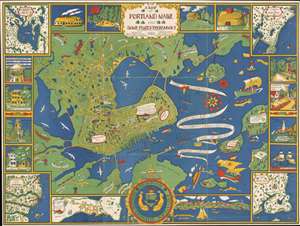
A Map of Portland Maine and Some Places Thereabout.
sold
- Digital Map Information
- Suitable for large format printing
- File Size: 151.13 MB
- File Type: ZIP / TIFF
- ICC color profile embedded
- Delivered instantly via download link
This is a 1928 Katherine Dudley chromolithograph pictorial city map or plan of Portland, Maine. The map depicts Portland from the Fore River to Mackworth Point and from the Presumpscot River to Fort Scammel and House Island. Whimsically illustrated, buildings throughout appear in profile labeled with white banners. These include schools, churches, the hospital, the public library, and the Y.M.C.A. Bug Light marks the entrance to Portland Harbor and the bay is filled with ships. Captain John Smith's vessel, which arrived in 1614, is evident, as are the Canceau, the Spitfire Bomb, and Captain Levett's 1623 expedition. The whole is bordered by a series of vignettes and inset maps depicting Portland's first church, first hotel, views State Street and Middle Street, and a view of Portland itself. The extraneous maps focus on Falmouth Neck, the Kennebunks, Sebaco Lake, and Prouts Neck. (more details)
A wonderful pictorial map of Portland, Maine promoting Portland's first nursery.
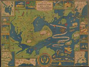
A Map of Portland Maine and Some Places Thereabout.
sold
- Digital Map Information
- Suitable for large format printing
- File Size: 64.98 MB
- File Type: ZIP / TIFF
- ICC color profile embedded
- Delivered instantly via download link
This is a 1928 Katherine Dudley pictorial city map or plan of Portland, Maine. The map depicts the region from the Fore River to Mackworth Point and from the Presumscot River to Fort Scammel and House Island. Wonderfully, almost whimsically, illustrated, buildings throughout town are illustrated in profile and labeled with white banners, including schools, churches, the hospital, the public library, and the Y.M.C.A. Roads throughout town are illustrated as well and the major ones are labeled. Bug Light marks the entrance to Portland Harbor and the bay is filled with ships. Captain John Smith's vessel, which arrived in 1614, is among those present, as is the Canceau, the Spitfire Bomb, and Captain Levett's expedition, which appeared in 1623. The whole is bordered by a series of vignettes and inset maps depicting such things and Portland's first church, first hotel, views State Street and Middle Street, and a view of Portland itself. The maps focus on Falmouth Neck, the Kennebunks, Sebaco Lake, and Prouts Neck (more details)
Stunning pictorial map by one of the great female pictorial cartographers.
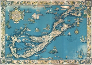
The Sommer Ilands. A map of the Bermuda Islands. Ya des Demonios, Isles of the Devils.
sold
- Digital Map Information
- Suitable for large format printing
- File Size: 64.22 MB
- File Type: ZIP / TIFF
- ICC color profile embedded
- Delivered instantly via download link
A stunning large format pictorial map of Bermuda issued in 1930 by a trio of female mapmakers based in Boston: Elizabeth Shurtleff, Helen F. McMillin, and her niece Elizabeth L. McMillin. The map covers all of Bermuda including the adjacent islands. Pictorial vignettes illustrating island flora, fauna, and social life fill the island and the whole is surrounded by a coral reef motif border. (more details)
Made by one of the great female pioneers of pictorial cartography.
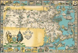
Map of Massachusetts The Old Bay State.
sold
- Digital Map Information
- Suitable for large format printing
- File Size: 57.37 MB
- File Type: ZIP / TIFF
- ICC color profile embedded
- Delivered instantly via download link
An uncommon 1930 pictorial map of Massachusetts issued by Tudor Press and Elizabeth Shurtleff, one of the most prominent female pictorial mapmakers. The map covers all of Massachusetts with vignette cartoon illustrations of various towns. Considerable focus is placed on industry, and many towns are highlighted with factory and/or mill illustrations. Indications of the merchandise produced there are also noted, including knit goods, shoes, jewelry, optical goods, textiles, etc. Other illustrations reference events of the American Revolutionary War. Surrounding the map are decorative armorial crests celebrating the many distinguished institutions of learning located throughout Massachusetts. Among them are Harvard, the Roxbury Latin School, Williams, Phillips Andover, the Bradford Academy, Amherst, Wheaton, the Abbot Academy, Mount Holyoke, Holy Cross, Tufts, MIT, Boston College, St. Marks, and Boston University. (more details)
Art Deco Prohibition view of Chicago as a mirror of the Untied States!
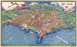
Chicago U.S.A. An Illustrated Map of Chicago Youthful City of the Big Shoulders.
sold
- Digital Map Information
- Suitable for large format printing
- File Size: 45.39 MB
- File Type: ZIP / TIFF
- ICC color profile embedded
- Delivered instantly via download link
An extraordinary 1931 large-format pictorial art-deco view and map of Chicago by Charles Turzak and Henry T. Chapman. Chromolithographed in 'five gay colors', the view humorously embraces Chicago as seen from a highpoint over Lake Michigan, to the northeast. It is centered on the Loop business district, and embraces urban Chicago from the Calmut to Highland Park, and inland as far as Wheaton. Turzak and Chapman's Chicago bustles with life, from 1930s airplanes filling the sky, and fast boats on Lake Michigan, to fast cars, sunbathing beauties, and an enormous blimp. Everything is embraced with wit and charm, from gang wars to Wrigley Tower ('Built of 5¢ Chewing Gum'), to bootlegging. The map, moreover, argues in its form for Chicago as a microcosm of the United States, a message reinforced by the upcoming 1933 Century of Progress World's Fair. The whole is surrounded by an art deco border that defines Chicago, 'youthful city of the big shoulders, restless, ingenious, willful, violent, proud to be alive!' (more details)