
Van de Velde, Charles William Meredith (sold)
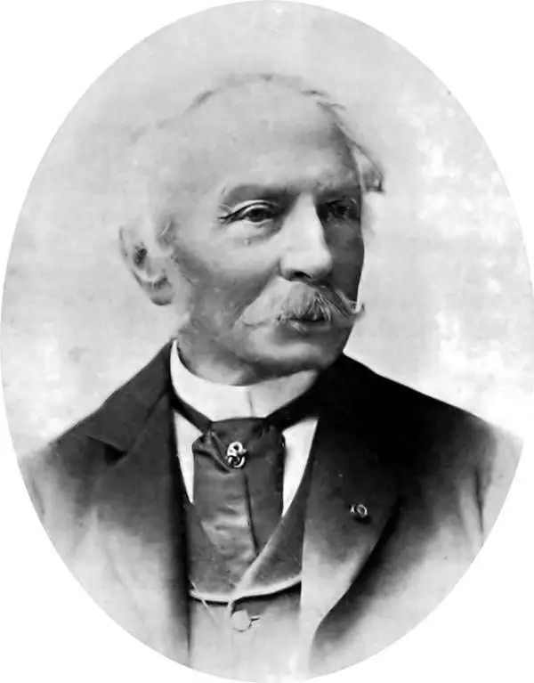
Charles William Meredith van de Velde (December 3, 1818 - March 20, 1898) was a Dutch cartographer, painter, missionary, lieutenant commander second class, and honorary member of the Red Cross. Born in Leeuwarden, Van de Velde was educated at the Naval Academy at Medemblik and earned the rank of lieutenant commander second class. He worked in the topographical office in Batavia (modern-day Jakarta) from 1830 until 1841 and was eventually appointed the office's director. He published the 1857 Faces of the Dutch East Indies about his time in Batavia. The work was illustrated by fifty plates of his own composition. He was forced to return to Europe in 1844 due to health concerns, but visited Ceylon (Sri Lanka), the Transvaal, and the Cape of Good Hope during the voyage. Once back in Europe, Van de Velde devoted himself to geographic, ethnographic, and cartographic pursuits, and also worked as a missionary, draftsman, and nurse. He visited Palestine in 1851 and undertook measurements and made drawings that he used to publish two maps in 1857 through Justus Perthes. He published a work on Palestine and Syria in 1857 in Paris (written in French) that contained 100 of his illustrations. Van de Velde worked with the Dutch Red Cross from its inception in 1863 and was present at the opening conference in Geneva that year. The following year he was sent to Denmark to help treat soldiers wounded during the Prussian-Austrian War, and six years later was called to France to work with the Dutch doctors treating soldiers wounded during the Franco-Prussian War. Van de Velde died in Menton, France on March 20, 1898.
'The crowning achievement of fifty years of exploration and research in the geography of Palestine' -Yehoshua Ben-Arieh
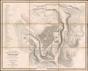
Plan of the Town and Environs of Jerusalem Constructed From the English Ordnance Survey and Measurements of Dr. T. Tobler.
sold
- Digital Map Information
- Suitable for large format printing
- File Size: 54.5 MB
- File Type: ZIP / TIFF
- ICC color profile embedded
- Delivered instantly via download link
Considered to be the most accurate map of Jerusalem published at the time, this is Charles William Meredith van de Velde's 1858 city plan or map of Jerusalem and its environs. Presenting the region in exceptional detail, the map covers from the Tombs of the Martyrs to Mount of Olives and from the Tomb of Simon the Just to the Hill of Evil Counsel. Important sites are labeled throughout, with the Dome of the Rock, the Al-Aqsa Mosque, the Church of the Holy Sepulcher, and the Church of the Tomb of the Virgin among them, and a further fifty-one sites are numerically identified and correspond with an index situated along the left border. Relief is indicated by hachure. (more details)
One of the most important 19th-century maps of the Holy Land.
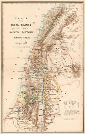
Carte de la Terre Sainte pour servir à l'etude des Saintes Ecritures par C.W.M. van de Velde.
sold
- Digital Map Information
- Suitable for large format printing
- File Size: 127.49 MB
- File Type: ZIP / TIFF
- ICC color profile embedded
- Delivered instantly via download link
One of the most important 19th-century maps of the region, this is the 1865 Charles William Meredith van de Velde map of the Holy Land. Created from Van de Velde's surveys, the map depicts from Syria to the Dead Sea and from the Mediterranean Sea to Mount Zalmon (Mt. Tsalmon). Per Mapping the Holy Land: The Foundation of a Scientific Cartography of Palestine, Van de Velde's map of Palestine
represented the complete body of Western geographical knowledge on Palestine, critically compiled, the verified on-site and completed by his own measurements and his own (physical) experience, including the hardships needed to make a scientific map.Van de Velde effortlessly blends the modern and the ancient. Myriad cities and towns are labeled throughout, including Jerusalem, Hebron, Tyre, Sidon, and Damascus, while different colors shade the regions historically belonging to each of the Twelve Tribes. (more details)