
Wynkoop Hallenbeck Crawford Co. (sold)

Wynkoop Hallenbeck Crawford Co. (fl. c. 1895 - 1925) was a large-scale printer and publisher based in New York in the late 19th and early 20th centuries. The firm originated with Matthew Bennet Wynkoop (February 15, 1830 - March 30, 1895) was born in Zanesville, Ohio and died in New York City. He mastered the printing trade in Pittsburg and moved to New York in 1850. He joined forces with John Johnson Hallenbeck (1817 - April 30, 1891) and an unknown 'Thomas' to form 'Wynkoop, Hallenbeck and Thomas'. When Thomas retired, the name was changed to 'Wynkoop and Hallenbeck', with Wynkoop being the senior partner. Wyncoop died in 1895 and shortly thereafter, Crawford joined the firm, which was consequently renamed, Wynkoop Hallenbeck Crawford. When John J. Hallenbeck died, in 1891, and his shares passed to Mr. Harry C. Hallenbeck, then a junior partner, who relocated it to Pearl street and meeting success, opened offices in Albany, New York and Lansing, Wisconsin. By 1902 they were one of the largest printing concerns in the United States. They began bidding on state contracts in 1901, acquiring contracts in Michigan. They also did extensive printing for the railroad and shipping industry. The firm seems not to have published after 1925.
The rarest iteration of this important map - the Lynchburg Edition.
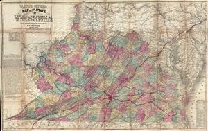
Lloyd's Official Map of the State of Virginia From actual surveys by order of the Executive 1828 and 1859.
sold
- Digital Map Information
- Suitable for large format printing
- File Size: 54.59 MB
- File Type: ZIP / TIFF
- ICC color profile embedded
- Delivered instantly via download link
An extremely scarce map, this is the Lynchburg edition of J. T. Lloyd's important map of Virginia – without a doubt the most influential map of Virginia to be issued during the American Civil War. Lloyd's enormous map covers Virginia just prior to the creation ... (more details)
Reconciling State and Private Land Ownership.
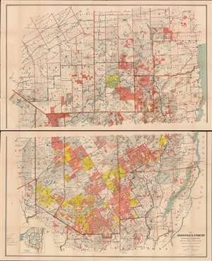
Map of the Adirondack Forest and Adjoining Territory Compiled from Official Maps and Field Notes on file in the State Departments at Albany, N.Y.
sold
- Digital Map Information
- Suitable for large format printing
- Full resolution TIFF file
- ICC color profile embedded
- Delivered instantly via download link
An uncommon large scale 1898 William Fox map of the Adirondack mountains of New York. The map covers the entire Adirondack Mountain region, extending from Saratoga to Plattsburg, and from Lewis County to Lake George and Lake Champlain. The map was made on behalf of the State Fisheries, game Commission for administrative purposes. The boundaries of the Adirondack State Park are defined by a bold blue line. Additional color coding designates the state of various lands. Pink shading identifies state forest preserve lands, yellow illustrates those lands bought or contract by the Forest Preserve Board, and lighter pink lands in which the state has joint ownership. (more details)