
Anson, George (sold)
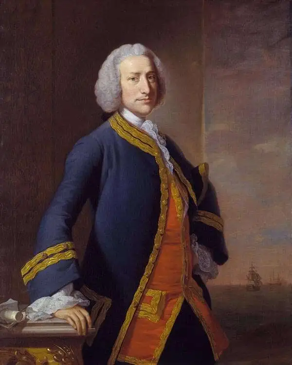
Baron George Anson (23 April 1697 - 6 June 1762) was a British commodore and a wealthy noble. Following Anson's aristocratic upbringing on the family estate of Shugborough in Sataffordshire, he joined the British Navy. Anson went through a series of rapid promotions and, in 1737, was given command of a fleet of six ships charged with the mission of attacking Spanish possessions in South America. This mission was ill-equipped and unprepared for the trials ahead. Storms and navigational errors took a heavy toll on the expedition. By the time Anson reached the island of Juan Fernandez his fleet had been diminished to only three ships and his crew reduced to roughly 1/3 of its original strength. Nonetheless, Anson's persistence eventually led to the capture of an immensely rich price, the Spanish treasure galleon Nuestra Senora de Covadonga. The galleon, taken off of Cape Espiritu Santo in 1743 was loaded with silver bullion and, more importantly, charts and maps detailing the routes between Mexico and the Far East used by the Spanish for over 200 years. Knowledge of this route enabled the British navy to disrupt Spanish trade in the Pacific and thus weaken its stranglehold on the Americas. Upon his return to England Anson was hailed as a national hero and made immensely wealthy by his share of the Nuestra's treasure. Anson retired from the Navy for a career in politics and was a Member of Parliament from 1744 to 1747. Anson subsequently continued his naval career with distinction as an administrator, becoming First Lord of the Admiralty (1757-1762). Seven British warships have borne the name HMS Anson in his honor. Anson County, North Carolina, and Ansonborough in Charleston, South Carolina, are also named in Anson's honor.
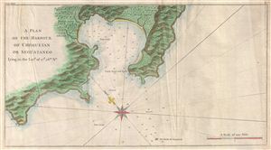
A Plan of the Harbour of Chequetan or Seguataneo Lying in the Lat.d of 17 d. 36 m. No.
sold
- Digital Map Information
- Suitable for large format printing
- DPI: 300
- File Size: 8.58 MB
- File Type: ZIP / TIFF
- ICC color profile embedded
- Delivered instantly via download link
An extremely attractive 1745 map of the Mexican harbor of Zihuatanejo by George Anson. Details the harbor beautifully showing mountains, waterways, and trees as well as offering detailed depth soundings and nautical references. Zihuatanejo is a stunningly ... (more details)
A Plan of the Harbour of Chequetan or Seguataneo Lying in the Lat.d of 17 d. 36 m. No.
sold
- Digital Map Information
- Suitable for large format printing
- DPI: 300
- File Size: 7.68 MB
- File Type: ZIP / TIFF
- ICC color profile embedded
- Delivered instantly via download link
An extremely attractive 1745 map of the Mexican harbor of Zihuatanejo by George Anson. Today Zihuatanejo is a stunningly beautiful resort area in Guerrero, Mexico, about 250 km north of Acapulco. This area was originally named Cihuatlán in Aztec, which ... (more details)
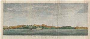
A View of the Entrance of the Port of Acapulco.
sold
- Digital Map Information
- Suitable for large format printing
- DPI: 300
- File Size: 7.24 MB
- File Type: ZIP / TIFF
- ICC color profile embedded
- Delivered instantly via download link
An extremely attractive 1745 view of the Mexican port city of Zihuatanejo by George Anson. This view details the starting point on the trans-Atlantic trade route long dominated by the Spanish in Mexico. Spanish Galleons laden with treasure would leave ... (more details)
Anson's Charts of the Two Ends of the Pacific Ocean
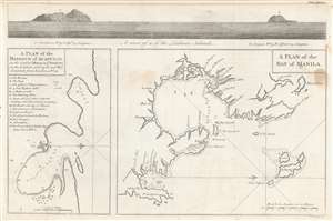
A plan of the harbour of Acapulco on the coast of Mexico in y'e South Sea, in the latitude of 16°45'N and west longitude from London 108°22' ;
A plan of the Bay of Manila.
sold
- Digital Map Information
- Suitable for large format printing
- Full resolution TIFF file
- ICC color profile embedded
- Delivered instantly via download link
This attractive 1748 engraving includes charts of the harbors of Acapulco, Mexico and Manila in the Philippines, the two chief ports for Spanish galleons crossing the Pacific Ocean. They are accompanied, at the top, with a coastal view of the Ladrone Islands: these were the usual midway point for the route between the two charted ports. The map accompanied the 1748 volume describing George Anson's privateering voyage around the world, wherein Anson led eight ships on a mission to disrupt, capture and despoil Spain's holdings in the Pacific. As Acapulco and Manila were essential ports at each end of a Spanish Pacific voyage, the inclusion of these charts in Anson's work was essential. Despite two ships having to return home, and one ship - the Wager - succumbing to mutiny, Anson's venture was a success; he returned to wealth and acclaim. (more details)
A hapless but ultimately successful expedition.
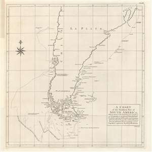
A chart of the southern part of South America, with the track of the Centurion...
sold
- Digital Map Information
- Suitable for large format printing
- DPI: 600
- File Size: 49.82 MB
- File Type: ZIP / TIFF
- ICC color profile embedded
- Delivered instantly via download link
A product of the remarkable Anson expedition and circumnavigation, this 1748 chart was engraved by Richard Seale and appeared in George Anson et al's A Voyage Round the World, in the Years MDCCXL, I, II, III, IV. It depicts the route of Anson's flagship, the Centurion, during the disastrous first phase of the expedition around Cape Horn, before finding rest and refuge at the Juan Fernandez Archipelago. (more details)
An English buccaneer's map of the Philippines.
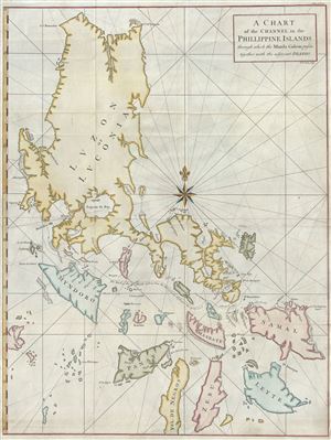
A Chart of the Channel in the Phillippine Islands through which the Manila Galeon passes together with the adjacent Islands.
sold
- Digital Map Information
- Suitable for large format printing
- DPI: 300
- File Size: 18.83 MB
- File Type: ZIP / TIFF
- ICC color profile embedded
- Delivered instantly via download link
Most likely the British buccaneer George Anson's most important published map, this is his important 1748 nautical chart of the Philippine islands (Philippines). The map covers the northern Philippine Islands from Cebu to the northern tip of Luzon. It ... (more details)
Marks the end of Spanish dominance in the 18th century Pacific.
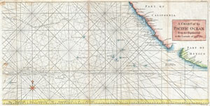
A Chart of the Pacific Ocean from the Equinoctial to the Latitude fo 39 1/2 d. No.
sold
- Digital Map Information
- Suitable for large format printing
- DPI: 300
- File Size: 9.89 MB
- File Type: ZIP / TIFF
- ICC color profile embedded
- Delivered instantly via download link
This is a rare 1748 nautical chart of the Pacific Ocean by George Anson and R. W. Seale. Chart depicts the trade routes used by Spanish Galleons from Acapulco, Mexico heading towards Manila in the Philippines. In particular, this chart depicts the ... (more details)
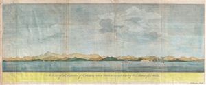
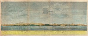
A View of the Entrance of Chequetan or Seguataneo bearing N.E. distant five Miles.
sold
- Digital Map Information
- Suitable for large format printing
- DPI: 300
- File Size: 6.93 MB
- File Type: ZIP / TIFF
- ICC color profile embedded
- Delivered instantly via download link
An extremely attractive 1748 coastal view of the Mexican harbor of Zihuatanejo by George Anson. Today Zihuatanejo is a stunningly beautiful resort area in Guerrero, Mexico, about 250 km north of Acapulco. This area was originally named Cihuatlan ... (more details)
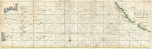
A Chart of the Pacific Ocean from the Equinoctial to the Latitude fo 39 1/2 d. No.
sold
- Digital Map Information
- Suitable for large format printing
- DPI: 300
- File Size: 14.6 MB
- File Type: ZIP / TIFF
- ICC color profile embedded
- Delivered instantly via download link
This is a rare 1748 nautical chart of the Pacific Ocean by the English map publisher R. W. Seale. Chart depicts the trade routes used by Spanish Galleons from Acapulco, Mexico to Manila in the Philippines. In particular, this chart depicts the ... (more details)
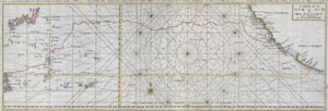
Carte de la Mer du Sud ou Mer Pacifique.
sold
- Digital Map Information
- Suitable for large format printing
- DPI: 300
- File Size: 6.22 MB
- File Type: ZIP / TIFF
- ICC color profile embedded
- Delivered instantly via download link
This is a rare nautical chart of the Pacific ocean by the English map publisher R. W. Seale. Chart depicts the trade routes used by Spanish Galleons from Acapulco, Mexico to Manila in the Philippines. In particular, this chart depicts the ... (more details)
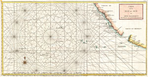
Carte de la Mer du Sud ou Mer Pacifique Entre l'Equateur et le 39 1.2 de Latitude Septentrionale.
sold
- Digital Map Information
- Suitable for large format printing
- DPI: 300
- File Size: 7.44 MB
- File Type: ZIP / TIFF
- ICC color profile embedded
- Delivered instantly via download link
This is a rare 1750 nautical chart of the Pacific Ocean by the French map publisher N. Bellin. Based on a similar chart in English prepared two years earlier by Seale. Chart depicts the trade routes used by Spanish Galleons from Acapulco, ... (more details)
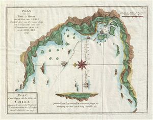
Plan d'une Baye de la Cote du Chili, decouverte par un des Vaisseaux d'Avitaillement de l'Escadre de Mr. Anson, en 1741. / Plan van een Baai en Haven aan de Kust van Chili Ontdekt door een Proviand Schip van't Esquader van den ommandeur Anson in de Zuid-Zee 1741.
sold
- Digital Map Information
- Suitable for large format printing
- DPI: 300
- File Size: 3.57 MB
- File Type: ZIP / TIFF
- ICC color profile embedded
- Delivered instantly via download link
An uncommon 1751 map of an unknown Chilean port discovered by the British Admiral George Anson during this seminal circumnavigation of the globe. Oriented to the east, the map shows the port in considerable detail including dramatic shore ... (more details)
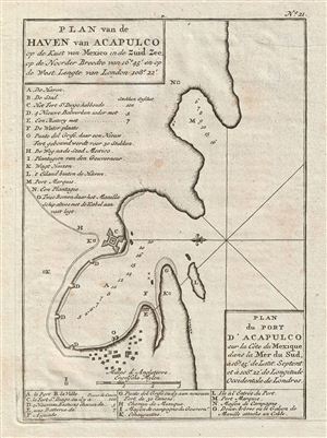
Plan du Port d'Acapulco sur la Cote du Mexique dans la Mer du Sud.
sold
- Digital Map Information
- Suitable for large format printing
- DPI: 300
- File Size: 2.51 MB
- File Type: ZIP / TIFF
- ICC color profile embedded
- Delivered instantly via download link
An uncommon 1751 map of Acapulco, Chile, by the British Admiral George Anson. Oriented to the east, the map details Acapulco Bay and its fortified port. In the 18th century Acapulco was the strategically important starting point for all ... (more details)
Marks the end of Spanish dominance in the 18th century Pacific.
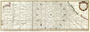
Carte de la Mer du Sud ou Mer Pacifique entre l'Equateur et le 39 1/2 . De Latitude Septentrionale.
sold
- Digital Map Information
- Suitable for large format printing
- DPI: 300
- File Size: 14.38 MB
- File Type: ZIP / TIFF
- ICC color profile embedded
- Delivered instantly via download link
This is a rare 1750 nautical chart of the Pacific Ocean by the French map publisher N. Bellin. Harkens to the great age of Pacific piracy and privateering. Based on a similar chart in English prepared three years earlier by Seale. Chart ... (more details)
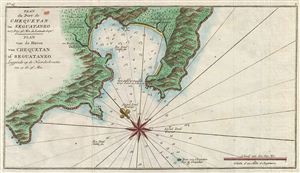
Plan du Port de Chequetan ou Seguataneo a 17 Deg: 36 Min de Latitude Septe. / Plan van de Haven van Chequetan of Seguataneo Leggende op de Noorderbreette van 17 Gr. 36 Min.
sold
- Digital Map Information
- Suitable for large format printing
- File Size: 2.37 MB
- File Type: ZIP / TIFF
- ICC color profile embedded
- Delivered instantly via download link
An extremely attractive 1765 map of the Mexican harbor of Zihuatanejo by George Anson and Jan van Schley. Details the harbor beautifully showing mountains, waterways, and trees as well as offering detailed depth soundings and nautical ... (more details)
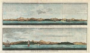
Gezigt van den Iagang van Chequetan, of Seguataneo leggende N.O. op een asstand van 5 Eng. Mylen. / Gezigt van den Ingang van de Haven van Acapulco.
sold
- Digital Map Information
- Suitable for large format printing
- File Size: 5.74 MB
- File Type: ZIP / TIFF
- ICC color profile embedded
- Delivered instantly via download link
A pair of appealing 1765 nautical views of the Mexican harbors of Acapulco and Zihuatanejo by George Anson and Jan van Schley. These shore profiles include beautiful renderings of 18th century sailing ships as well as still ... (more details)
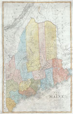
Map of Maine Constructed from the most Correct Surveys With Sectional Distances and Elevations or Level, of the St. Croix River from Calais Bridge.
sold
- Digital Map Information
- Suitable for large format printing
- Full resolution TIFF file
- ICC color profile embedded
- Delivered instantly via download link
This is a rare and beautiful 1843 first edition map of Maine by W. Anson. The northern boundary of Maine is depicted according to the Treaty of 1842, making it one of the first maps published following the ... (more details)