
Bailey, Oakley Hoopes (sold)
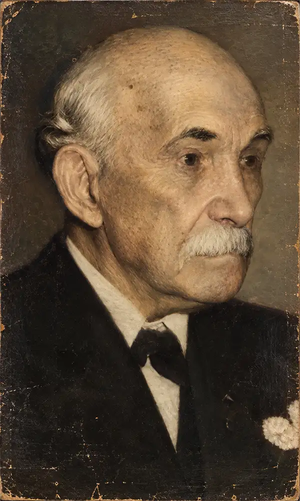
Bailey near the end of his long life.
Oakley Hoopes Bailey (June 14, 1843 - August 13, 1947) was a prolific American viewmaker, artist, and lithographer active in the late 19th and early 20th centuries. Bailey was born in Beloit, Mahoning County, Ohio. He matriculated in 1861 at Mount Union College in Alliance, Ohio, where he studied architecture. At the outbreak of the American Civil War (1861 - 1865), he briefly abandoned his studies for 2 years, during which time he saw combat as a Union soldier. After the war, in 1866, he returned to Mount Union to complete his degree. Bailey was the younger brother of another view artist, Howard Heston Bailey (1836 - 1878), and followed his brother into the print business, producing his first city views of Milwaukee, Wisconsin, in 1871. Active from 1871 to 1926, Bailey produced more than 375 recorded city views across more than 13 states and 2 Canadian provinces, making him one of the most active viewmakers in American history. In 1875, he settled in Cambridge, Massachusetts, and most of his subsequent work focused on Massachusetts and Connecticut. Bailey worked with many other American viewmakers of the period, including his brother, Howard Heston Bailey, Thaddeus M. Flower, and J. C. Hazen, among others. Even his wife, Sarah F. Bailey (1846 - 19??), got into the business, drawing at least one view of Watkins Glen, New York. Around 1904, in his 60s, Bailey entered a publishing partnership with Thomas S. Hughes, publishing their 'Aero-Views' as 'Hughes and Bailey'. Together, Hughes and Bailey revisited many of Bailey's early view sites, remaking them sometimes 20-40 years later, with the idea of setting them beside the earlier views to show how much the towns had changed. The partnership lasted until about 1926. Bailey died in his hometown of Alliance at the ripe old age of 103.
'One of the grandest, most strikingly wonderful and beautiful freaks of nature of its kind in the known world' - Bailey
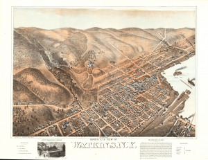
Bird's Eye View of Watkins, N.Y.
sold
- Digital Map Information
- Suitable for large format printing
- File Size: 54.86 MB
- File Type: ZIP / TIFF
- ICC color profile embedded
- Delivered instantly via download link
This is a striking Sarah F. Bailey chromolithograph bird's-eye view map of Watkins Glen, located at the southern tip of Seneca Lake, of New York's stunning Finger Lakes. This view is notable as being the only 19th-century American bird's-eye view we are aware of to be drafted by a woman, Sarah Bailey, wife of prominent viewmaker O. H. Bailey. When this view was made, Watkins Glen, which refers more specifically to the stunning river gorges just west of Watkins, was widely promoted as a natural wonder. (more details)
Rare bird's-eye view of Norwich, Connecticut early in the Industrial Revolution.
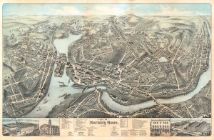
City of Norwich Conn. 1876.
sold
- Digital Map Information
- Suitable for large format printing
- File Size: 135.7 MB
- File Type: ZIP / TIFF
- ICC color profile embedded
- Delivered instantly via download link
This is a rare 1876 chromolithograph bird's-eye view of Norwich, Connecticut, by Oakley Hoopes Bailey. Centered on the conjunctions of the Yantic, Shetucket, and Thames Rivers, the view looks northwards towards Norwich from a fictive high point just to the south. It illustrates Norwich early in the industrial revolution, with paddlewheel steamships competing for space on the river with sailing ships. Holly Hock Island is here a place of industry, with large factories billowing black smoke. Forested bucolic hills fade off into the horizon. (more details)
The absolute best view of Boston.
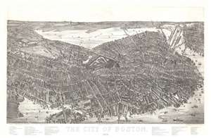
The City of Boston. 1879.
sold
- Digital Map Information
- Suitable for large format printing
- File Size: 40.5 MB
- File Type: ZIP / TIFF
- ICC color profile embedded
- Delivered instantly via download link
A magnificent 1879 bird's-eye view and map of Boston by James Compton Hazen and Oakley Hoopes Bailey, it is considered the largest and most detailed view of Boston Proper. The view presents Boston from an imaginary elevated position to the southeast of the city, looking northwest towards the Charles River with Cambridge appearing in the upper left and East Boston in the upper right. Hazen's slight and novel exaggeration of the vertical axis enhances the view with an intense three-dimensionality. This effect further highlighted by Hazen's use of a modified axonometric perspective - a technique that assumes a uniform fixed height and angle relative to all buildings, here modified only slightly to create a subtle perspective within the main Boston peninsula. The traditional view modality reasserts itself beyond the city proper where the background and outlying areas recede into the horizon. (more details)
The absolute best view of Boston.
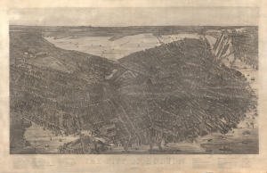
The City of Boston. 1879.
sold
- Digital Map Information
- Suitable for large format printing
- File Size: 259.17 MB
- File Type: ZIP / TIFF
- ICC color profile embedded
- Delivered instantly via download link
A magnificent 1879 bird's-eye view and map of Boston by James Compton Hazen and Oakley Hoopes Bailey, considered the largest and most detailed view of Boston Proper ever issued. The fine realistic detail is both striking and somewhat revolutionary, with a novel vertical exaggeration of scale to make buildings appear almost three-dimensional, unlike any other American city view of which we are aware. (more details)
Long Island Land Scam.
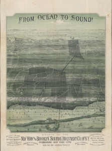
From Ocean to Sound!
sold
- Digital Map Information
- Suitable for large format printing
- File Size: 55.9 MB
- File Type: ZIP / TIFF
- ICC color profile embedded
- Delivered instantly via download link
A stunning 1892 Oakley H. Bailey chromolithograph bird's-eye view of a portion of Suffolk County, Long Island. Bailey issued the view for the New York and Brooklyn Suburban Investment Company. The view is a striking artifact charting urbanization. It is also associated with the rash of land speculation scams that plagued Long Island in the late 19th century. (more details)
The sole recorded example.
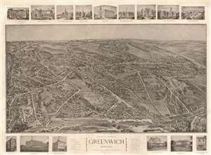
View of the Borough of Greenwich Connecticut.
sold
- Digital Map Information
- Suitable for large format printing
- File Size: 61.28 MB
- File Type: ZIP / TIFF
- ICC color profile embedded
- Delivered instantly via download link
This is the sole recorded example of Hughes / Bailey 1904 bird's-eye view of Greenwich, Connecticut. Presenting the town and its surrounds amidst rolling, wooded hills, the view encompasses the area roughly bounded by Railroad Avenue in the south, Old Church Road to the East, and Oakridge Street to the west. North Maple Avenue can be spied in the distance. Streets are labeled on the view itself. The town's buildings are rendered in detailed perspective. (more details)