
Dubreuil, Bes, A. and F. (sold)

A. Bes and F. Dubreuil (fl. c. 1844 - 1880) were French editors, printers, and lithographers based in Paris.
One of the earliest European maps to Illustrate the Califorina Gold Region.
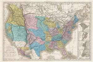
Carte Générale du Théâtre de la Guérre dans les États-Unis de L'Amérique avec une Carte du Mexique pour suivre les Opérations Militaires.
sold
- Digital Map Information
- Suitable for large format printing
- DPI: 300
- File Size: 18.58 MB
- File Type: ZIP / TIFF
- ICC color profile embedded
- Delivered instantly via download link
A fascinating Mexican-American War era map of the United States by Jean Baptiste Tardieu. The map covers the United States from Atlantic to Pacific including Texas and the new territory acquired by the United States during the Mexican American War (1846 – 1848), the discoveries of Lewis and Clark, American claims in British Columbia, and the California Gold Discovery. Inset submaps detail Mexico, Washington D.C., Boston, Philadelphia, and New York. The map is a bizarre amalgam of up-to-date details, cartographic speculation, outright myths, and political positioning. (more details)
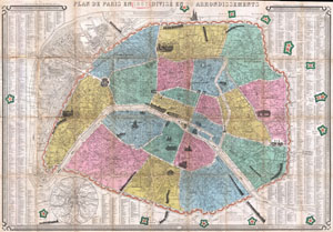
Plan de Paris en 1863 Divise en 20 Arrondissements.
sold
- Digital Map Information
- Suitable for large format printing
- File Size: 33.15 MB
- File Type: ZIP / TIFF
- ICC color profile embedded
- Delivered instantly via download link
This is an extremely attractive 1863 tourist pocket map of Paris, France. Covers the old walled city of Paris and the immediate vicinity. Divided up into 20 arrondissments. Important buildings are shown in profile. Trains entering and leaving the city are also ... (more details)
Includes charming vignettes of trains entering and leaving the city.
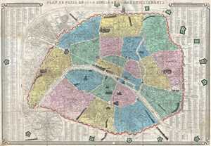
Plan de Paris en 1864 Divisé en 20 Arrondissements.
sold
- Digital Map Information
- Suitable for large format printing
- File Size: 23.57 MB
- File Type: ZIP / TIFF
- ICC color profile embedded
- Delivered instantly via download link
This is an 1864 J. N. Henriot city map or plan of Paris France. The map depicts the city from the Basilica of St. Denis (Abbaye de St. Denis) to the Fort de Bicêtre and from the Bois de Boulogne to the Fort de Nogent and the Fot de Rosny. Paris is divided into ... (more details)
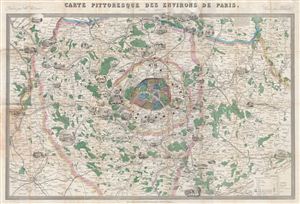
Carte Pittoresque Des Environs de Paris.
sold
- Digital Map Information
- Suitable for large format printing
- File Size: 33.83 MB
- File Type: ZIP / TIFF
- ICC color profile embedded
- Delivered instantly via download link
An appealing c. 1870 pictorial map of the environs of Paris by A. Vuillemin. Centered on the embastilled center of Paris, this map overs from St. Pierre in the northwest to Chartres in the southwest to Oulchy in the northeast and Provins in the southeast. ... (more details)
Overlooks Paris from the east and illustrates the Louvre, Notre Dame, and the Arc de Triomphe.
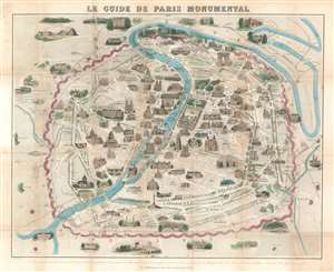
Le Guide de Paris Monumental.
sold
- Digital Map Information
- Suitable for large format printing
- File Size: 42.69 MB
- File Type: ZIP / TIFF
- ICC color profile embedded
- Delivered instantly via download link
Overlooking Paris from the east, this 1878 Jacques-Alphonse Testard pictorial map of Paris presents the 'City of Light' from a unique perspective. Drawn 'from' the donjon at the Château de Vincennes, Pere Lachaise cemetery and the Gare de Lyon are prominant in the foreground. Paris's other monuments line both banks of the Seine, which bisects the map. The Pantheon, Notre Dame, the Louvre, the Arc de Triomphe, and Les Invalides are all illustrated in profile. The city's streets wind their way from one end of the city to the other, with many of Baron Haussmann's Grands Boulevards illustrated and labeled. Paris's old city walls, colored pink, encircle the city, along with several railroad lines. (more details)
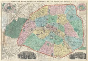
Nouveau Plan Complet Illustre de la Ville de Paris en 1883.
sold
- Digital Map Information
- Suitable for large format printing
- Full resolution TIFF file
- ICC color profile embedded
- Delivered instantly via download link
This is a beautiful 1883 folding map or plan of Paris, France by the French cartographer A. Vuillemin. Centered on the Seine River, it covers embastilled Paris as contained in the Thiers Wall, as well as its immediate vicinity, including the Bois de ... (more details)
Map of Paris drawn for the 1889 Exposition Universelle.

Nouveau Plan Complet Illustre de la Ville de Paris en 1889.
sold
- Digital Map Information
- Suitable for large format printing
- File Size: 34.69 MB
- File Type: ZIP / TIFF
- ICC color profile embedded
- Delivered instantly via download link
A bright and stunning map of Paris made by A. Vuillemin for the 1889 Exposition Universelle (World's Fair). Covers the walled center of Paris as well as its immediate vicinity to the west, including the Bois de Boulogne. Important buildings are ... (more details)