
Bregante y Orbay, Francisco (sold)

Francisco Bregante y Orbay (fl. 1840 - 1867) was a Spanish engraver and draftsman active with the Dirección Hidrografía in the middle part of the 19th century. Bregante y Orbay specialized in lettering and text. A relative, Salvador Bregante y Orbay, also worked for the Dirección Hidrografía in a related capacity.
Most dangerous Maritime passage in West Africa.
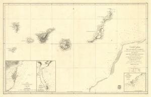
Carta Esférica de las Islas Canarias y Parte de la Costa Ocidental de Africa, que Comprende desde Puerto Cansado Hasta Cabo Bojador, levantada en 1834 á 1838.
sold
- Digital Map Information
- Suitable for large format printing
- DPI: 600
- File Size: 55.49 MB
- File Type: ZIP / TIFF
- ICC color profile embedded
- Delivered instantly via download link
A striking 1853 nautical chart or maritime map of the Canary Islands and the coast of Africa in the vicinity of Cape Bojador. The map depicts one of the most dangerous passages in African navigation - the rounding of Cape Bojador. The Canary Islands were significant to mariners from the 15th through the 19th centuries, when they were considered a vital stopover point and bridge between four continents: Africa, North America, South America, and Europe. (more details)
The Pleasure of Vipers...
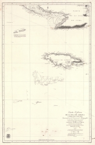
Carta Esférica de la Isla de Jamaica y Parte de la de Cuba.
sold
- Digital Map Information
- Suitable for large format printing
- File Size: 41.35 MB
- File Type: ZIP / TIFF
- ICC color profile embedded
- Delivered instantly via download link
A scarce 1857 Dirección de Hidrografía nautical chart or maritime map of Jamaica, the Little Cayman Islands, and Southern Cuba. Centered on Pendro Bank (Vibora), the map extends as far north as Nipe Bay on Cuba's north coast, and as far west as Little Cayman. The seas to the south are largely empty, but the Serrana Bank atoll in the western Caribbean is noted. (more details)
Rare map of the Virgin Islands in the final days of the Danish West Indies.
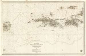
Carta Esférica de Parte de Las Islas Virgenes desde la Culebra a La Tortola.
sold
- Digital Map Information
- Suitable for large format printing
- File Size: 72.25 MB
- File Type: ZIP / TIFF
- ICC color profile embedded
- Delivered instantly via download link
A stunningly engraved 1859 Dirección Hidrografía nautical chart or maritime map of the Virgin Islands, including the U.S. Virgin Islands of St. Thomas and St. John. Centered on St. Thomas, the map covers from Isla de Culbera (Puerto Rico) to the island of Tortola (British Virgin Islands), and from Jost Van Dyke as far south as Vieques. The chart exhibits meticulously rendered topography and illustrates cities and towns in exacting detail, showing individual streets, blocks, and even important buildings throughout. At sea, there are countless soundings and other information useful to the navigator. (more details)
South China Sea - then as now, an important and strategic artery.
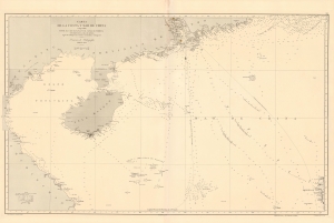
Carta de la Costa y Mar de China comprendida entre el Cabo Batangan y el Canal de Formosa con parte de la Isla de Luzon, segun los trabajos mas recientes macionales y estrangeros.
sold
- Digital Map Information
- Suitable for large format printing
- File Size: 48.36 MB
- File Type: ZIP / TIFF
- ICC color profile embedded
- Delivered instantly via download link
A rare 1869 Direccion Hidrografía nautical map detailing the China coast and the South China Sea from, roughly, Hong Kong and Macao south to Hue (Vietnam) and Luzon (the Philippines), thus embracing a highly-trafficked and critical trade and strategic channel in the 19th century (as today). The map focuses heavily on coastal maritime routes, but pushes inland along major river arteries, including a detailed mapping of the Pearl River Delta as far as Canton (Guangzhou). In Vietnam, several factorias antiguas are noted, underscoring early European trade activity. (more details)