
Cadell, Thomas (sold)
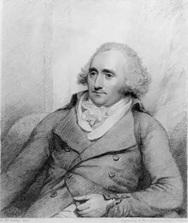
Thomas Cadell the elder (November 12, 1742 - December 27, 1802) was an English publisher and bookseller. Born in Bristol, Cadell was apprenticed to a London bookseller named Andrew Millar in March 1758, and became Millar's partner in April 1765 after finishing his seven-year apprenticeship. He took over the business with the help of Millar's assistant following Millar's death in 1768. Not only was Cadell a successful bookseller, but he also found success in publishing, publishing poetry by Robert Burns, and works by jurist William Blackstone, economist Adam Smith, and Edward Gibbon's Decline and Fall of the Roman Empire. Cadell married the daughter of Reverend Thomas Jones on April 1, 1769, with whom he had two children, a son and a daughter. Cadell retired in 1793 and his son, Thomas Cadell the younger (1773 - 1836), took over the business. Cadell died at home of an asthma attack on December 27, 1802.
One of the earliest detailed maps of New Zealand, following Cook's first voyage.
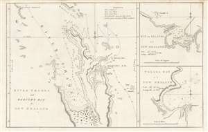
River Thames and Mercury Bay..., Bay of Islands..., Tolaga Bay...
sold
- Digital Map Information
- Suitable for large format printing
- DPI: 600
- File Size: 23.73 MB
- File Type: ZIP / TIFF
- ICC color profile embedded
- Delivered instantly via download link
This is an important map of the bays of northern New Zealand (Mercury, Tolaga, Bay of Islands, and the Firth of Thames) published by John Hawkesworth in his An account of the voyages undertaken, a 1773 book recounting recent British voyages to the Pacific, including the first voyage of Captain James Cook. The map is based on Cook's papers and sketches and constitutes the first detailed map of these bays. (more details)
The Caribbean Theater of the Revolutionary War.
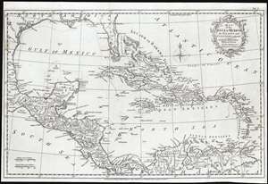
Map of the Gulf of Mexico, the Islands and Countries Adjacent.
sold
- Digital Map Information
- Suitable for large format printing
- Full resolution TIFF file
- ICC color profile embedded
- Delivered instantly via download link
This is an attractive 1777 map of the West Indies and the adjacent coasts of North, Central and South America, by the British cartographer Thomas Kitchin. The map includes Florida and the Gulf of Mexico in the north and west, the Central American coastline and the northern parts of South America extending to the mouth of the Orinoco River. Florida is unusually long, breaking into an archipelago at its tip, and with the St. John River extending almost its full length. Major towns and ports are marked throughout. New Orleans is shown and named. La Salle's settlement on Matagorda Bay - here named 'B. de St. Bernard' - is shown and dated 1685. A Spanish Presidio is also marked on the bay. (more details)
One of the earliest obtainable English maps to name and recognize the newly created United States.
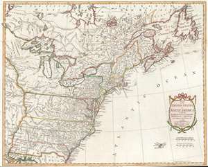
Map of the United States in North America: with the British, French and Spanish Dominions adjoining, according to the Treaty of 1783.
sold
- Digital Map Information
- Suitable for large format printing
- DPI: 600
- File Size: 19.55 MB
- File Type: ZIP / TIFF
- ICC color profile embedded
- Delivered instantly via download link
After nine years of war between the mother country and its American colonies, this first edition 1783 Thomas Kitchin map of the United States is one of the earliest obtainable English printed maps that names and recognizes the newly independent United States of America. The map depicts the nascent country from just west of the Mississippi River to the Atlantic Ocean and from Hudson Bay to New Orleans and the Gulf of Mexico. Unique geography catches the viewer's attention, with Pennsylvania occupying a fair portion of southern New York and Virginia, North Carolina, South Carolina, and Georgia stretching from the Atlantic coast to the Mississippi River. Myriad cities, towns, and villages are labeled, including Philadelphia, New York, Boston, Newport, Baltimore, Charleston, and Savannah. Native American tribes are referenced, including the Iroquois, Miami, Cherokee, Creek, Chickasaw, and Choctaw. Important coastal locations, such as Cape Cod, Boston Harbor, Delaware Bay, Chesapeake Bay, Cape May, Cape Hatteras, and Cape Fear are also identified. All five Great Lakes are labeled and rivers, lakes, and mountains are noted. (more details)