
Carey, Edward L. (sold)

Edward L. Carey (April 7, 1805 - June 16, 1845) was an American publisher, aesthete, art lover, and the co-founder, along with Abraham Hart, of the prominent publishing firm Carey and Hart. Carey was the son of American publisher Mathew Carey (1760 - 1839) and Bridget Flahaven Carey. He initially worked for his brother, Henry Charles Carey who, along with relative and partner Isaac Lea, purchased their father's publishing house in 1822, rebranding it as Carey and Lea. Eventually, Edward Carey became a junior partner in the firm, acquiring half of the shares belonging to Lea, and the imprint briefly changed to Carey, Lea, and Carey. On November 1, 1829, Edward Carey detached himself from his brother's firm and formed a partnership with Abraham Hart (1810 - 1885), an employee of Carey, Hart, and Carey. This firm, known as Carey and Hart, was successful for twenty-five years, publishing works by Henry Wadsworth Longfellow, William Cullen Bryant, and Eliza Leslie. Carey suffered from declining health during the last three years of his life. According to William Gilmore Sims, Carey died 'after suffering for some years from a tedious affliction of the spine.' Carey died on June 16, 1845 at the age of 40. Before his death, he was elected President of the Academy of Fine Arts, but declined the position due to his health.
Beautiful example of the first Carey and Hart state of Tanner's map of New York City.
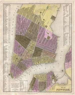
City of New-York.
sold
- Digital Map Information
- Suitable for large format printing
- DPI: 300
- File Size: 9 MB
- File Type: ZIP / TIFF
- ICC color profile embedded
- Delivered instantly via download link
A beautiful example of the 1844 Carey and Hart edition of Tanner's Map of New York City. The map covers Manhattan from the Battery to 37th Street (Murray Hill) and from the Hudson River to the East River. It also includes parts of adjacent Brooklyn (Brooklyn ... (more details)
Rare final Carey and Hart edition of Tanner's Florida.
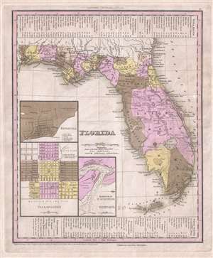
Florida.
sold
- Digital Map Information
- Suitable for large format printing
- Full resolution TIFF file
- ICC color profile embedded
- Delivered instantly via download link
A fine example of the last state of the Carey and Hart edition of Tanner's 1845 map of Florida. Florida here is illustrated shortly after the Second Seminole War (1835–1842) in the year it became the 27th U.S. State. The map covers all of peninsular ... (more details)
One of the first maps to show Jedediah Smith's cartography. Also illustrates the Republic of Texas!
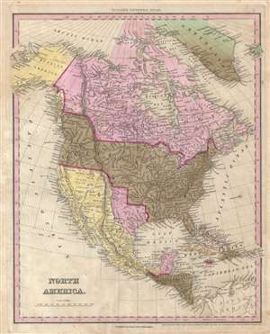
North America.
sold
- Digital Map Information
- Suitable for large format printing
- DPI: 300
- File Size: 7.29 MB
- File Type: ZIP / TIFF
- ICC color profile embedded
- Delivered instantly via download link
This is Tanner's rare 1845 map of North America showing the Republic of Texas at its fullest. The map cover all of North America, from the Arctic Circle, Greenland, and Alaska, to Mexico, Central America, the Caribbean, and the West Indies Islands. It ... (more details)
Includes an inset map of the Carolina Gold Region - the first Gold Rush in the United States.
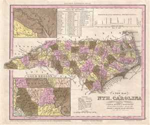
A New Map of Nth. Carolina with its Canals, Roads and Distances from place to place, along the Stage and Steam Boat Routes.
sold
- Digital Map Information
- Suitable for large format printing
- DPI: 300
- File Size: 4.6 MB
- File Type: ZIP / TIFF
- ICC color profile embedded
- Delivered instantly via download link
This is an 1845 Henry Schenck Tanner map North Carolina published by Edward L. Carey and Abraham Hart. The map depicts the region from Tennessee, North Carolina, and South Carolina to Cape Hatteras and from Virginia to South Carolina. Featuring an ... (more details)
Includes a detailed inset map of Charleston.
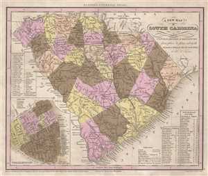
A New Map of South Carolina with its Canals, Roads and Distances from place to place, along the Stage and Steam Boat Routes.
sold
- Digital Map Information
- Suitable for large format printing
- DPI: 300
- File Size: 4.65 MB
- File Type: ZIP / TIFF
- ICC color profile embedded
- Delivered instantly via download link
This is an 1845 Henry Schenck Tanner map of South Carolina published by Edward L. Carey and Abraham Hart. The map depicts the region from North Carolina to Georgia and from the point where North Carolina, Georgia, and South Carolina meet to the ... (more details)
Illustrates the former Washington City Canal - now under Constitution Avenue.
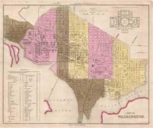
City of Washington.
sold
- Digital Map Information
- Suitable for large format printing
- DPI: 300
- File Size: 4.71 MB
- File Type: ZIP / TIFF
- ICC color profile embedded
- Delivered instantly via download link
This is an 1845 Henry Schenck Tanner map of Washington, D.C. published by Edward L. Carey and Abraham Hart. The map depicts the city from Georgetown and the Potomac River to the Marine Hospital and the Anacostia River and from George Washington ... (more details)
Depicts the short-lived 'neutral zone' between the Sioux and the Sauks and Foxes, negotiated by William Clark, half of the duo of Lewis and Clark.
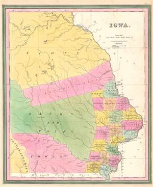
Iowa.
sold
- Digital Map Information
- Suitable for large format printing
- DPI: 600
- File Size: 10.54 MB
- File Type: ZIP / TIFF
- ICC color profile embedded
- Delivered instantly via download link
This is a first edition 1846 Samuel Augustus Mitchell map of Iowa. The map depicts the region from central Iowa to Wisconsin and Illinois and from Lake St. Croix to Missouri. Only the extreme southeastern portion of the territory has been surveyed, with the familiar grid of the Public Land Survey System providing some organization. A handful of counties are illustrated, labeled, and shaded different colors to allow for easy differentiation. Iowa City and Dubuque are labeled, as are several other cities and towns. The rest of Iowa is divided between the Sioux, Sauks and Foxes, Iowas, and Pottawattamies. The only other land here is a 40-mile wide neutral zone of land that was purchased from the Sauk and the Sioux in an effort to establish territorial rights between the tribes. This treaty, agreed to in 1825, was facilitated by William Clark, of Lewis and Clark fame, and the surveying was completed by U.S. Deputy Surveyor Captain Nathan Boone, son of Daniel Boone. (more details)
World - from the American Perspective.
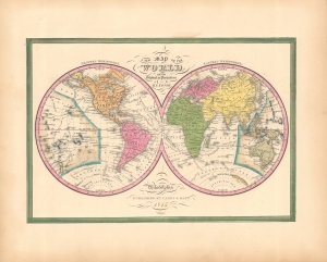
A New Map of the World in the Globular Projection.
sold
- Digital Map Information
- Suitable for large format printing
- File Size: 9.29 MB
- File Type: ZIP / TIFF
- ICC color profile embedded
- Delivered instantly via download link
This is the 1846 first edition of S. Augustus Mitchell's double-hemisphere world map. (more details)