
Colortext Publications (sold)

Colortext Publications (c. 1933 – 1950) was a Chicago based firm active in the middle part of the 20th century. The firm's earliest work is a series of pamphlets associated with the Chicago Century of Progress International Exposition (1933 - 1934). Following the exposition Colortext partnered with various artist to create a series of pictorial maps known as 'Story Maps.' The firm partnered with such notable pictorial map artists as Ernest Dudley Chase, Egbert G. Jacobson, Julio de Diego, A. Walker, and W.E. Vogelear. Although it is unclear who founded the firm, it is registered business at 8 South Michigan Avenue, Chicago, as early as 1933. In 1938 and 1940, the firm produced to exceptional publications, a panoramic view of Chicago and the Military Panoramap of the Theatre of War. These depart markedly from the 'Story Map' model and reveal a greater level of sophistication than evident in Colortext's earlier publications. Sometime after World War II Colortext was acquired by the Chicago businessman and druggist Paul J. Mandalbach. The firm's last publication was in 1950, a Story Map of the West Indies.
Uncommon pictorial map of Ireland.
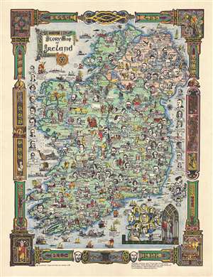
Story Map of Ireland.
sold
- Digital Map Information
- Suitable for large format printing
- File Size: 9.93 MB
- File Type: ZIP / TIFF
- ICC color profile embedded
- Delivered instantly via download link
An uncommon 1937 pictorial map of Ireland by the Chicago firm Colortext. The map covers all of Ireland with historical and literary figures highlighted with profile images near the locations with which they are most associated. The border work is drawn of the ... (more details)
Playful map of the West Indies.
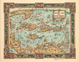
The Story Map of the West Indies.
sold
- Digital Map Information
- Suitable for large format printing
- File Size: 18.37 MB
- File Type: ZIP / TIFF
- ICC color profile embedded
- Delivered instantly via download link
This is a 1936 Colortext pictorial story map of the West Indies. The map depicts the region from Florida and the Gulf of Mexico and the Yucatan Peninsula to the Leeward Islands and Georgetown, Guyana and from New York and Chicago to northern South America. Each island is labeled, along with multiple locations including cities and towns, such as Havana, Port-au-Prince, and San Juan. Flags are used in the Leeward Islands to identify which European country claimed suzerainty. The British Union Jack, for example, appears next to Bermuda and the Bahamas. Numerous vignettes populate the map, including native birds, animals, and fish, pirates and pirate ships, and locals dressed in indigenous costumes. Historical events are also chronicled, such as Ponce de Leon's first settlement on Puerto Rico and the naval battle of Santiago. Cities in the United States are also noted, including New York City (illustrated by its famous skyline), Washington, D.C. (marked by the U.S. Capitol), Detroit, Chicago, and Miami. The whole is surrounded by a decorative border motif derived from indigenous tropical fruits and West Indian handicraft. (more details)
A beautiful and brilliantly colored pictorial map of the West Indies.
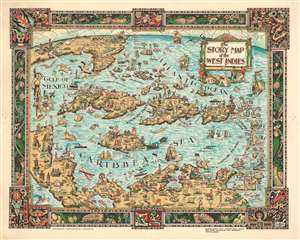
The Story Map of the West Indies
sold
- Digital Map Information
- Suitable for large format printing
- File Size: 22.12 MB
- File Type: ZIP / TIFF
- ICC color profile embedded
- Delivered instantly via download link
This is a 1936 Colortext pictorial story map of the West Indies. The map depicts the region from the Gulf of Mexico and the Yucatan Peninsula to the Leeward Islands and Georgetown, Guyana and from New York and Chicago to northern South America. Highly detailed, each island is labeled, along with myriad locations including cities and towns, such as Havana, Port-au-Prince, and San Juan. Flags are used in the Leeward Islands to identify which European country claimed ownership of each island. The British Union Jack is also illustrated next to Bermuda and the Bahamas. Numerous vignettes populate the map, including native birds, animals, and fish, pirates and pirate ships, and locals dressed in indigenous costumes. Historical events are also chronicled, such as Ponce de Leon's first settlement on Puerto Rico and the naval battle of Santiago. Cities in the United States are also noted, including New York City (illustrated by its famous skyline), Washington, D.C. (marked by the U.S. Capitol), Detroit, Chicago, and Miami. The whole is surrounded by a decorative border that employs a motif derived from indigenous tropical fruits and native West Indian handicraft. (more details)
Snapshot of Mexican culture, history, and industry.
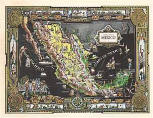
Story Map of Mexico.
sold
- Digital Map Information
- Suitable for large format printing
- File Size: 30.49 MB
- File Type: ZIP / TIFF
- ICC color profile embedded
- Delivered instantly via download link
This is a 1939 Colortext pictorial story map of Mexico. Colortext uses pictorial icons to promote Mexican industry and culture, highlight events in Mexican history, and mark important sites across the country. Images of ranches, fishermen, miners, and basket weavers are illustrated alongside dancers and tourists. Historical figures, including Cortez, Montezuma II, Francisco Hernandez de Cordoba, appear next to both historical and modern sites, such as Chichen Itza, the baths at Aguascalientes, and the lighthouse at Mazatlán. The pictorial border is heavily influenced by Aztec aesthetics, situating the Aztec calendar in the corners and masks along the top and bottom. (more details)
Snapshot of American culture, history, and industry.
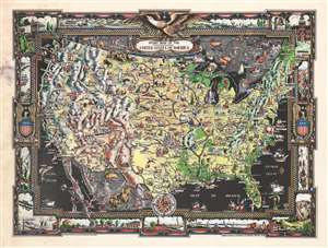
Story Map of the United States of America.
sold
- Digital Map Information
- Suitable for large format printing
- File Size: 29.15 MB
- File Type: ZIP / TIFF
- ICC color profile embedded
- Delivered instantly via download link
This is a 1939 Colortext first edition story map of the United States. Depicting the continental U.S., this colorful map combines elements of American culture, landscape, and industrial production. Dramatic representations of the Rocky Mountains, the Ozarks, the Sierra Nevadas, and the Appalachians illustrate the geographical diversity of the nation, particularly when compared with the broad plains of the Midwest. Icons mark famous sites, promote American industry and agriculture, and highlight historical figures and events. The sharp-eyed can find portraits of George Washington, Ulysses S. Grant, and Buffalo Bill among views of the U.S. Capitol, Hoover Dam (labeled Roosevelt Dam), and Independence Hall. Illustrations of grain elevators, oil derricks, and blimps are juxtaposed with views of sites like Mesa Verde, Old Faithful, and The Alamo. The whole is surrounded by a pictorial border focused on the the original thirteen colonies. (more details)
Unique panoramic view of World War II.
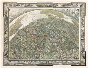
The Military Panoramap of the Theatre of War. Observation Point 200 Miles Directly Above Bern.
sold
- Digital Map Information
- Suitable for large format printing
- File Size: 14.94 MB
- File Type: ZIP / TIFF
- ICC color profile embedded
- Delivered instantly via download link
This is a highly unusual 1940 military map of Europe illustrating the Theater of War in the first years of World War II. Produced in the spirit of Richard Edes Harrison using a globular perspective with exaggerated topography, this map presents Europe from a ... (more details)