
Donn, John M. (sold)

John M. Donn (1871 - August 9, 1931) was an American architect. Donn lived and worked in Washington, D.C., and designed several government buildings. Donn served as the chief draughtsman of the Hawaiian Territorial Survey and was also the Second Assistant. He created a map of Hawaii and a map of Oahu for the Hawaii Territory Survey. He also updated a map of Maui created by the Hawaiian Government Survey.
First scientific survey of Maui.
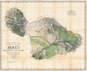
Maui, Hawaiian Islands.
sold
- Digital Map Information
- Suitable for large format printing
- File Size: 310 MB
- File Type: ZIP / TIFF
- ICC color profile embedded
- Delivered instantly via download link
This is the 1903 Frank S. Dodge and John M. Donn map of Maui in the Hawaiian Islands. This map is the first scientific survey of Maui as well as the first map commissioned by U.S. Government after Hawaii's 1898 annexation. (more details)
A visually striking map of the Garden Isle.
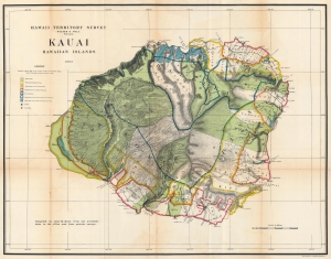
Hawaii Territorial Survey. Kauai Hawaiian Islands.
sold
- Digital Map Information
- Suitable for large format printing
- File Size: 95.27 MB
- File Type: ZIP / TIFF
- ICC color profile embedded
- Delivered instantly via download link
This is a stunning 1903 John M. Donn map of Kauai, created for the Hawaiian Territorial Survey. It is the first comprehensive large-scale modern map of Kauai. (more details)
1st modern survey of Hawaii.
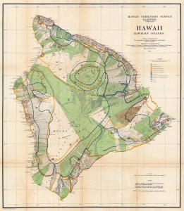
Hawaii Hawaiian Islands.
sold
- Digital Map Information
- Suitable for large format printing
- File Size: 135.38 MB
- File Type: ZIP / TIFF
- ICC color profile embedded
- Delivered instantly via download link
This is a 1906 John M. Donn map of Hawaii, Hawaiian Islands. This map represents the first comprehensive modern survey of Hawaii. (more details)
First comprehensive modern survey of Oahu.
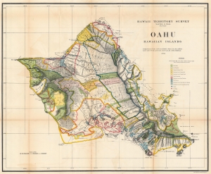
Oahu Hawaiian Islands.
sold
- Digital Map Information
- Suitable for large format printing
- File Size: 107.82 MB
- File Type: ZIP / TIFF
- ICC color profile embedded
- Delivered instantly via download link
This is a 1906 John M. Donn map of Oahu, Hawaiian Islands. It represents the first comprehensive modern mapping of Oahu. (more details)