
Dosseray, Jean (sold)

Jean Dosseray (1868 - 1904) was a Belgian publisher and editor active in Brussels during the late 19th century. He published science-based maps for schools and tourists.
Early Tourism Map.
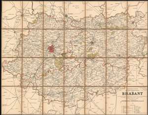
Nouvelle Carte Routière et Administrative du Brabant contenant les noms de toutes les communies, des principaux hameaux, les chemins de fer, station, routes, canaux, etc. etc.
sold
- Digital Map Information
- Suitable for large format printing
- File Size: 49.66 MB
- File Type: ZIP / TIFF
- ICC color profile embedded
- Delivered instantly via download link
This is an 1886 Jean Dosseray map of Brabant Province in Belgium. The map was published to capitalize on the growing ease of rail travel and the rise of commercial tourism. Numerous cities and towns are identified throughout the province, with Brussels (the capital of Belgium and the province) and Louvain shaded red. Major roads, railroads, and canals are illustrated as well. (more details)
The Congo Free State and Scramble for Africa.
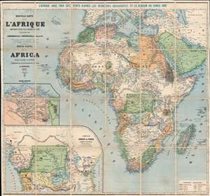
Nouvelle Carte de l'Afrique Contenant Toutes les Stations Belges. Nuova Carta dell'Africa Colle Ultime Scoperte.
sold
- Digital Map Information
- Suitable for large format printing
- Full resolution TIFF file
- ICC color profile embedded
- Delivered instantly via download link
This is an 1890 Jean Dosseray wall map of Africa, published five years after the Berlin Conference that defined the Scramble for Africa. Dosseray uses color to illustrate regions claimed by various European powers, including France, England, Spain, Italy, Germany, and Portugal. Some are also identified by flags, including Algeria (France), Angola (Portugal), and Mozambique (Portugal). The bright green region in central Africa represents the Congo Free State, privately owned by King Leopold II of Belgium. The large inset map in the lower left focuses on the Congo Free State and the free economic zone in Central Africa established by the Berlin Conference. A second inset just above focuses on the Nile Delta. The critical Suez Canal is also illustrated. (more details)
Curious multi-national educational map.
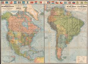
Nouvelle Carte de l'Amérique Nord et Sud. Physical and Political Map of North and South America. Nuova Mapa del Due America. Nueva Mapa de las dos Américas.
sold
- Digital Map Information
- Suitable for large format printing
- Full resolution TIFF file
- ICC color profile embedded
- Delivered instantly via download link
This is an attractive 1890 Jean Dosseray map of North and South America. The map is divided into sections dedicated to North America and South America. Although most of the content is in French, additional titling in English, Italian, and Spanish underscore the author's intended pan-European audience. A row of flags across the top add a vexillological component. Bold lines trace continental railroad networks throughout both maps. In addition, significant attention is given to First Peoples nations, which are labeled throughout. An inset in the lower left focuses on the Aleutian Islands and the Bering Sea. (more details)
Comparing the World - inside and out.
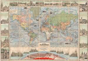
Nuevo Mapa-Mundi Planisferio Ilustrado con Más Notables Monumentos de España y Portugal, Senalando las divisiones fisicas y politicas de la Tierra y las Colonias de los Estados de Europa, a si como las épocas de los principales descubrimientos.
sold
- Digital Map Information
- Suitable for large format printing
- Full resolution TIFF file
- ICC color profile embedded
- Delivered instantly via download link
This is a rare 1890 Jean Dosseray map of the world with incorporated comparative mountains charts. The large central map presents a detailed look at the world in 1890, highlighting the vast colonial empires of Great Britain, Denmark, Spain, France, and Portugal. Many of Britain's colonial possessions are underlined in red. Mountains ranges, watersheds, ocean currents, and wind directions are illustrated. Bold black lines trace railroads, including the American Transcontinental Railroad and the Trans-Siberian Railroad (although not yet complete). Vignette illustrations include a boat under polar bear attack and whaling ships, among others. (more details)