
Fischgrund, Eugenio (sold)

Eugenio Fischgrund (1905 - 1980) was a travel writer and publisher of posters, books and postcards active in Mexico City. Fischgrund owned several imprints, including Athenaeum Fischgrund Publishing, which he founded c. 1930, and Editorial de Arte. He was also one of the first to publish and distribute prints of works by Mexican artists in the United States. Some of his artists included Diego Riviera (1886 – 1957), Charles X. Carlson (1902–1991), F. Lugo, Rafael Martínez Padilla (1878–1958), and Miguel Gomez Medina.
A pictorial overview of Mexican life, history, and culture from the most prominent Mexican pictorial map artist!
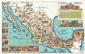
Pictorial Map of Mexico.
sold
- Digital Map Information
- Suitable for large format printing
- Full resolution TIFF file
- ICC color profile embedded
- Delivered instantly via download link
This is a 1931 Miguel Gomez Medina pictorial map of Mexico. The map depicts all of Mexico from the southern United States (labeling Arizona, New Mexico, and Texas) to the Belize, Guatemala, and the Pacific Ocean and from the Pacific Ocean and Baja California to the ... (more details)
Celebrated Mexican artist Miguel Gomez Medina.
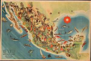
Mexico Pictorial Map.
sold
- Digital Map Information
- Suitable for large format printing
- File Size: 36.69 MB
- File Type: ZIP / TIFF
- ICC color profile embedded
- Delivered instantly via download link
This is a rare 1931 Miguel Gómez Medina pictorial map of Mexico. Depicting the entire country and beautifully illustrated, Medina seamlessly blends Mexico's culture, agriculture, and industry into a coherent and attractive whole. Mayan ruins are illustrated in the Yucatan Peninsula, highlighting Mexican history. Oranges, cacao, bananas, pineapple, coffee, and cotton are among the crops included to emphasize agriculture, while fish, sharks, oysters, and other sea life show the bounty of Mexico's coastal waters. Factories and oil derricks promote Mexican industry. Even Mexican terrain is depicted, from the deserts of the north to the jungles of the south. (more details)
Miguel Gómez Medina's finest and rarest pictorial map!
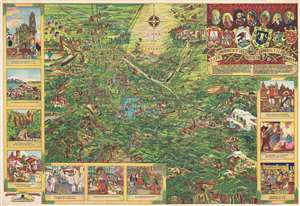
Mapa Pintoresco del Distrito Federal y Alrededores. Pictorial Map of the Federal District and Surroundings.
sold
- Digital Map Information
- Suitable for large format printing
- File Size: 29.55 MB
- File Type: ZIP / TIFF
- ICC color profile embedded
- Delivered instantly via download link
Issued during the Golden Age of Pictorial Maps (c. 1920 - 1960), this is a wonderful whimsical map of the Valley of Mexico City (DF, Distrito Federal) by Mexican artist Miguel Gómez Medina. Although not drawn to scale, the map centers on the lake of Xochimilco and extends north as far as the majestic ruins of Teotihuacan, and as far as the volcano Popocatépetl. The grid structure of the Centro Histórico and the Zócalo are obvious just to the north of the lake. Cartoon illustrations throughout focus on Mexican life and culture but also include highways and railroads – indications that Mexico is both rich in culture and rapidly embracing modern technological developments. The map proper is surrounded by scenes from Mexican life, including a street view of Cuernavaca, a village market, the Nevado de Toluca, the Convento de Tepotzotlan, and a night scene in the Zócalo during Mexican Independence Day La Noche de 'El Grito', among other scenes. (more details)
Miguel Gómez Medina's finest and rarest pictorial map!
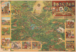
Mapa Pintoresco del Distrito Federal y Alrededores. Pictorial Map of the Federal District and Surroundings.
sold
- Digital Map Information
- Suitable for large format printing
- DPI: 600
- File Size: 64.71 MB
- File Type: ZIP / TIFF
- ICC color profile embedded
- Delivered instantly via download link
This is a whimsical 1935 pictorial map of the Valley of Mexico City (DF, Distrito Federal) by Mexican artist Miguel Gómez Medina. Made during the golden age of pictorial maps (c. 1920 - 1960), it reflects important changes in Mexican politics and culture, including an embrace of the country's pre-colonial roots. (more details)
Miguel Gómez Medina's finest and rarest pictorial map!
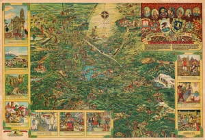
Mapa Pintoresco del Distrito Federal y Alrededores. Pictorial Map of the Federal District and Surroundings.
sold
- Digital Map Information
- Suitable for large format printing
- File Size: 92.75 MB
- File Type: ZIP / TIFF
- ICC color profile embedded
- Delivered instantly via download link
Issued during the Golden Age of Pictorial Maps (c. 1920 - 1960), this is a whimsical map of the Valley of Mexico City (DF, Distrito Federal) by Mexican artist Miguel Gómez Medina. (more details)