
Fremin, A. R. (sold)

A. R. Fremin (fl. c. 1810 - c. 1860) was a French geographer active in the early to mid 19th century. He is known to have been a student of the cartographer Jean-Baptiste Poirson. Fremin drew and compiled maps for many prominent French cartographic publishers of the period including Tardieu, Logerot, Dufour, Monin, Duvotenay, Dyonnet, and Vuillemin. Little else is known of Fremin's life and work.
Kiteguen and Kioumi - Maldanado's fictional discoveries in the Pacific Northwest.
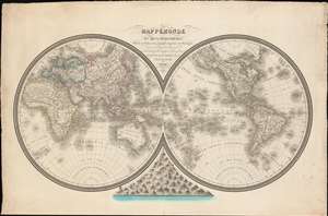
Mappemonde en Deux Hémisphères, Offrant un Tableau des Principales Hauteurs de Montagnes.
sold
- Digital Map Information
- Suitable for large format printing
- DPI: 600
- File Size: 901.13 MB
- File Type: ZIP / TIFF
- ICC color profile embedded
- Delivered instantly via download link
A dramatic separately-published French 1826 double-hemisphere map of the world by L. M. Berthe and A. R. Fremin. The map includes a bizzare and ephemeral treatment of the Pacific Northwest integrating the fictional discoveries of Maldonado (Kiteguen and Kioumi) and de Fonte (Valasco). It is further striking for its comparative Mountains chart at bottom center. (more details)
Unusual early 19th century attempt to reconcile De Fonte with Cook and Vancouver

Planisphère suivant la projection de Mercator, Élémens de Géographie Moderne a l'usage des Collèges et Maisons d'Éducation, Redigés suivant la Methodes de MM Mentelle et l'Abbé Gautier; et en accord avec les traités, Cours et Leçons adoptés pour l'instruction publique ou particulière.
sold
- Digital Map Information
- Suitable for large format printing
- DPI: 300
- File Size: 8.58 MB
- File Type: ZIP / TIFF
- ICC color profile embedded
- Delivered instantly via download link
An uncommon and attractive c. 1830 map of the world by the French map and atlas publisher Augustin Legrand illustrating several speculative northwest passages and submarine topography. Set on a Mercator Projection, the map is centered on the Pacific and includes the entire world with the exception of the extreme Arctic and Antarctic regions. The map proper is surrounded by allegorical imagery and extensive textual annotation. (more details)
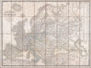
Carte Generale des routes de poste de L'Europe Dressee d'apres les itineraires les plus nouveaux de chaque etats.
sold
- Digital Map Information
- Suitable for large format printing
- DPI: 300
- File Size: 39.85 MB
- File Type: ZIP / TIFF
- ICC color profile embedded
- Delivered instantly via download link
An extremely scarce 1844 postal map of Europe in case or pocket format by the French map publishers A. Logerot and A. R. Fremin. Details the whole of Europe noting thousands of towns, cities, and villages as well as the roads that connect them. Shows mileage for ... (more details)
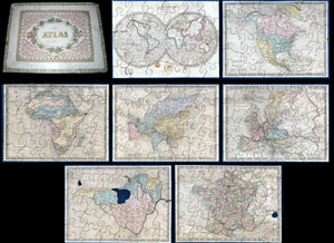
A very attractive an unusual c. 1850 jigsaw puzzle atlas published by Auguste Logerot. Consists a custom box of seven interesting jigsaw puzzle maps: the World, North America, South America, Europe, Asia, Africa and France. Each map is mounted on a board and ... (more details)