
Graphic Company (sold)

Graphic Company (1872 - 1890), or The Graphic Company, was a New York City based printing house in the latter half of the 19th century. The company was founded by the brothers James H. Goodsell and C. M. Goodsell. The Goodsell Brothers were born in Michigan and, for a time, ran a printing business in Chicago, which they lost during the 1871 Great Chicago Fire. They moved to New York in 1872, drawing investors and founding The Graphic Company with $500,000 USD in investment capital, much of it from Canada where it was publically traded. Among their investors were the prominent Republicans Alexander Robey 'Boss' Shepherd and Benjamin Franklin Butler. It was originally created as a newspaper, The Daily Graphic, but quickly expanded to other forms of printing. In 1873, they concocted a publicity stunt to build a giant branded balloon to send aeronauts John Wise and Washington H. Donaldson across the Atlantic in just 60 hours – an attempt that ended in disaster in a Connecticut field just 120 miles from its starting point. By 1874, The Graphic Company advertised as general lithographers, engravers, and power press printers, with specializations in commercial lithography (stock certificates, checks, notes, etc), presentation cards, chromolithography, and photo-lithography. Within a year, they had become a large and successful printing house, largely due to large government printing contracts that may have been dubiously obtained, possibly through investors Sherman and Butler. In 1878, they introduced an additional periodical, The Weekly Graphic. The Goodsells sold their shares in The Graphic Company by at least 1886. By 1888, the company changed its name to the American Graphic Company. In 1889, it was advertised as the Graphic Publishing Company. For most of its operation, the company was located at 39-41 Park Place, New York. The firm was dissolved by court order in March of 1890. The Goodsell Brothers were also, from 1872, publishers of the Financier, a successful financial journal based at 156 and 158 Broadway, and the Insurance Spectator.
Illustrates the Union and Confederate lines during the Siege of Knoxville.
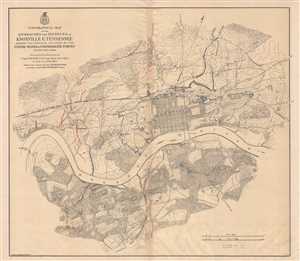
Topographical Map of the Approaches and Defences of Knoxville E. Tennessee Shewing the Positions Occupied by the United Stated and Confederate Forces During the Siege.
sold
- Digital Map Information
- Suitable for large format printing
- File Size: 17.62 MB
- File Type: ZIP / TIFF
- ICC color profile embedded
- Delivered instantly via download link
This is an 1864 Orlando M. Poe map of Union and Confederate positions surrounding Knoxville, Tennessee during the Siege of Knoxville. Centered on Knoxville and the Holston River, the map depicts the city of Knoxville and its environs, with particular focus placed ... (more details)
The best Civil War era map of Atlanta, Georgia.
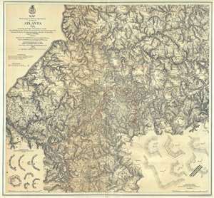
Map Illustrating the Military Operations in Front of Atlanta, Ga. From the Passage of Peach Tree Creek, July 19th 1864, to the Commencement of the Movement upon the Enemy's Lines of Communication, South of Atlanta, August 26th 1864 .
sold
- Digital Map Information
- Suitable for large format printing
- File Size: 43.56 MB
- File Type: ZIP / TIFF
- ICC color profile embedded
- Delivered instantly via download link
This is a rare separate-issue 1874 map of Atlanta, Georgia, and the area roughly five miles around. The large format map was issued by the War Department in 1874, but depicts Atlanta from surviving war records as it appeared shortly before and during the Battle ... (more details)
Amazing Civil War map depicting the Battles of Lookout Mountain and Missionary Ridge.
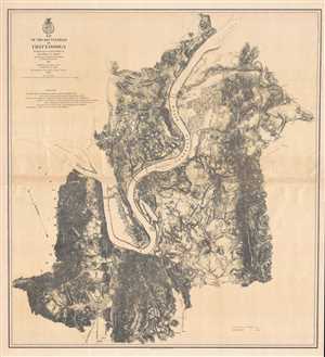
Map of the Battlefield of Chattanooga. Prepared to accompany Report of Maj. Gen. U.S. Grant by direction of Brig. Gen. W.F. Smith.
sold
- Digital Map Information
- Suitable for large format printing
- File Size: 20.42 MB
- File Type: ZIP / TIFF
- ICC color profile embedded
- Delivered instantly via download link
This is an 1875 William Farrar Smith map of the Chattanooga Campaign, a series of battles around Chattanooga, Tennessee in late November 1863. Centered on Chattanooga with the Tennessee River snaking its way past the city, the map depicts the region from ... (more details)
An Encyclopedia of Arctic Exploration.
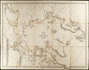
Map of the North Polar Region.
sold
- Digital Map Information
- Suitable for large format printing
- File Size: 356.13 MB
- File Type: ZIP / TIFF
- ICC color profile embedded
- Delivered instantly via download link
This 1879 William Bauman map of the North Pole surveys over 400 years of Arctic exploration. It was produced to accompany the posthumous report of Captain Charles F. Hall's final, fatal expedition to determine the fate of the British Arctic explorer, Sir John Franklin. It includes dated notations pertinent to Franklin and Hall's journeys, as well as the accomplishments of approximately 17 explorers reaching back to the 16th century, including the explorations of the Siberian coast by Adolf Erik Nordenskiöld (1832 - 1901) in his successful search for a northeast passage. (more details)
'Largest scale map of the territory...' - Streeter
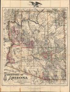
Official Map of the Territory of Arizona.
sold
- Digital Map Information
- Suitable for large format printing
- Full resolution TIFF file
- ICC color profile embedded
- Delivered instantly via download link
This is the first official map of Arizona Territory, published in 1880 by Emil A. Eckhoff and Paul Riecker. Rumsey calls this 'one of the best maps of Arizona as a territory.' It represents the primary cartographic resource during one of the most exciting and romantic periods of Arizona's history - recording the Arizona Silver and Copper mining boom, the early development of the territory's infrastructure and railroads, and the era of frontier lawlessness marked by the Gunfight at O.K. Corral, and other similar events. (more details)