
Magini, Giovanni Antonio (sold)

Giovanni Antonio Magini (June 13, 1555 - February 11, 1617) was an Italian astronomer, astrologer, cartographer, and mathematician. Born in Padua, he completed his studies in philosophy in Bologna in 1579. In 1588 he was chosen over Galileo Galilei as the chair of mathematics at the University of Bologna after the death of Egnatio Danti. Magini was a prolific writer, putting forth theories of celestial motion (he was a supporter of a geocentric solar system), the use of quadrants in surveying and astronomy, and trigonometry. In 1608, Magini produced the first map of Italy to improve on that of Gastaldi: his meticulously researched and beautifully engraved 8-sheet Italia Nuova was hugely influential: upon its publication, Blaeu promptly copied it to produce his own wall map of Italy; the rest of the mapmaking establishment swiftly followed suit. Consequently, virtually every 17th century map of Italy can be identified as a derivative of Magini's monumental achievement. His atlas, Atlante geografico d’Italia, was published posthumously by his son in 1620. This work was intended to include maps of every Italian region with exact nomenclature and historical notes. He also served as court astrologer for the Duke of Mantua.
An attractive small-format map of India and the Spice Islands.
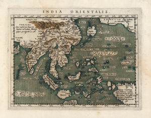
India Orientalis.
sold
- Digital Map Information
- Suitable for large format printing
- DPI: 600
- File Size: 7.01 MB
- File Type: ZIP / TIFF
- ICC color profile embedded
- Delivered instantly via download link
This is Giovanni Magini's 1596 map of the East Indies. It presents what, prior to the explosion of the Dutch into the spice trade, was the state of the art of the European mapping of the East. (more details)
One of the Earliest Maps on the Mercator Projection.
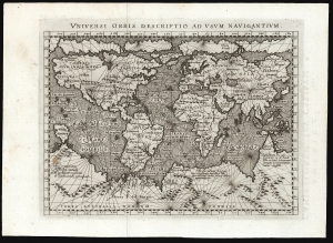
Universi Orbis Descriptio Ad Usum Navigantium.
sold
- Digital Map Information
- Suitable for large format printing
- Full resolution TIFF file
- ICC color profile embedded
- Delivered instantly via download link
This beautifully engraved world map is the 1596 first edition of Giovanni Magini's reduction of Mercator's 1569 world wall map. It is among the first commercial maps not by Mercator himself to employ the projection. (more details)
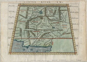
Tabula Asiae IX.
sold
- Digital Map Information
- Suitable for large format printing
- Full resolution TIFF file
- ICC color profile embedded
- Delivered instantly via download link
A scarce and unusual 1597 Ptolemaic map of what constitutes modern day Iran, Pakistan and Afghanistan. Presented on a trapezoidal projection with bold mountain ranges dividing the region. This map was engraved by G. Magini and G. Porro based upon the 1561 ... (more details)
One of the rarest and most beautiful Ortelius maps.
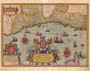
Serenissimae Reipublicae Genuensis Ducatus Et Dominii Nova Descriptio.
sold
- Digital Map Information
- Suitable for large format printing
- Full resolution TIFF file
- ICC color profile embedded
- Delivered instantly via download link
This is a beautiful example of Jan Baptista Vrients' map of the Republic of Genoa, added to Ortelius' Theatrum Orbis Terrarum in 1608. It is among the scarcest of the maps appearing in the Ortelius opus, having appeared in only the four final editions of the work. Typical of the maps thus included by Vrients, it is a tour de force of decorative cartography and stands among the most sumptuously engraved of the maps to appear in Ortelius' opus. Also, Ortelius atlases printed by Vrients enjoyed hand coloring of a very high quality, and the present map exemplifies this: the coloration on the cartouches, compass roses and ships is particularly rich. (more details)
Important highly decorative map from the first specific Atlas of Italy.
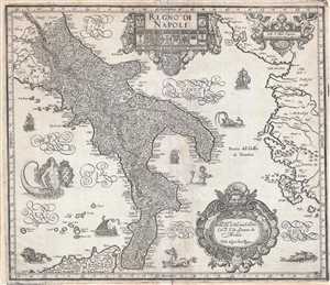
Regno di Napoli.
sold
- Digital Map Information
- Suitable for large format printing
- Full resolution TIFF file
- ICC color profile embedded
- Delivered instantly via download link
A beautifully engraved 1620 map of southern Italy or the Kingdom of Naples by Giovanni Antonio Magini. Centered on the Gulf of Taranto, this magnificent decorative map covers from Rome northern Sicily and from Rome to Albania, inclusive of al of southern ... (more details)
Important highly decorative map from the first specific Atlas of Italy.
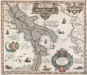
Regno di Napoli.
sold
- Digital Map Information
- Suitable for large format printing
- DPI: 300
- File Size: 9.2 MB
- File Type: ZIP / TIFF
- ICC color profile embedded
- Delivered instantly via download link
A beautifully engraved 1620 map of southern Italy or the Kingdom of Naples by Giovanni Antonio Magini. Centered on the Gulf of Taranto, this magnificent decorative map covers from Rome northern Sicily and from Rome to Albania, inclusive of al of southern ... (more details)
The First Major Innovation in the mapping of Italy since Magini.
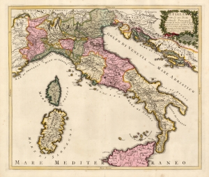
L'Italia con Le sue Poste e Strade Principali descritta da Giacomo Cantelli da Vignola Geografo del Serenis. Sigr. Duca di Moda. Data in luce d Pietro Schenk Intagliator in Rame in Amsterdam con Privilegio delli miei Seci: S le Seci: S: Stati di Hollanda et di West Frisia, il primo di Settembre 'l Anno 1701.
sold
- Digital Map Information
- Suitable for large format printing
- Full resolution TIFF file
- ICC color profile embedded
- Delivered instantly via download link
This is a beautiful example of a scarce, 1701 Peter Schenk map of Italy, focusing specifically on the country's post roads. It is derived from, and credits, the similarly-titled 1695 map produced by the Italian mapmaker Giacomo Cantelli da Vignola. Cantelli's map, printed in the year of that mapmaker's death, was the first significantly updated map of Italy to appear since Magini's 1608 Italia Nuova, which provided the basis for most maps of Italy issued in 17th and early 18th centuries. (more details)
The Dominant Mapping of Italy of the 17th Century, Updated and Amended.
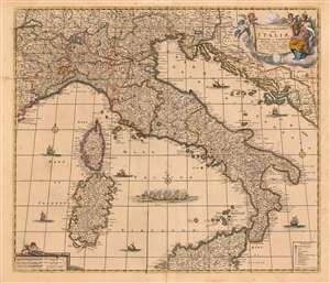
Novissima et Accuratissima totius Italiae, Corsicae et Sardiniae Descriptio Correcta, multis auct Locis et Viis editaque.
sold
- Digital Map Information
- Suitable for large format printing
- Full resolution TIFF file
- ICC color profile embedded
- Delivered instantly via download link
This is an attractive and scarce map of Italy, engraved c. 1680 by Frederik De Wit, but updated in 1721 by the Amsterdam publishers Covens and Mortier. Covens and Mortier added many place names and included the post road system first introduced on a 1695 map of Italy by Giacomo Cantelli da Vignola. The map covers the Italian Peninsula in its entirety including the Dalmatian coast, at the time controlled by the Republic of Venice, as well as the islands of Corsica, Sardinia, and part of Sicily. As with virtually every map of Italy produced in the seventeenth century, De Wit follows the model established by Magini's monumental 1608 Italia Nuova. Magini's map was justifiably influential, rendering the whole of Italy and its islands in magnificent detail with their river systems clearly presented and mountains shown pictorially. (more details)