
Phillips, Augustus Dewey (sold)

Augustus Dewey Phillips (May 6, 1898 - December 14, 1975), a.k.a. 'Gus', was an American artist, cartographer, and publisher. Born on Mount Desert Island, Maine, as a boy Augustus and his brother Luther Savage Phillips (1891 - 1960) helped their dad in a variety of odd jobs, including maintaining a boat rental business and harvesting and selling ice. Augustus graduated from Hebron Academy and then attended the University of Maine for a short time. After leaving university, Phillips became a Maine Guide and worked as a carpenter and draftsman in the South Portland and Boothbay Harbor ship and boat yards. The brothers traveled together widely throughout Maine. Luther went on to start a popular map and postcard business out of Northeast Harbor, Maine. After Luther died in 1960, Augustus took over the map businesses. In a tragic turn of events, in 1973 an out of control bush fire destroyed the Phillips studio and much of the surviving stock, making all Phillips' maps issued prior to that date rare. His passion for landscapes helped Augustus create his own map style. Augustus expanded the business and continued making new maps until he died in 1975. Augustus' son, Donald Beekman Phillips (1935 - 2009) continued the business after his father's death. Augustus married Mary Fletcher on April 26, 1922, with whom he had four children.
Historic homes!
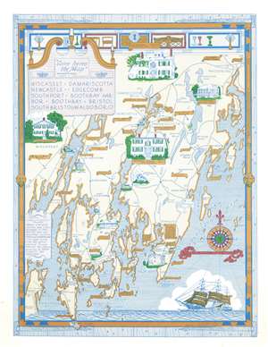
Wiscasset. Damariscotta. Newcastle. Edgecomb. Southport. Boothbay Harbor. Boothbay. Bristol. South Bristol. Waldoboro.
sold
This is a 1966 Augustus Dewey Phillips pictorial map of Lincoln, County, Maine depicting from Montsweag Bay to Muscongus Bay and from Waldoboro to Cape Island. Phillips highlights local history, the county's historic whaling towns, and identifies many local businesses. The towns of Damariscotta, Waldoboro, Wiscasset, Boothbay Harbor, Newcastle, Boothbay, and others appear. Vignettes illustrate important historic structures, including the Marie Antoinette House in North Edgecomb, Castle Tucker, the Stetson House in Damariscotta, the Boothbay Railway Museum, and the Kavanagh House in Damariscotta Mills. The Round Top Dairy, Cable's Gifts, the Rock Schoolhouse, Emerson's Smorgasbord, the Boothbay Golf Club, and the Bayside Oaks Snack Bar represent a sampling of the local establishments. A text along the left provides a short history of Lincoln County's founding. (more details)
Beautifully detailed pictorial map of the Upper Penobscot Bay region.
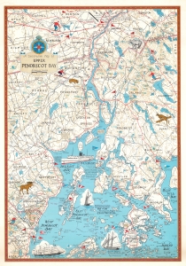
This is a charming 1972 Augustus D. Phillips pictorial map of the upper Penobscot Bay. Featuring illustrations of ships and local wildlife, Phillips's many iconic Maine maps combine practical information, history, humor, and beautiful detail, making them a favorite of 'in the know' collectors. (more details)
The Allagash Wilderness Waterway and the Dickey-Lincoln Dam Project.
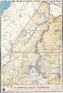
The Phillips Map of Northern Maine's St John - Allagash Wilderness Featuring the Allagash Wilderness Waterway State Park and Indicating the Lake to be Created If, or When, the Dickey Dam is Built.
sold
A brilliant juxtaposition of the results of conservation and 'progress', this is a 1973 Augustus D. Phillips and Son map of the St. John - Allagash Wilderness in northern Maine. Phillips highlights the conservation success of the Allagash Wilderness Waterway alongside the potential disaster posed by the Dickey-Lincoln hydroelectric dam project. (more details)
Visit Acadia National Park!
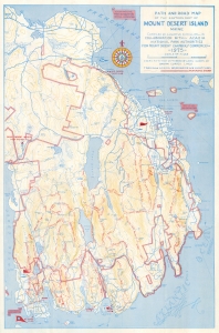
Path and Road Map of the Eastern Part of Mount Desert Island Maine. Path and Road Map of the Western Part of Mount Desert Island Maine.
sold
This is a 1975 Augustus D. Phillips map of Acadia National Park, Mount Desert Island, Maine. Phillips was a local of Mount Desert Island, living most of his life in Northeast Harbor. His fun pictorial maps were popular with tourists and locals alike, enjoying a wide following. (more details)
Pictorial map of Maine.
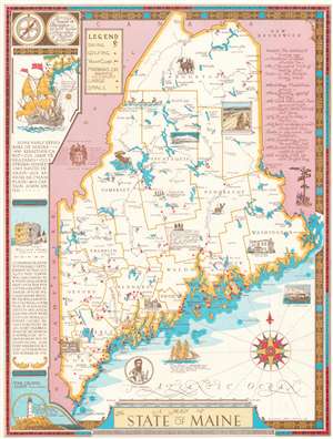
This is a 1980 A. D. Phillips and Son pictorial map of Maine. Pictorial vignettes highlight the Kavanagh House in Damariscotta Mills, the John Holmes House in Alfred, and the Ruggles House in Columbia Falls. Maine's wildlife also takes center stage, with illustrations of a moose, a deer, and a black bear. Mount Desert Island is beautifully illustrated. Maine's many ski areas are marked by skier icons, while red dots identify golf courses. Red flags note yacht clubs and red triangles identify large and small marinas. A poem appears in the upper left corner, while a list of early explorers of Maine occupies the left border. (more details)