
Postlethwayt, Malachy (sold)

Malachy Postlethwayt (c. 1707 - 1767) was a British economist and commercial expert famous for his publication of the commercial dictionary titled The Universal Dictionary of Trade and Commerce in 1751. The dictionary was a translation and adaptation of the Dictionnaire économique of the French Inspector General of the Manufactures for the King, Jacques Savary des Brûlons. Malachy claims to have spent nearly 20 years adapting and researching his important dictionary, which attained a popular following. The second edition of the Dictionary issued in 1752, was updated with a series of fine maps based upon D'Anville's work, but updated by Postlethwayt to reflect his political and social views. Politically Postlethwayt was extremely conservative and highly patriotic though his views more often than not took the form of rants against the social and political enemies of the British Empire. In the mid-1740s Postlethwayt lobbied for the Royal Africa Company and was known for his pro-slavery advocacy. His belief that the slave trade had a place in the larger "political arithmetic" of empire, promoted through his many popular books and other publications, in time became the party line for the ruling class. Despite his misguided feelings about the Africa slave trade, Postlethwayt was an influential and thoughtful economist whose ideas influenced Adam Smith, Samuel von Pufendorf, Alexander Hamilton, and others. Postlethwayt also commonly spelled his name as Postlethawyte and Postlethwait.
A fine 18th century wall map of North America.
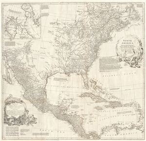
North America.
sold
- Digital Map Information
- Suitable for large format printing
- Full resolution TIFF file
- ICC color profile embedded
- Delivered instantly via download link
This is an exceptionally interesting and beautiful 1752 wall map of North America composed by Malachy Postlethwayte. Postlethwayte, an englishman, prepared this map for issue in conjunction with the second edition (1752) of his popular Dictionary of Trade & ... (more details)
A fine 18th century wall map of North America.
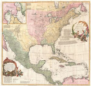
North America.
sold
- Digital Map Information
- Suitable for large format printing
- DPI: 300
- File Size: 40.79 MB
- File Type: ZIP / TIFF
- ICC color profile embedded
- Delivered instantly via download link
This is an exceptionally interesting and beautiful 1752 wall map of North America composed by Malachy Postlethwayte. Postlethwayte, an Englishman, prepared this map for issue in conjunction with the second edition (1752) of his popular Dictionary of Trade & ... (more details)
Anglophile edition of D'Anville's East Asia and Southeast Asia.
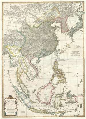
Second part of Asia, being China, part of India and Tartary: the islands of Sonda, Molucka, Philippin, Japan and c.
sold
- Digital Map Information
- Suitable for large format printing
- DPI: 300
- File Size: 31 MB
- File Type: ZIP / TIFF
- ICC color profile embedded
- Delivered instantly via download link
An exceptional 1755 map of East Asia by Malachy Postlethwayte and Solomon Bolton. Centered on the South China Sea, the map covers from Mongolia to java and from the Bay of Bengal to Hokkaido and new Guinea. It includes the countries of China, Japan, ... (more details)
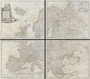
A Correct Map of Europe Divided into its Empires Kingdoms & c.
sold
- Digital Map Information
- Suitable for large format printing
- DPI: 300
- File Size: 38.71 MB
- File Type: ZIP / TIFF
- ICC color profile embedded
- Delivered instantly via download link
A curious and uncommon three panel 1755 wall map of europe by the english publisher M. Postlethwayte. Postlethwayte commissioned the well-known engraver Thomas Kitchen to compile this map based upon earlier maps by Vaugondy, d'Anville, and others. A ... (more details)
Quirky 18th century British four-sheet wall map identifying the Biblical paradise of Ophir.
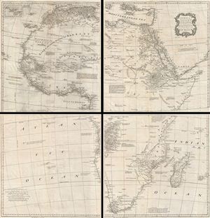
Africa, Performed by the Sr. D'Anville under the Patronage of the Duke of Orleans.
sold
- Digital Map Information
- Suitable for large format printing
- DPI: 300
- File Size: 56.05 MB
- File Type: ZIP / TIFF
- ICC color profile embedded
- Delivered instantly via download link
A curious and uncommon four panel wall map 1755 map of Africa by the english publisher M. Postlethwayte. A derivative of D'Anville's map of 1749, Postlethwayte's map covers the entire continent of Africa from the Mediterranean to the Cape of Good ... (more details)
Quirky 18th century British multi-sheet wall map of the Near and Middle East.
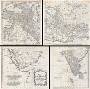
First Part of Asia, being Turkey, Arabia, Persia, most of India and Tartary.
sold
- Digital Map Information
- Suitable for large format printing
- DPI: 300
- File Size: 43.02 MB
- File Type: ZIP / TIFF
- ICC color profile embedded
- Delivered instantly via download link
A curious and uncommon four panel wall map 1786 map of India, Persia, and Arabia by the english publisher M. Postlethwayte. Published in four separate panels, this map can be either joined as a single massive map as assembled, as above, in separate ... (more details)
An invaluable reference to the 18th century African Slave trade.
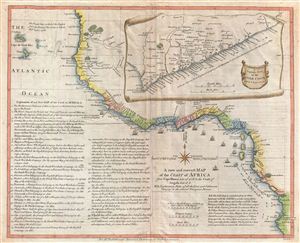
A new and correct Map of the Coast of Africa from Cape Blanco Lat. 20°, 40'. N. to the Coast of Angola, Lat. 11° . S. With Explanatory Notes of all the Forts and Settlements belonging to the several European Powers.
sold
- Digital Map Information
- Suitable for large format printing
- DPI: 300
- File Size: 11.09 MB
- File Type: ZIP / TIFF
- ICC color profile embedded
- Delivered instantly via download link
An important and very interesting 1755 map of western Africa by the english publisher M. Postlethwayte. This map covers the west coast of Africa from Cape Blanco and the Senegal River southwards past Sierra Leone, the Grain Coast, the Ivory Coast, ... (more details)
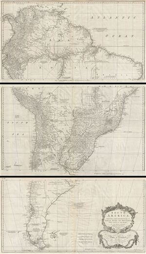
South America. Performed Under the Patronage of Louis Duke of Orleans First Prince of the Blood.
sold
- Digital Map Information
- Suitable for large format printing
- DPI: 300
- File Size: 57.7 MB
- File Type: ZIP / TIFF
- ICC color profile embedded
- Delivered instantly via download link
A curious and uncommon three panel 1755 wall map of South America by the English publisher M. Postlethwayte. A derivative of D'Anville's earlier map, Postlethwayte's map covers the entire continent from the Lesser Antilles and Panama to Cape ... (more details)
A fine 18th century wall map of North America.
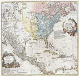
North America.
sold
- Digital Map Information
- Suitable for large format printing
- DPI: 300
- File Size: 40.31 MB
- File Type: ZIP / TIFF
- ICC color profile embedded
- Delivered instantly via download link
This is an exceptionally interesting and beautiful 1766 wall map of North America composed by Malachy Postlethwayte. Postlethwayte, an Englishman, prepared this map for issue in conjunction with the 3rd edition (1766) of his popular Dictionary ... (more details)