
Schedler, Joseph (sold)

Joseph Schedler (April 22 1813 - December 12, 1887) was a New York based engraver, printer, lithographer, and globe maker active from about 1850 to at least 1889. Schedler was born in Germany and immigrated to the United States, a Forty-Eighter fleeing the German Revolutions of 1848-1849. He was active from at least 1850 when he partnered with fellow German immigrant, the landscape artist, painter, and engraver, Theodore August Liebler (1830 – 18??), to found the lithography firm of Schedler and Liebler, 129 William Street. The firm completed engraving work for J. H. Colton as early as 1852 but probably dissolved by 1854. Schedler filed a patent in 1878 for a crystallotype machine, a device the employed electrotyping to print textured crystalline surfaces. He is best known today as a globe maker. Joseph Schedler's globes won prizes at the Paris International Exhibition in 1867, the American Institute Fair in 1869 and the Vienna International Exhibition in 1873. From at least 1876 records suggest he relocated to Jersey City, New Jersey. Schedler's son, Herman, was also a globe maker, and inherited his father's business sometime around 1877, producing globes will to about 1901.
Meeting Point of Germany, Switzerland, and Austria.
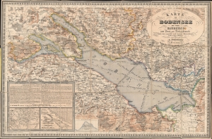
Karte vom Bodensee und seiner Umgebung zum Hand und Reisegebrauche nach den neuesten und besten Materialien.
sold
- Digital Map Information
- Suitable for large format printing
- File Size: 43.72 MB
- File Type: ZIP / TIFF
- ICC color profile embedded
- Delivered instantly via download link
A stunning hand-colored c. 1860 pocket folding map of Lake Constance (the Bodensee) and environs on the German-Swiss-Austrian border by J. Schedler, perhaps Joseph Schedler, who emigrated to the United States and worked there as a cartographer. (more details)
Rare Civil War map of the Battle of Vicksburgh from Spangenberg manuscript.
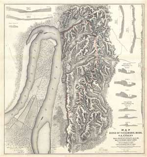
Map of the Siege of Vicksburg, Miss. By the U.S. Forces Under the Command of Genl. U.S. Grant, U.S. Vls. Maj. F.E. Prime, Chief Engr. Surveyed and constructed under the direction of Capt. C.B. Comstock, U.S. Engr.s and Lt. Col. Js. H. Wilson . . . Drawn by Chs. Spangenberg.
sold
- Digital Map Information
- Suitable for large format printing
- File Size: 36.14 MB
- File Type: ZIP / TIFF
- ICC color profile embedded
- Delivered instantly via download link
This is a rare c. 1863 separate issue Charles Spangenberg Civil War map of the Siege of Vicksburg (May 18, 1863 - July 4, 1863). This map, considered one of the most attractive Civil War maps, is based upon a manuscript map drawn by military engineer Charles ... (more details)
Rare Civil War map of the Battle of Vicksburgh from Spangenberg manuscript.
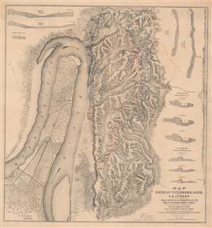
Map of the Siege of Vicksburg, Miss. By the U.S. Forces Under the Command of Genl. U.S. Grant, U.S. Vls. Maj. F.E. Prime, Chief Engr. Surveyed and constructed under the direction of Capt. C.B. Comstock, U.S. Engr.s and Lt. Col. Js. H. Wilson . . . Drawn by Chs. Spangenberg.
sold
- Digital Map Information
- Suitable for large format printing
- File Size: 67.43 MB
- File Type: ZIP / TIFF
- ICC color profile embedded
- Delivered instantly via download link
This is a rare c. 1863 separate issue Charles Spangenberg Civil War map of the Siege of Vicksburg (May 18, 1863 - July 4, 1863). This map, considered one of the most attractive Civil War maps, is based upon a manuscript map drawn by military engineer Charles Spangenberg shortly after the siege. It covers Vicksburg and the surrounding hills as well as the full bend of the Mississippi River. To the right of the map there are various cross sections illustrating the Confederate and Union fortifications. (more details)
Urbanization of Elizabeth, New Jersey.
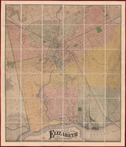
Map of the City of Elizabeth.
sold
- Digital Map Information
- Suitable for large format printing
- File Size: 95.52 MB
- File Type: ZIP / TIFF
- ICC color profile embedded
- Delivered instantly via download link
This is a previously uncatalogued 1871 Ernest L. Meyer and W. F. Wonneberg cadastral wall map of Elizabeth, New Jersey. This map is a unique record of the urban expansion of Elizabeth through the late 19th century. (more details)
The First Map Specifically of the Catskill Mountains
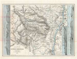
Map of the Catskill Mountains. Surveyed by A. Guyot. Drawn by Ernest Sandoz. 1880.
sold
- Digital Map Information
- Suitable for large format printing
- File Size: 28.54 MB
- File Type: ZIP / TIFF
- ICC color profile embedded
- Delivered instantly via download link
This is Arnold Guyot's 1879 map of the Catskill Mountains. It is the only early map to focus specifically on the range, and the very first to accurately depict the region, and provide a useful tool for traveling it. The far-ranging Swiss geologist was an inveterate trekker, and his surveys of not only the Catskills but also the lion's share of the Appalachian mountain range were executed personally, on foot. His map provides the elevation above sea level for virtually every peak shown on the map. Prior to his surveys, misconceptions about the Catskills abounded. For example, 'High Peak' had been so named based upon the assumption that it was the highest in the range: Guyot's survey took him far deeper into the mountains than prior surveys, however, and his cataloguing of the less-accessible mountains ranks High Peak only twenty third. Guyot, as he did in his other maps of the Appalachians, resolved epidemic disagreements about place names by relying on the terminology used by the denizens of the region he was mapping - diverging from this discipline on rare occasions where clarity in language called for it (for example, swapping Round Top with High Peak to reflect the reality that Round Top was the higher of the two.) (more details)