
Stanley, Henry Morton (sold)
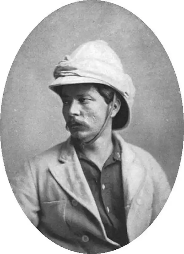
Sir Henry Morton Stanley (January 28, 1841 - May 10, 1904) was a British journalist and explorer and a seminal figure in the history of exploration for which we can offer only a cursory treatment here. Stanley is renowned for his explorations of central Africa, locating the missionary and explorer David Livingstone, and his search for the source of the Nile. Born in Wales, Stanley was the illegitimate son of an 18 year old woman and an unknown man, saddling him with the burden of illegitimacy throughout his life. Rowlands moved to the United States in 1859, where he adopted the name Henry Morton Stanley under unclear circumstances. Stanley fought on both sides of the American Civil War and also served in the Union Navy, possibly the only man to serve in all three. After the war, Stanley became a foreign correspondent for the New York Herald, for which he traveled the world, writing stories about his explorations for the paper.
Determining the Source of the Congo.
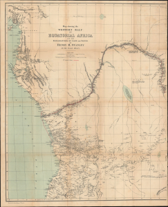
Map showing the Western Half of Equatorial Africa and the Explorations by Land and Water of Henry M. Stanley in the years 1874 - 1877.
sold
- Digital Map Information
- Suitable for large format printing
- File Size: 26.27 MB
- File Type: ZIP / TIFF
- ICC color profile embedded
- Delivered instantly via download link
This is Henry Morton Stanley's 1878 map of western central Africa, prepared for the first Canadian edition of his book Through the Dark Continent. It traces the route of Stanley's First Trans-Africa Expedition. (more details)
The first complete and relatively accurate mapping of the Congo River.
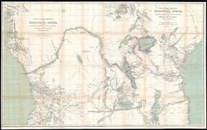
Westliche Hälfte von Äquatorial-Afrika und die Forschungsreisen zu Land und zu Wasser von Henry M. Stanley in den Jahren 1874 - 77. / Östliche Hälfte von Äquatorial-Afrika und den Forschungsreisen zu Land und zu Wasser von Henry M. Stanley in den Jahren 1874 - 77.
sold
- Digital Map Information
- Suitable for large format printing
- File Size: 81.23 MB
- File Type: ZIP / TIFF
- ICC color profile embedded
- Delivered instantly via download link
A map of considerable historical significance, this is the 1878 German edition Edward Weller and Henry Morton Stanley's map of Equatorial Africa, the first to describe the course of the entire Congo River. The map depicts the region from the Atlantic Ocean to the Indian Ocean and from the mouth of the Bight of Biafra to the southern tip of Lake Malawi (Lake Nyassa). The bright red line present on the map traces Stanley's expedition from Zanzibar to the Atlantic Ocean, with myriad locations identified along its path and some commentaries on different locations included. (more details)
Traces the first half of Stanley's first expedition across Africa from 1874 - 1877.
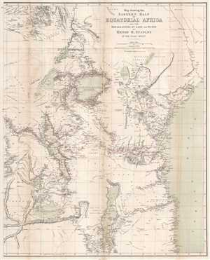
Map showing the Eastern Half of Equatorial Africa and the Explorations by Land and Water of Henry M. Stanley in the years 1874 - 1877.
sold
- Digital Map Information
- Suitable for large format printing
- File Size: 16.13 MB
- File Type: ZIP / TIFF
- ICC color profile embedded
- Delivered instantly via download link
This is a rare 1879 Henry Morton Stanley map of East Africa. The map depicts the region from South Sudan to Zambia and Mozambique and from the Democratic Republic of the Congo to the Indian Ocean. A study in stark contrast, Stanley's route from Zanzibar across the continent to Uzimba in the modern-day Democratic Republic of the Congo, is highly detailed. Points all along the route are labeled, including during his circumnavigation of Lake Victoria and Lake Tanganyika. Notes concerning the region's larger lakes are also included, such as their elevation above sea level and the name of the first European to 'discover' each lake. However, outside of the immediate vicinity of Stanley's expedition, the map is blank, underlining the complete lack of knowledge then available concerning African geography and its people. Tribes are named, and river courses are included, but the majority of the territory depicted is left blank. (more details)
Traces the first half of Stanley's first expedition across Africa from 1874 - 1877.
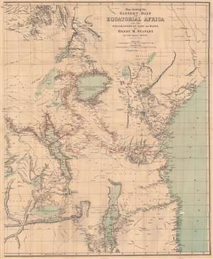
Map showing the Eastern Half of Equatorial Africa and the Explorations by Land and Water of Henry M. Stanley in the years 1874 - 1877.
sold
- Digital Map Information
- Suitable for large format printing
- File Size: 31.76 MB
- File Type: ZIP / TIFF
- ICC color profile embedded
- Delivered instantly via download link
This is a rare 1879 Henry Morton Stanley map of East Africa - one of the first maps to accurately illustrated the Rift Valley. Coverage extends from South Sudan to Zambia and Mozambique and from the Democratic Republic of the Congo to the Indian Ocean. A study in stark contrast, Stanley's route from Zanzibar across the continent to Uzimba in the modern-day Democratic Republic of the Congo, is highly detailed. Points all along the route are labeled, including during his circumnavigation of Lake Victoria and Lake Tanganyika. Notes concerning the region's larger lakes are also included, such as their elevation above sea level and the name of the first European to 'discover' each lake. However, outside of the immediate vicinity of Stanley's expedition, the map is blank, underscoring a general lack of knowledge. Tribes are named, and river courses are included, but the majority of the territory is blank. (more details)