
Starckman, Pieter (sold)

Pieter Starckman (fl. c. 1680 - 1730), a.k.a Peter or Petrus, was a Dutch engraver active in the late 17th and early 18th centuries. Starckman was likely born in Amsterdam in March of 1655, the son of Steven Starckman and Atalijntge van Oostijnen. During much of his career he was active in the Hague, but some records suggested that in the early 18th century he held a royal appoint in France as Graveur du Roy en Geograpie, Fortifications et Marines. Starckman engraved for numerous cartographers as well as on his own account, usually signing his work as 'P. Starckman'. He collaborated with the finest mapmakers of his day, including De Fer and De L'Isle.
Rare, Separately Issued.
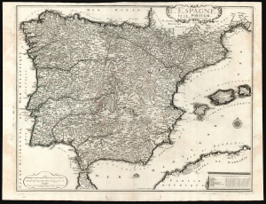
L'Espagne et le Portugal par N. De Fer Geographe de sa Majesté Catolique.
sold
- Digital Map Information
- Suitable for large format printing
- DPI: 600
- File Size: 73.85 MB
- File Type: ZIP / TIFF
- ICC color profile embedded
- Delivered instantly via download link
This is a beautiful example of Nicholas De Fer's 1705 map of Spain and Portugal, including the Balearic islands and part of the North African coast. Typical of De Fer's work, the map is superbly detailed, while remaining restrained and elegant in its decoration. (more details)
A sarce and beautiful map of Paris, France.
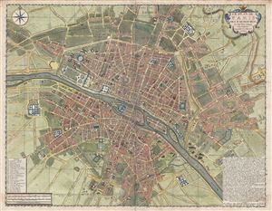
Le Plan de Paris ses Faubourgs et ses Environs.
sold
- Digital Map Information
- Suitable for large format printing
- DPI: 300
- File Size: 25.62 MB
- File Type: ZIP / TIFF
- ICC color profile embedded
- Delivered instantly via download link
A fine example of De Fer's scarce and beautiful 1717 map of Paris, France. Centered on the Seine River, the map covers from Ile aux Cygnes to Mont Louis, and from Les Porcherons to Le Gaubourg Saint-Marceau. All streets, gardens, important buildings, palaces, some ... (more details)
The ambition of a French Empire in America.
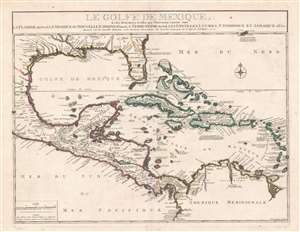
Le Golfe De Mexique, Et les Provinces et Isles qui l'Environe comme sont La Floride Au Nord Le Mexique ou Nouvelle Espagne . . . 1717
sold
- Digital Map Information
- Suitable for large format printing
- DPI: 600
- File Size: 40.96 MB
- File Type: ZIP / TIFF
- ICC color profile embedded
- Delivered instantly via download link
This is a beautiful example of Nicholas De Fer's rare 1717 map of Florida, the West Indies, the Gulf of Mexico and Central America. This region was central to French ambitions for an American empire, and follows upon the establishment of La Salle's colony on Matagorda Bay, and d'Iberville and Bienville's fortification of the Mississippi (Fort de Missisipi). Just one year after this map was issued, in 1718, Jean-Baptiste Le Moyne de Bienville founded New Orleans. Centered on Cuba, coverage extends from roughly Cape Fear to the Equator and from the Mexico City to Barbados. Bermuda, along with its surrounding shoals, breaks the border on the upper right. It is distinctive for its sophisticated mapping of the Gulf Coast and Florida, a region then little known but heavily disputed. (more details)
Fine early nautical chart of Sardinia.
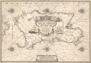
Nouvelle Carte de L'Isle de Sardaigne et partie de Celle de Corce.
sold
- Digital Map Information
- Suitable for large format printing
- DPI: 600
- File Size: 27.85 MB
- File Type: ZIP / TIFF
- ICC color profile embedded
- Delivered instantly via download link
This is a rare 1719 Henri Michelot nautical map of the island of Sardinia, Italy. Michelot was active in the Mediterranean Sea for many years, and his charts benefit from his expertise in those waters - making them among the finest available at the time of publication. Accordingly, coastal features are abundantly named, depth soundings are marked for the island's anchorages, and coastal landmarks such as towers and hills are indicated pictorially. The famous salt flats of Cagliari and the Oristano lagoon are marked as well. (more details)