
Tardieu, Pierre Antoine-François (sold)

Pierre Antoine-François Tardieu (February 17, 1757 - January 14, 1822), also known as Tardieu de l'Estrapade, for his address at Place de L'Estrapade, was a French geographical engraver and publisher active in Paris during the late 18th and early 19th centuries. A member of the large and prolific Tardieu family, which, for over 200 years, produced multiple skilled and active engravers. A disciple of his uncle Pierre-François Tardieu, in his youth Antoine-Francois would sign his works Pierre-François (or P.F. Tardieu; 1711 - 1771) , but later in his career began using his own name or (P.A.F. Tardieu). His two sons, Pierre-Antoine Tardieu and Ambroise Tardieu (1788 - 1841), both became noted geographical engravers in the own right.
1796 Collot Map of the Country of the Illinois (Mississippi River near Missouri, St. Louis, Illinois
The first published map of the St. Louis area.
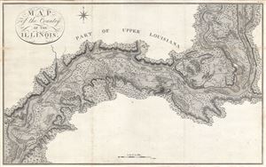
Map of the Country of the Illinois.
sold
- Digital Map Information
- Suitable for large format printing
- DPI: 300
- File Size: 13.95 MB
- File Type: ZIP / TIFF
- ICC color profile embedded
- Delivered instantly via download link
A map of 'superlative' rarity, this is Victor Collot's 1796 map of the Mississippi River in the vicinity of St. Louis, Missouri, or what at the time was known as the 'Country of the Illinois.' Focusing on the Mississippi River valley, this map covers from the ... (more details)
Florida during the second Spanish period when it became a refuge for escaped slaves and American Indian tribes who regularly raided the United States.
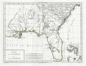
Carte de la Floride et de la Georgie.
sold
- Digital Map Information
- Suitable for large format printing
- DPI: 300
- File Size: 5.76 MB
- File Type: ZIP / TIFF
- ICC color profile embedded
- Delivered instantly via download link
This is a stunning 1798 Pierre Antoine-François Tardieu map of Florida and Georgia. The map depicts the region from Louisiana to the Atlantic Ocean and from South Carolina to the Gulf of Mexico. Some Historical Context Created during the second era of Spanish ... (more details)
Spanish Florida: a volatile frontier of Native nations, runaway slaves, and imperial rivalry.
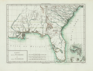
Carte de la Floride et de la Georgie.
sold
- Digital Map Information
- Suitable for large format printing
- Full resolution TIFF file
- ICC color profile embedded
- Delivered instantly via download link
This is Pierre François Antoine Tardieu's 1798 map of Spanish Florida and Georgia. With coverage from Louisiana to the Atlantic Ocean and from South Carolina to the Gulf of Mexico, this map was issued during the second era of Spanish rule in Florida. At this time, Florida became a haven for runaway slaves and a base of operations for Native American attacks on the United States. The map is printed on striking French Revolutionary period blue-tinted paper. (more details)
Map prepared for Napoleon's catastrophic invasion of Russia.
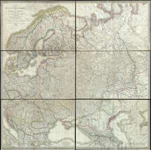
Carte de la Russie d'Europe, avec l'Empire d'Autriche, la Suede, le Danemark et la Norwege, la Prusse, le Grand Duche de Varsovie, les provinces Illyriennes, et une partie de la Confederation du Rhin et de la Turquie d'Europe.
sold
- Digital Map Information
- Suitable for large format printing
- DPI: 300
- File Size: 135.89 MB
- File Type: ZIP / TIFF
- ICC color profile embedded
- Delivered instantly via download link
This extraordinary six-sheet 1812 wall map of Russia was prepared by Pierre M. Lapie and Pierre Antoine-François Tardieu in anticipation of Napoleon's catastrophic 1812 French Invasion of Russia. Centered on Moscow (Moscau), the map depicts European Russia ... (more details)
A call for brotherhood against the hated English.
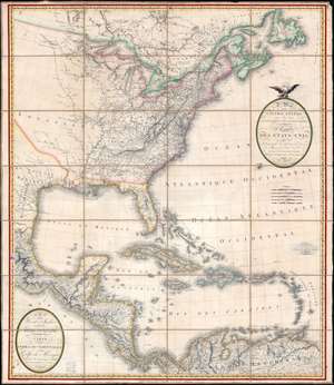
A Map of the United States and Canada, New-Scotland, New-Brunswick and New-Foundland. / Carte des Etats-Unis, avec le Canada, La Nouvelle Ecosse, Le Nouveau Brunswick et Terre-Neuve. / A Map of the West-Indies and of the Mexican-Gulph. / Carte des Indies Occidental et du Golfe du Méxique.
sold
- Digital Map Information
- Suitable for large format printing
- Full resolution TIFF file
- ICC color profile embedded
- Delivered instantly via download link
A lavish, large-scale French map of the United States and West Indies issued in September of 1812 - shortly after the outbreak of the War of 1812 (1812 - 1815). This is one of the few major French cartographic productions not focused on Europe to appear during the Napoleonic Wars (1803 - 1815) and needs to be addressed in this context to be fully understood. With titles both in English and French, it calls for brotherhood and alliance against the hated English. (more details)
Napoleonic map of South America during the Wars of Independence.

A Map of South America. / Carte de L'Amérique Méridionale.
sold
- Digital Map Information
- Suitable for large format printing
- Full resolution TIFF file
- ICC color profile embedded
- Delivered instantly via download link
A striking and expansive two-section 1814 case map of South America issued by Pierre Lapie. The map captures South America at the height of the Spanish American Wars of Independence (1808 - 1833), a heady and violent period that reshaped the continent's political geography. (more details)