
Texas General Land Office (sold)

The Texas General Land Office (GLO) (December 22, 1836 - Present) is an agency of the state government of Texas responsible for the management of land and mineral rights that are owned by the state. Established by the Congress of the Republic of Texas on December 22, 1836, the agency manages Texas's publicly owned land, negotiates and enforces leases concerning the use of that land, and sells public lands. Part of these proceeds are put into the state's Permanent School Fund, which helps fund public education in Texas. The GLO has managed The Alamo in San Antonio since 2011. After Texas was annexed by the United States in 1845, the state maintained control over all its public lands from when it had been a sovereign state, making Texas the only U.S. state to control all its own public lands. All federal land in Texas was acquired either through purchase (for example military bases) or donation (national parks).
Early days of Calhoun County.
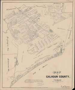
Map of Calhoun County, Texas.
sold
- Digital Map Information
- Suitable for large format printing
- File Size: 14.35 MB
- File Type: ZIP / TIFF
- ICC color profile embedded
- Delivered instantly via download link
A rare 1879 plat map of Calhoun County Texas produced by the Texas General Land Office. It denotes the various landowners of properties in the county, revealing elements of local history. (more details)
Land ownership and layers of history.
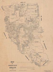
Map of Cherokee County, 1879.
sold
- Digital Map Information
- Suitable for large format printing
- File Size: 25.43 MB
- File Type: ZIP / TIFF
- ICC color profile embedded
- Delivered instantly via download link
An 1879 Texas General Land Office cadastral map of Cherokee County, Texas. The map features manuscript highlighting the relocation of Jacksonville to Troup, to capitalize on the route Great Northern Railroad. Moreover, the early history of the county, from Spanish colonization though to Texas statehood, can be deduced from the plots and other features. (more details)
Prime real estate on the Brazos.
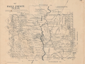
Map of Falls County, Texas.
sold
- Digital Map Information
- Suitable for large format printing
- File Size: 16.62 MB
- File Type: ZIP / TIFF
- ICC color profile embedded
- Delivered instantly via download link
A scarce 1879 plat map of Falls County, Texas produced by the Texas General Land Office. It provides a detailed portrait of the county roughly thirty years after its creation. (more details)
Cattle country.
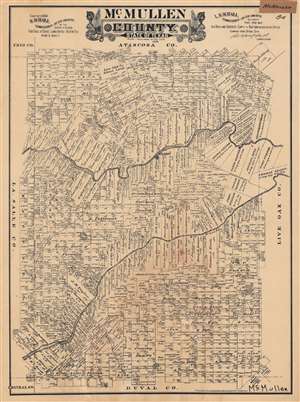
McMullen County. State of Texas.
sold
- Digital Map Information
- Suitable for large format printing
- File Size: 61.43 MB
- File Type: ZIP / TIFF
- ICC color profile embedded
- Delivered instantly via download link
This is a very rare 1889 plat or cadastral map of McMullen County, Texas produced by Augustus Gast for the Texas General Land Office. It shows the demarcation of properties and their owners in the South Texas county, which was and remains primarily ranchland. (more details)