
Westermann, Georg (sold)
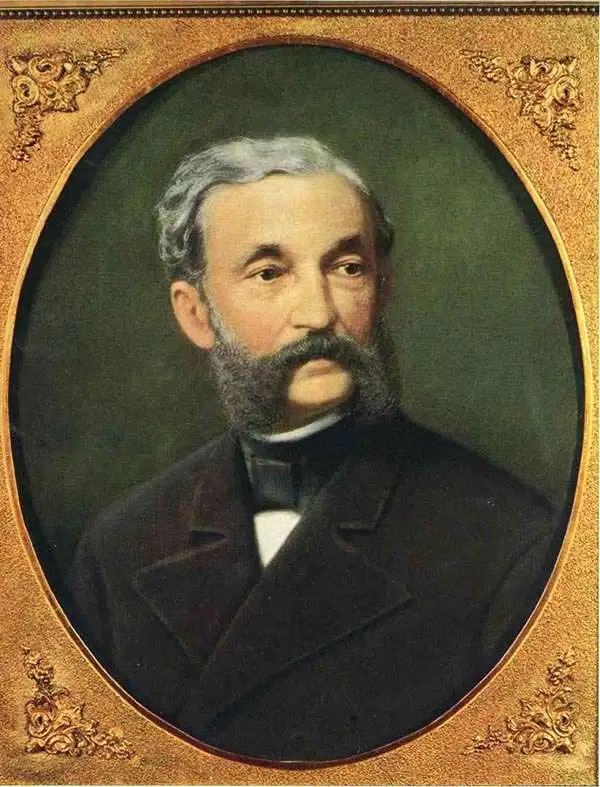
Georg (George) Westermann (February 23, 1810 - September 7, 1879) was a German publisher and the founder of Westermann Verlag, based in Braunschweig, which still exists to this day and publishes as part of the Westermann Group. Born in Leipzig, Westermann attended the Humanistic Gymnasium Albertina in Freiberg before moving to Brunswick to work as an apprentice to a book publisher and seller in 1827. He founded his own publishing bookstore in Braunschweig in 1838 and married Blanca Vieweg on November 29th of that year. Westermann expanded his operation in 1845 by acquiring his own printing works, which he later supplemented with a lithographic machine, steam-powered letterpresses, and a bookbindery. After Westermann died in 1879, his son Friedrich took over the business.
1st foreign-language atlas map of San Francisco Bay.
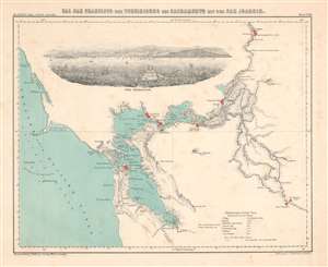
Bai San Francisco und Vereinigung des Sacramento mit dem San Juaquin.
sold
- Digital Map Information
- Suitable for large format printing
- DPI: 600
- File Size: 4.61 MB
- File Type: ZIP / TIFF
- ICC color profile embedded
- Delivered instantly via download link
This is a bilingual English and German 1854 Henry Lange map of San Francisco Bay and the surrounding region. The first specific map of San Francisco Bay in a foreign language, it depicts the region from the Pacific Ocean to Sacramento and from Sacramento to San Joaquin. Depth soundings appear throughout San Francisco Bay, San Pablo Bay, and Suisun Bay. Points, islands, straits, and other coastal features are illustrated, providing a detailed view of the bay and its hazards. San Francisco, Vallejo, New York of the Pacific, Sacramento City, Stockton, and San Joaquin are highlighted in red. The region's extensive river system is illustrated in detail, and its creek, streams, and rivers are all labeled. (more details)
An ethnographic pictorial wall map of Africa.
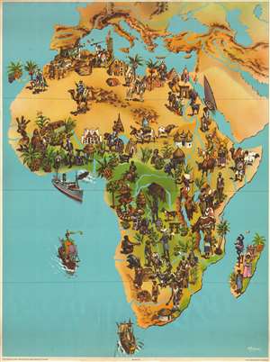
[Africa].
sold
- Digital Map Information
- Suitable for large format printing
- File Size: 124.47 MB
- File Type: ZIP / TIFF
- ICC color profile embedded
- Delivered instantly via download link
This is a c. 1957 Georg Westermann Verlag pictorial wall map of Africa. The map depicts the entire continent, stretching from central Europe to the Cape of Good Hope and from the Atlantic Ocean to the Indian Ocean and the Persian Gulf. Stunningly illustrated, the ... (more details)
Includes musk oxen, a polar bear, and caribou.
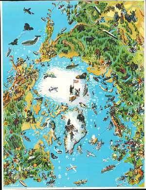
This is a 1957 Westermann pictorial map of the Arctic. Centered on the North Pole, the map incorporates parts of the northern hemisphere, including Siberia, Canada, Greenland, and most of Europe encircle the northern icecap. Illustrations of Arctic wildlife, such as musk oxen, elephant seals, polar bears, caribou, walruses, and moose add charm and educational value. Trappers, fishermen, Inuit, loggers, and explorers appear as well. Colored diamonds featuring chemical symbols mark mineral deposits. Icebergs dot most of the Arctic Ocean and some of the Atlantic, creating hazards for the steamships plying these waters. Airliners traverse the Atlantic as well, highlighting the newfound interconnectedness of the mid-20th century. (more details)
International Geophysical Year - bringing global attention to Antarctica.
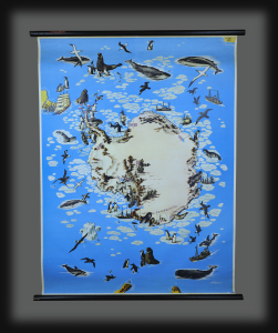
This is a c. 1957 Westermann Verlag pictorial wall map of Antarctica. The map corresponds with the International Geophysical Year (IGY) of 1957-1958, a global scientific collaboration that brought international attention to Antarctica. (more details)
Penguins and whales!
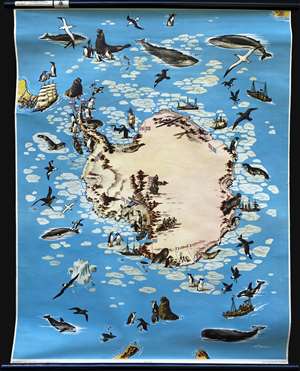
Nr. 570 Südpolargebiet Landtierleben und Forschung.
sold
- Digital Map Information
- Suitable for large format printing
- Full resolution TIFF file
- ICC color profile embedded
- Delivered instantly via download link
This is a c. 1957 Westermann Verlag pictorial wall map of Antarctica. Many species of penguins, whales, and seals populate the continent, and icebergs drift out to sea. Seabirds, including albatross and skuas, soar in the skies over the Antarctic ocean. Sailing ships spanning centuries of exploration ply the surrounding waters, including a vessel resembling those used by Sir Francis Drake or Jacob Le Maire rounding Cape Horn. International flags stake claims and chronicle Antarctic exploration, heralding the successes of Norway's Roald Amundsen, Britain's Robert Falcon Scott, and the U.S.'s Richard Byrd. French flags surround the French Dumont d'Urville Station, a scientific station in southeastern Antarctica. Established on January 12, 1956, the station remains in active use today and can accommodate 120 people during the summer and thirty over the winter months. (more details)