

Kentucky.
sold
- Digital Map Information
- Suitable for large format printing
- DPI: 300
- File Size: 2.92 MB
- File Type: ZIP / TIFF
- ICC color profile embedded
- Delivered instantly via download link
A beautiful example of Finley's important 1827 map of Kentucky. Depicts the state with moderate detail in Finley's classic minimalist style. Shows river ways, roads, canals, and some topographical features. Offers color coding at the county level. Title and scale ... (more details)
Showing Creek and Cherokee territory prior to the Trail of Tears.

Georgia.
sold
- Digital Map Information
- Suitable for large format printing
- DPI: 300
- File Size: 3.49 MB
- File Type: ZIP / TIFF
- ICC color profile embedded
- Delivered instantly via download link
A beautiful example of Finley's important 1827 map of Georgia. Depicts the state with moderate detail in Finley's classic minimalist style. Shows river ways, roads, canals, and some topographical features. Offers color coding at the county level. Finley's map ... (more details)
Showing Creek and Cherokee territory prior to the Trail of Tears.

Alabama.
sold
- Digital Map Information
- Suitable for large format printing
- DPI: 300
- File Size: 3.29 MB
- File Type: ZIP / TIFF
- ICC color profile embedded
- Delivered instantly via download link
A beautiful example of Finley's important 1827 map of Alabama. Depicts the state with moderate detail in Finley's classic minimalist style. Shows river ways, roads, canals, and some topographical features. Offers color coding at the county level. Finley's map ... (more details)

New Jersey.
sold
- Digital Map Information
- Suitable for large format printing
- DPI: 300
- File Size: 3.81 MB
- File Type: ZIP / TIFF
- ICC color profile embedded
- Delivered instantly via download link
A beautiful example of Finley's important 1827 map of New Jersey. Depicts the state with moderate detail in Finley's classic minimalist style. Shows river ways, roads, canals, and some topographical features. Offers color coding at the county level. Title and ... (more details)
Remarkable detail of the Delaware Bay.

Delaware.
sold
- Digital Map Information
- Suitable for large format printing
- DPI: 300
- File Size: 3.05 MB
- File Type: ZIP / TIFF
- ICC color profile embedded
- Delivered instantly via download link
A beautiful example of Finley's important 1827 map of Delaware. This rare map plate configuration depicts the state individually rather than bundled with Maryland - as is more common. Depicts the state with moderate detail in Finley's classic minimalist ... (more details)
Rare exclusive depiction of Maryland.

Maryland.
sold
- Digital Map Information
- Suitable for large format printing
- DPI: 300
- File Size: 3.63 MB
- File Type: ZIP / TIFF
- ICC color profile embedded
- Delivered instantly via download link
A beautiful example of Finley's important 1827 map of Maryland. This rare map plate configuration depicts the state individually rather than bundled with Delaware or Virginia - as is more common. Depicts the state with moderate detail in Finley's ... (more details)
Rare exclusive depiction of South Carolina.

South Carolina
sold
- Digital Map Information
- Suitable for large format printing
- DPI: 300
- File Size: 3.06 MB
- File Type: ZIP / TIFF
- ICC color profile embedded
- Delivered instantly via download link
A beautiful example of Finley's important 1827 map of South Carolina. This rare map plate configuration depicts the state individually rather than bundled with North Carolina - as is more common. Depicts the state with moderate detail in Finley's ... (more details)
Rare exclusive depiction of North Carolina.
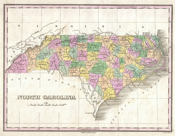
North Carolina
sold
- Digital Map Information
- Suitable for large format printing
- DPI: 300
- File Size: 3.01 MB
- File Type: ZIP / TIFF
- ICC color profile embedded
- Delivered instantly via download link
A beautiful example of Finley's important 1827 map of North Carolina. This rare map plate configuration depicts the state individually rather than bundled with South Carolina - as is more common. Depicts the state with moderate detail in Finley's ... (more details)
One of the first obtainable maps of Missouri.

Missouri.
sold
- Digital Map Information
- Suitable for large format printing
- DPI: 300
- File Size: 3.02 MB
- File Type: ZIP / TIFF
- ICC color profile embedded
- Delivered instantly via download link
A beautiful example of Finley's important 1827 map of Missouri shortly following statehood. This is one of the earliest obtainable maps of the State of Missouri. Depicts a very early county configuration with most of the population attached to ... (more details)
Unusal configuration of pre-Republic Texas.
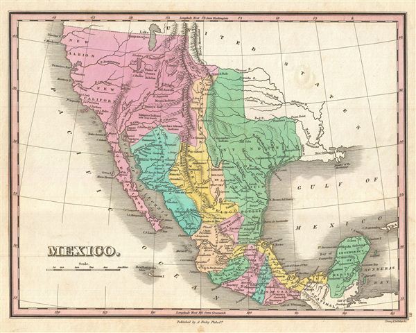
Mexico.
sold
- Digital Map Information
- Suitable for large format printing
- DPI: 300
- File Size: 3.5 MB
- File Type: ZIP / TIFF
- ICC color profile embedded
- Delivered instantly via download link
A scarce and important 1827 map of Mexico by Anthony Finley. Covers from upper California and New Albion south to Guatemala, including the modern day regions of California, New Mexico, Arizona, Colorado, Utah, Nevada, Texas and Mexico. Offers ... (more details)
Scarce imaginative 1650 plan of Jerusalem.
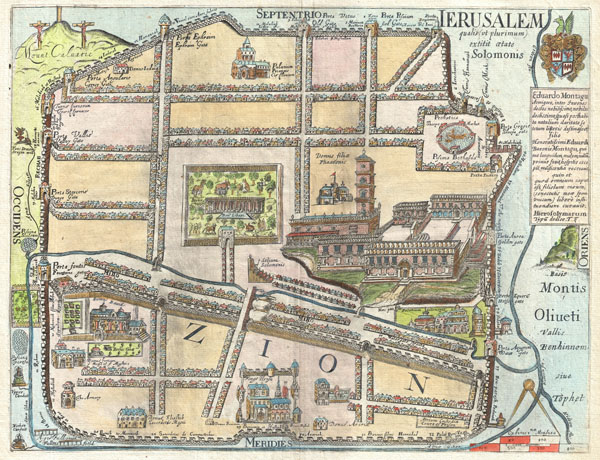
IERUSALEM qualis (ut plurimum) extitit ætate Solomonis
sold
- Digital Map Information
- Suitable for large format printing
- DPI: 300
- File Size: 7.23 MB
- File Type: ZIP / TIFF
- ICC color profile embedded
- Delivered instantly via download link
An extremely rare and altogether fascinating 1650 map of Jerusalem by Thomas Fuller. Depicts the old walled city of Jerusalem during the reign of the Biblical King Solomon, ca. 961-922 BC. On the whole this is a highly imaginative map of the ... (more details)

Egypt.
sold
- Digital Map Information
- Suitable for large format printing
- DPI: 300
- File Size: 19.14 MB
- File Type: ZIP / TIFF
- ICC color profile embedded
- Delivered instantly via download link
Pinkerton's extraordinary 1818 map of Egypt. Covers the region centered on the Nile River from its delta along the Mediterranean south to the Island of Philae and the city of Aswan. Notes numerous cities and villages along the river as well ... (more details)

Europe.
sold
- Digital Map Information
- Suitable for large format printing
- DPI: 300
- File Size: 25.06 MB
- File Type: ZIP / TIFF
- ICC color profile embedded
- Delivered instantly via download link
Pinkerton's extraordinary 1818 map of Europe. Covers Europe at the beginning of the 19th century. Offers considerable detail with political divisions and color coding at the regional level. Identifies cities, towns, castles, swamps, ... (more details)

Turkey in Europe.
sold
- Digital Map Information
- Suitable for large format printing
- Full resolution TIFF file
- ICC color profile embedded
- Delivered instantly via download link
Pinkerton's extraordinary 1818 map of the Turkey in Europe. Covers the Ottoman Empire's holdings in Europe at the beginning of the 19th century. Includes Greece, Albania, Macedonia, Bosnia, Croatia, Bulgaria, Rumania, and Moldova. ... (more details)

Austrian Dominions.
sold
- Digital Map Information
- Suitable for large format printing
- DPI: 300
- File Size: 25.44 MB
- File Type: ZIP / TIFF
- ICC color profile embedded
- Delivered instantly via download link
Pinkerton's extraordinary 1818 map of the Austrian Dominions. Covers the Austro-Hungarian Empire at the height of its influence. Includes Bohemia, Tyrol, Austria, Croatia, Sclavonia, Hungary, Transylvania, and parts of Poland. ... (more details)

Russia in Europe.
sold
- Digital Map Information
- Suitable for large format printing
- DPI: 300
- File Size: 22.25 MB
- File Type: ZIP / TIFF
- ICC color profile embedded
- Delivered instantly via download link
Pinkerton's extraordinary 1818 map of Russia in Europe. Covers the European portions of Russia between Prussia and the Ural Mountains. Extends north to the Arctic and south as far as the Crimea and Black Sea. Offers ... (more details)

France.
sold
- Digital Map Information
- Suitable for large format printing
- Full resolution TIFF file
- ICC color profile embedded
- Delivered instantly via download link
Pinkerton's extraordinary 1818 map of France. Covers the entire country from the Bay of Biscay to the English Channel to the Mediterranean, to the borders with Switzerland and Germany. Drawn shortly after the ... (more details)

Holland.
sold
- Digital Map Information
- Suitable for large format printing
- DPI: 300
- File Size: 17.53 MB
- File Type: ZIP / TIFF
- ICC color profile embedded
- Delivered instantly via download link
Pinkerton's extraordinary 1818 map of Holland. Covers what is essentially today's Netherlands between the Belgium and Germany. Offers excellent undersea detail regarding various shoals and other dangers, ... (more details)

Portugal.
sold
- Digital Map Information
- Suitable for large format printing
- DPI: 300
- File Size: 18.31 MB
- File Type: ZIP / TIFF
- ICC color profile embedded
- Delivered instantly via download link
Pinkerton's extraordinary 1818 map of the Portugal. Covers from the entire nation of Portugal as well as parts of the adjacent Spanish provinces of Galicia, Leon, Estremadura and Andalucía. Offers ... (more details)

Germany South of the Mayn.
sold
- Digital Map Information
- Suitable for large format printing
- DPI: 300
- File Size: 23.1 MB
- File Type: ZIP / TIFF
- ICC color profile embedded
- Delivered instantly via download link
Pinkerton's extraordinary 1818 map of the southwestern part of Germany. Covers from the from Frankfort south to Lake Constance and east to Bishop. Includes the provinces of Swabia, Bavaria, and ... (more details)