
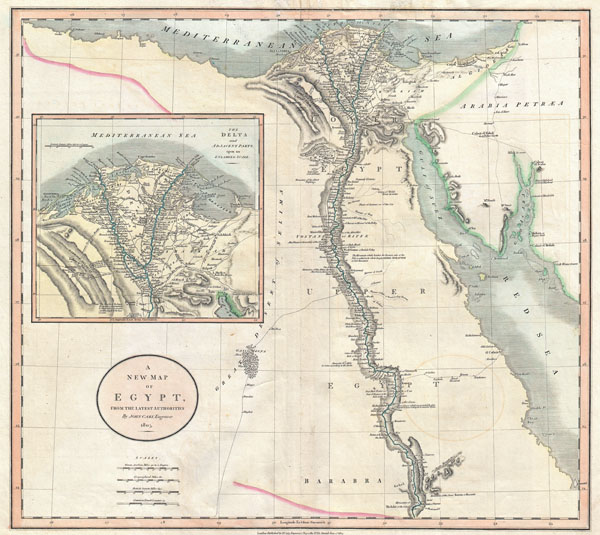
A New Map of Egypt, from the Latest Authorities.
sold
- Digital Map Information
- Suitable for large format printing
- DPI: 300
- File Size: 3.04 MB
- File Type: ZIP / TIFF
- ICC color profile embedded
- Delivered instantly via download link
An exceptionally beautiful example of John Cary's important 1805 Map of the Egypt. Covers Egypt in extraordinary detail focusing on the course of the Nile River Valley from the Delta region south to Aswan. Notes the sites of numerous riverside villages and cities ... (more details)
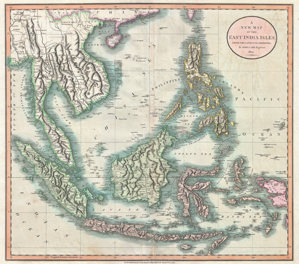
A New Map of the East India Isles, from the Latest Authorities.
sold
- Digital Map Information
- Suitable for large format printing
- DPI: 300
- File Size: 60.54 MB
- File Type: ZIP / TIFF
- ICC color profile embedded
- Delivered instantly via download link
An exceptionally beautiful example of John Cary's important 1801 Map of the East Indies. Covers all of Southeast Asia and the Malay Peninsula, including Singapore, as well as the Philippines, Borneo, Sumatra, java, the Celebes, and parts of Papua New Guinea. One ... (more details)

A New Map of Piedmont, the Duchies of Savoy and Milan; and the Republic of Genoa; with their Subdivisions.
sold
- Digital Map Information
- Suitable for large format printing
- DPI: 300
- File Size: 18.33 MB
- File Type: ZIP / TIFF
- ICC color profile embedded
- Delivered instantly via download link
An exceptional example of John Cary's important 1799 map of Piedmont. Extends from Lake Geneva in the north southward as far as Nice and eastward as far as Parma, Italy. Predates the Italian solidarity movement of the mid 19th century. Includes the old Italian ... (more details)
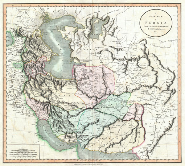
A New Map of Persia, from the Latest Authorities.
sold
- Digital Map Information
- Suitable for large format printing
- DPI: 300
- File Size: 15.86 MB
- File Type: ZIP / TIFF
- ICC color profile embedded
- Delivered instantly via download link
An exceptional example of John Cary's important 1801 map of Persia. Extending from the Black Sea coast eastward as far as Kabul and southward as far south as the Persian Gulf, this map encompasses modern day Iraq, Iran, and Afghanistan, the seat of the current ... (more details)
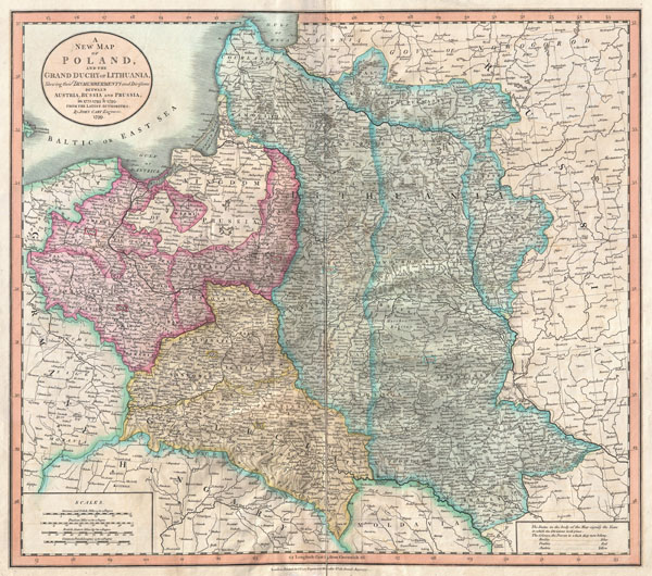
A New Map of Poland and the Grand Duchy of Lithuania, Shewing their Dismemberments and Divisions between Austria, Russia and Prussia in 1772, 1793, & 1795.
sold
- Digital Map Information
- Suitable for large format printing
- DPI: 300
- File Size: 16.14 MB
- File Type: ZIP / TIFF
- ICC color profile embedded
- Delivered instantly via download link
A nice example of John Cary's rare 1799 map of Poland. Covers the entire block of territory claimed by the Polish-Lithuanian Commonwealth (Rzeczpospolita) from the Baltic Sea south to Hungary and eastward as far as Russia. This map is designed to illustrate ... (more details)
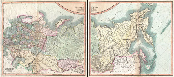
A New Map of the Russian Empire, Divided into its Governments; from the Latest Authorities.
sold
- Digital Map Information
- Suitable for large format printing
- DPI: 300
- File Size: 33.31 MB
- File Type: ZIP / TIFF
- ICC color profile embedded
- Delivered instantly via download link
An excellent example of John Cary's extremely rare two part 1799 Map of the Russian Empire. This is considered one of the first accurate maps of the Russian Empire. Covers from the Baltic Sea to the Aleutians Islands with extraordinary attention to detail ... (more details)

A New Map of the West India Isles.
sold
- Digital Map Information
- Suitable for large format printing
- DPI: 300
- File Size: 15.84 MB
- File Type: ZIP / TIFF
- ICC color profile embedded
- Delivered instantly via download link
A beautiful example of John Cary's important 1803 map of Florida, Central America and the West Indies. Covers from Texas (called Cenis) eastward to the Carolinas and the Bahamas, and then southward past Florida and the West Indies to include all of Central ... (more details)
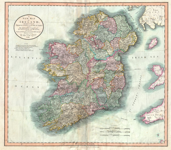
A New Map of Ireland, Divided into its Provinces and Counties: Also, The Opposite Coasts of Scotland and Wales; shewing the several Ports form whence the Packets depart for Ireland.
sold
- Digital Map Information
- Suitable for large format printing
- DPI: 300
- File Size: 8.57 MB
- File Type: ZIP / TIFF
- ICC color profile embedded
- Delivered instantly via download link
John Cary's wonderful 1799 Map of the Ireland. Depicts the Emerald Isle in considerable detail with color coding at the county and province level. Also includes parts of nearby Scotland and Wales. Figures above many of the town names denote distance ... (more details)
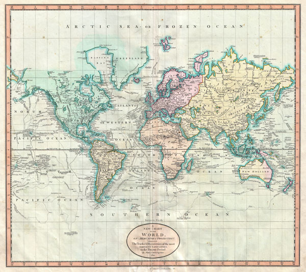
A New Chart of the World, on Mercator's Projection: Exhibiting the Track & Discoveries of themost Eminent Navigators, to the Present Period.
sold
- Digital Map Information
- Suitable for large format printing
- DPI: 300
- File Size: 16.93 MB
- File Type: ZIP / TIFF
- ICC color profile embedded
- Delivered instantly via download link
John Cary's wonderful 1801 Map of the World on Mercator's Projection. Details the entire world as it was known at the turn of the 19th century. Displays the continents in considerable detail but offers only minimal information in the Arctic and ... (more details)
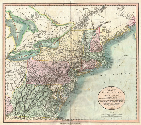
A New Map of Part of the United States of North America, Containing those of New York, Vermont, New Hampshire, Massachusets, Connecticut, Rhode Island, Pennsylvania, New Jersey, Delaware, Maryland and Virginia.
sold
- Digital Map Information
- Suitable for large format printing
- DPI: 300
- File Size: 16.49 MB
- File Type: ZIP / TIFF
- ICC color profile embedded
- Delivered instantly via download link
Published by John Cary in 1806, this is one of the most interesting atlas maps of the northeastern parts of the United States to appear in the early 19th century. Covers from Lake Huron southward as far as Virginia and North Carolina and ... (more details)
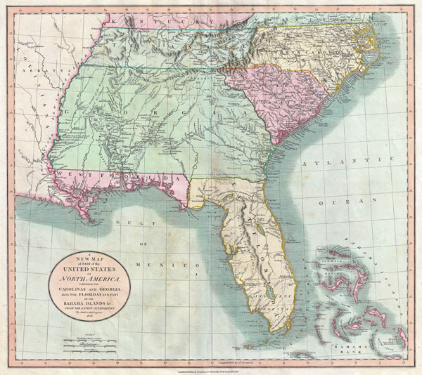
A New Map of Part of the United States of North America, Containing the Carolinas and Georgia, also the Floridas and Part of the Bahama Islands etc.
sold
- Digital Map Information
- Suitable for large format printing
- DPI: 300
- File Size: 17.51 MB
- File Type: ZIP / TIFF
- ICC color profile embedded
- Delivered instantly via download link
Published by John Cary in 1805, this is one of the most interesting and attractive maps of the American southeast to appear in the first years of the 19th century. Covers from Kentucky and Virginia South include all of modern day North ... (more details)
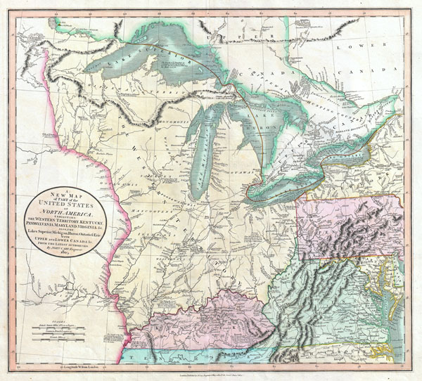
A New Map of Part of the United States of North America, exhibiting The Western Territory, Kentucky, Pennsylvania, Maryland, Virginia & C. Also, the Lakes Superior, Michigan, Huron, Ontario & Erie; with Upper and Lower Canada & C. From the Latest Authorities.
sold
- Digital Map Information
- Suitable for large format printing
- DPI: 300
- File Size: 16.69 MB
- File Type: ZIP / TIFF
- ICC color profile embedded
- Delivered instantly via download link
Published by John Cary in 1805, this is one of the most interesting and attractive maps of the American Frontier and the Great Lakes to emerge in the first years of the 19th century. Covers from Lakes Superior south along the ... (more details)
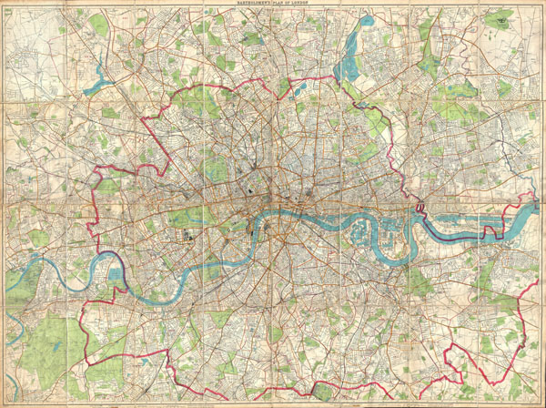
London Fire Brigade Instructional Map. / Bartholomew's Plan of London.
sold
- Digital Map Information
- Suitable for large format printing
- File Size: 116.3 MB
- File Type: ZIP / TIFF
- ICC color profile embedded
- Delivered instantly via download link
An enormously proportioned and extremely unusual map of London, England prepared by John Bartholomew. Covers the entire city of London from Kenton in the northwest, to Richmond Park in the southwest, to Hospital Hill in the ... (more details)
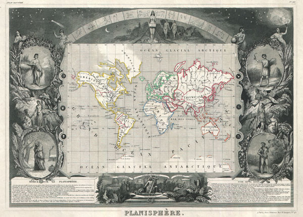
Planisphere.
sold
- Digital Map Information
- Suitable for large format printing
- DPI: 300
- File Size: 10.39 MB
- File Type: ZIP / TIFF
- ICC color profile embedded
- Delivered instantly via download link
This is a rare 1847 map of the world by French map publisher Victor Levasseur. Probably Levassuer's most sought after atlas map. Depicts the world on a Mercator projection with continents and some countries defined with ... (more details)
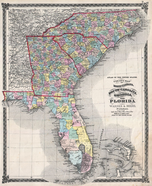
County Map of North Carolina, South Carolina, Georgia and Florida.
sold
- Digital Map Information
- Suitable for large format printing
- File Size: 14.15 MB
- File Type: ZIP / TIFF
- ICC color profile embedded
- Delivered instantly via download link
An attractive hand colored 1874 map of the southeastern part of the United States by Warner and Beers. Includes the states of North Carolina, South Carolina, Georgia and Florida. Also includes part of the Bahamas. ... (more details)

Pianta della Citta di Firenze.
sold
- Digital Map Information
- Suitable for large format printing
- DPI: 300
- File Size: 24.13 MB
- File Type: ZIP / TIFF
- ICC color profile embedded
- Delivered instantly via download link
A rare and extraordinary 1847 map of Firenze or Florence, Italy by Giuseppe Molini. This magnificently engraved map was originally drawn in 1731 by the Florentine architect Ferdinando Ruggieri. Oriented to the ... (more details)
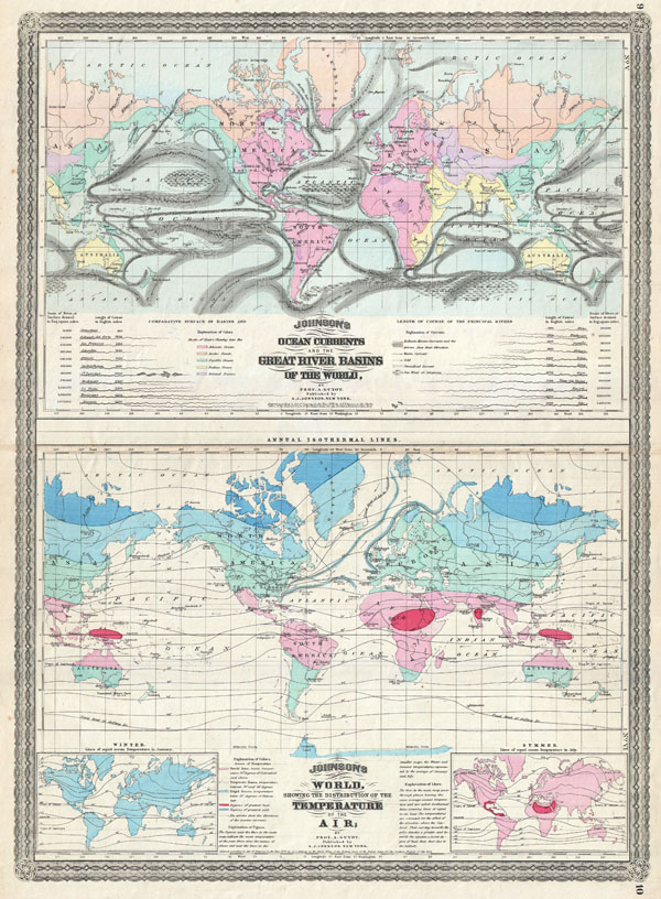
Johnson's Ocean Currents and the Great River Basins of the World, by Prof A. Guyot. / Johnson's World showing the Distribution of the Temperature of the Air; by Prof A. Guyot.
sold
- Digital Map Information
- Suitable for large format printing
- File Size: 17.88 MB
- File Type: ZIP / TIFF
- ICC color profile embedded
- Delivered instantly via download link
This is A. J. Johnson 1870 thematic map of the world illustrating Currents, River Basins, and Air Temperature. Combines two maps, both based upon the work of Geologist A. Guyot, on a single folio sheet. The ... (more details)

Johnson's Sweden and Norway. / Johnson's Denmark with Sleswick & Holstein.
sold
- Digital Map Information
- Suitable for large format printing
- File Size: 16.95 MB
- File Type: ZIP / TIFF
- ICC color profile embedded
- Delivered instantly via download link
This is A. J. Johnson 1870 map of Sweden, Norway and Denmark. This is actually a composite on a single folio sheet of two maps formerly issued on separate sheets. Depicts the area in considerable detail with ... (more details)
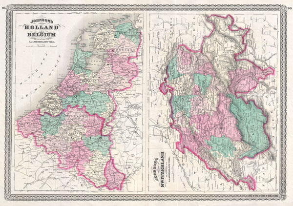
Johnson's Switzerland. / Johnson's Holland and Belgium.
$100.00
Acquire
- Digital Map Information
- Suitable for large format printing
- File Size: 16.09 MB
- File Type: ZIP / TIFF
- ICC color profile embedded
- Delivered instantly via download link
This is A. J. Johnson 1870 map of Switzerland, Holland (The Netherlands) and Belgium. This is actually a composite on a single folio sheet of two maps formerly issued on separate sheets. Depicts the area in ... (more details)

Johnson's New Jersey. / Johnson's Delaware and Maryland.
sold
- Digital Map Information
- Suitable for large format printing
- File Size: 18.95 MB
- File Type: ZIP / TIFF
- ICC color profile embedded
- Delivered instantly via download link
This is A. J. Johnson 1870 map of New Jersey, Delaware and Maryland. This is actually a composite on a single folio sheet of two maps formerly issued on separate sheets. Depicts the area in considerable ... (more details)