

Johnson's New Brunswick and Quebec, The Dominion of Canada.
sold
- Digital Map Information
- Suitable for large format printing
- File Size: 18.71 MB
- File Type: ZIP / TIFF
- ICC color profile embedded
- Delivered instantly via download link
This is A. J. Johnson 1870 map of Quebec and New Brunswick, Canada. Depicts the area in considerable detail with color coding according to county and district. Features the spirograph style border common to Johnson's atlas work in 1870. Steel plate engraving ... (more details)

Johnson's Turkey in Asia. / Johnson's Persia, Arabia, Beloochistan and Afghanistan.
sold
- Digital Map Information
- Suitable for large format printing
- File Size: 16.62 MB
- File Type: ZIP / TIFF
- ICC color profile embedded
- Delivered instantly via download link
This is A. J. Johnson 1870 map of what is today considered the Middle East. Divided into two maps on a single sheet and based upon earlier separate Johnson maps. The upper map focuses on Turkey and the territories claimed by the Ottoman Empire. Includes ... (more details)
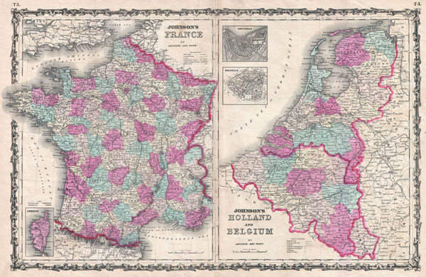
Johnson's France. / Johnson's Holland and Belgium.
$100.00
Acquire
- Digital Map Information
- Suitable for large format printing
- File Size: 18.75 MB
- File Type: ZIP / TIFF
- ICC color profile embedded
- Delivered instantly via download link
This is A. J. Johnson and Ward's 1862 map of France, Holland (The Netherlands) and Belgium. Divided into two separate maps. The left hand map focuses on France and is color coded according to department. An inset map in the lower left depicts the island ... (more details)
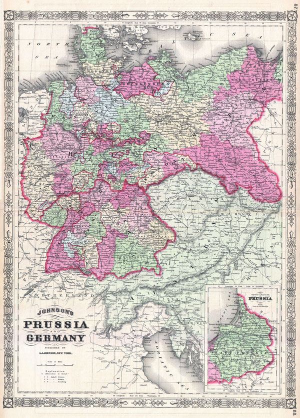
Johnson's Prussia and Germany.
sold
- Digital Map Information
- Suitable for large format printing
- File Size: 16.77 MB
- File Type: ZIP / TIFF
- ICC color profile embedded
- Delivered instantly via download link
This is A. J. Johnson and Ward's 1866 map of Prussia and Germany. Covers the region in considerable detail with color coding according to districts. Also includes much of Austria. An inset in the lower left quadrant details northeastern Prussia or ... (more details)

Johnson's Asia.
sold
- Digital Map Information
- Suitable for large format printing
- File Size: 19.73 MB
- File Type: ZIP / TIFF
- ICC color profile embedded
- Delivered instantly via download link
This is A. J. Johnson and Ward's 1867 map of Asia. Covers the continent in considerable detail with regional color coding. Includes parts of Africa, Europe and Polynesia. In 1867 Johnson did a major re-engraving of many of his maps, including this ... (more details)

Johnson's Austria, Turkey in Europe and Greece.
sold
- Digital Map Information
- Suitable for large format printing
- File Size: 21 MB
- File Type: ZIP / TIFF
- ICC color profile embedded
- Delivered instantly via download link
This is A. J. Johnson and Ward's 1863 map of Austria, Turkey in Europe and Greece. Covers from Italy eastward to include all of Austria, Hungary, the Balkans (Bosnia, Serbia, Albania, Croatia, Macedonia, Bulgaria, Rumania, etc.), Greece and parts of ... (more details)

Johnson's England and Wales.
sold
- Digital Map Information
- Suitable for large format printing
- File Size: 22.67 MB
- File Type: ZIP / TIFF
- ICC color profile embedded
- Delivered instantly via download link
This is A. J. Johnson and Ward's 1862 map of England and Wales. Covers both England and Wales in considerable detail with color coding at the county level. Shows major roadways, cities, rivers, trains and ferry crossings. Upper right hand quadrant ... (more details)

Johnson's Pennsylvania and New Jersey.
sold
- Digital Map Information
- Suitable for large format printing
- File Size: 18.32 MB
- File Type: ZIP / TIFF
- ICC color profile embedded
- Delivered instantly via download link
This is a beautiful example of A. J. Johnson's 1866 map of Pennsylvania and New Jersey. This rare map offers a fascinating snapshot of these union states shortly following the close of the American Civil War. Map shows both states in full with ... (more details)

Coast Chart No. 109, Boston Bay and Approaches. / Coast Charts 109 & 110, Massachusetts Bay with the Coast from Cape Ann to Cape Cod.
sold
- Digital Map Information
- Suitable for large format printing
- File Size: 46.59 MB
- File Type: ZIP / TIFF
- ICC color profile embedded
- Delivered instantly via download link
A rare 1877 coastal chart of Boston Bay, Boston Harbor, and environs. Covers the Massachusetts coastline from Cape Ann southward past Gloucester, Marblehead, Lynn, Boston and Cohasset to Green Harbor River. Offers astounding inland detail ... (more details)
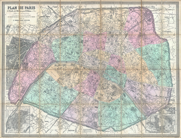
Plan de Paris a l'Echelle de 2 Millim, pour 25 Metres, Indiquant les Nouveaux percements et les changements de noms de Voies publiques avec plans supplementaires pour Les Bois de Boulogne et de Vincennes.
sold
- Digital Map Information
- Suitable for large format printing
- File Size: 101.2 MB
- File Type: ZIP / TIFF
- ICC color profile embedded
- Delivered instantly via download link
A stunningly executed 1882 large format folding pocket map of Paris, France by E. Andriveau-Goujon. Focuses on the old walled center of Paris from Neuilly in the northwest to Pantin in the northeast, Issy in the southwest, and Ivry in ... (more details)
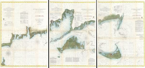
Preliminary Coast Charts Nos. 12, 13 & 14. Coast of the United States Monomoy and Nantucket Shoals to Block Island. / No. 14 From Entrace to Buzzard's Bay Mass. to Block Island Sound R.I. / No. 13 From Muskeget Channel to Buzzard's Bay and Engrance to Vineyard Sound Mass. / No. 12 From Monomoy and Nantucket Shoals to Muskeget Channel Mass.
sold
- Digital Map Information
- Suitable for large format printing
- File Size: 79.9 MB
- File Type: ZIP / TIFF
- ICC color profile embedded
- Delivered instantly via download link
A scarce and extraordinary 1860 set of three large format nautical charts covering from Block Island and Buzzard Bay eastward to include all of Martha's Vineyard (Marthas Vineyard) and Nantucket. This map set consists of three separate ... (more details)

Coast Chart No. 21, New York Bay and Harbor, New York
sold
- Digital Map Information
- Suitable for large format printing
- File Size: 12.89 MB
- File Type: ZIP / TIFF
- ICC color profile embedded
- Delivered instantly via download link
A rare 1861 costal chart of New York City, it's harbor, and environs. One of the first 19th century carts to depicts New York City as we know it today, including Manhattan, Queens, Brooklyn, the Bronx and Staten Island. Also includes ... (more details)

Upper Part of San Francisco Bay, California.
sold
- Digital Map Information
- Suitable for large format printing
- File Size: 9.88 MB
- File Type: ZIP / TIFF
- ICC color profile embedded
- Delivered instantly via download link
This is an attractive 1863 U.S. Coast Survey chart or nautical map or the southern part of San Francisco Bay, California. Covers from Alviso and Redwood city northward as far as Point Avisadera. Includes Union City, Johnson's ... (more details)

Le Grand Throne Imperial.
sold
- Digital Map Information
- Suitable for large format printing
- DPI: 300
- File Size: 3.98 MB
- File Type: ZIP / TIFF
- ICC color profile embedded
- Delivered instantly via download link
This is a rare 1756 view of the Grand Throne Room of the Imperial Forbidden City, Beijing China. The Grand Throne Imperial is beautifully rendered complete with tiny court functionaries scurrying about. Prepared by N. Bellin ... (more details)
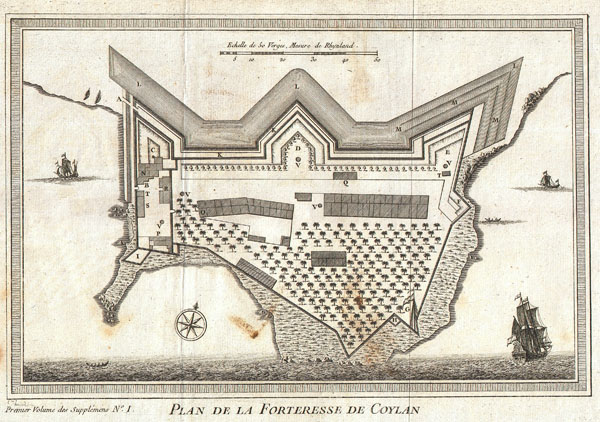
Plan de la Forteresse de Coylan.
sold
- Digital Map Information
- Suitable for large format printing
- DPI: 300
- File Size: 3.58 MB
- File Type: ZIP / TIFF
- ICC color profile embedded
- Delivered instantly via download link
This is a rare 1756 map of the fort of Kollam, Kerala, on India's Malabar Coast by French cartographer N. Bellin. Kollam, or as it is otherwise Known Quilon or Coylan, lies roughly 71 km north of Trivandrum, India. Kollam ... (more details)

A View of the Entrance of the Port of Acapulco.
sold
- Digital Map Information
- Suitable for large format printing
- DPI: 300
- File Size: 7.24 MB
- File Type: ZIP / TIFF
- ICC color profile embedded
- Delivered instantly via download link
An extremely attractive 1745 view of the Mexican port city of Zihuatanejo by George Anson. This view details the starting point on the trans-Atlantic trade route long dominated by the Spanish in Mexico. Spanish Galleons ... (more details)

A Plan of the Harbour of Chequetan or Seguataneo Lying in the Lat.d of 17 d. 36 m. No.
sold
- Digital Map Information
- Suitable for large format printing
- DPI: 300
- File Size: 7.68 MB
- File Type: ZIP / TIFF
- ICC color profile embedded
- Delivered instantly via download link
An extremely attractive 1745 map of the Mexican harbor of Zihuatanejo by George Anson. Today Zihuatanejo is a stunningly beautiful resort area in Guerrero, Mexico, about 250 km north of Acapulco. This area was originally ... (more details)

Sketch G Showing the Progress of the Survey in Section VII From 1849 to 1853.
sold
- Digital Map Information
- Suitable for large format printing
- DPI: 300
- File Size: 7.52 MB
- File Type: ZIP / TIFF
- ICC color profile embedded
- Delivered instantly via download link
This is an attractive 1852 U.S. Coast Survey triangulation chart of the coast of Florida. Covers from Perdido Bay eastward past Pensacola Bay and Santa Rosa Bay so St. Marks and Appalachie Bay. Shows the city of ... (more details)
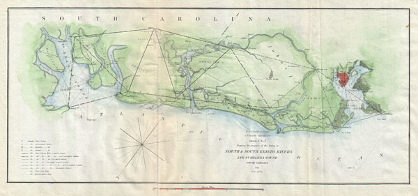
Sketch E. No. 3 Shewing the progress of the Survey at North & South Edisto Rivers and St. Helena Sound, South Carolina.
sold
- Digital Map Information
- Suitable for large format printing
- DPI: 300
- File Size: 5.44 MB
- File Type: ZIP / TIFF
- ICC color profile embedded
- Delivered instantly via download link
This is an attractive 1852 U.S. Coast Survey triangulation chart of the Coast of South Carolina between St. Helena's Sound and Charleston. Focuses on the inlets and waterways on John's Island, James Island, ... (more details)
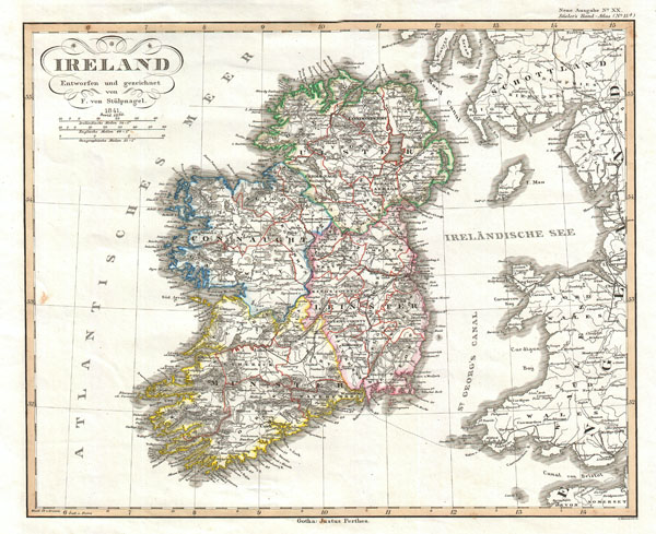
Ireland Entworfen und gezeichnet von F. von Stulpnagel.
sold
- Digital Map Information
- Suitable for large format printing
- DPI: 300
- File Size: 6.7 MB
- File Type: ZIP / TIFF
- ICC color profile embedded
- Delivered instantly via download link
This is a fine early example of Justus Perthes' Map of Ireland. Shows the island divided into four districts: Ulster, Connaught, Leister and Munster. Shows roads, railroads, local political divisions and ... (more details)