
Two sided map of Sag Harbor and East Hampton, New York.

Sag Harbor, Suffolk Co. / East Hampton, Suffolk Co. L.I.
sold
- Digital Map Information
- Suitable for large format printing
- File Size: 19.28 MB
- File Type: ZIP / TIFF
- ICC color profile embedded
- Delivered instantly via download link
A scarce example of Fredrick W. Beers' map of the Sag Harbor and East Hampton, Long Island, New York. Published in 1873, this map is printed on both sides. On the Sag Harbor Side, this magnificent map covers the town of Sag Harbor in considerable detail from the ... (more details)
Early map of Southold and Shelter Island, New York.

Southold and Shelter Island Suffolk Co. L.I.
sold
- Digital Map Information
- Suitable for large format printing
- File Size: 9.81 MB
- File Type: ZIP / TIFF
- ICC color profile embedded
- Delivered instantly via download link
A rare example of Fredrick W. Beers' Map of Southold and Shelter Island, Long Island, New York. Published in 1873, this magnificent map covers from Franklinville and Mattituck Hills eastward past Cutchogue harbor, Peconic Village, Great Hog Neck Southold, ... (more details)
Detailed plan of Manhattan and the Bronx.
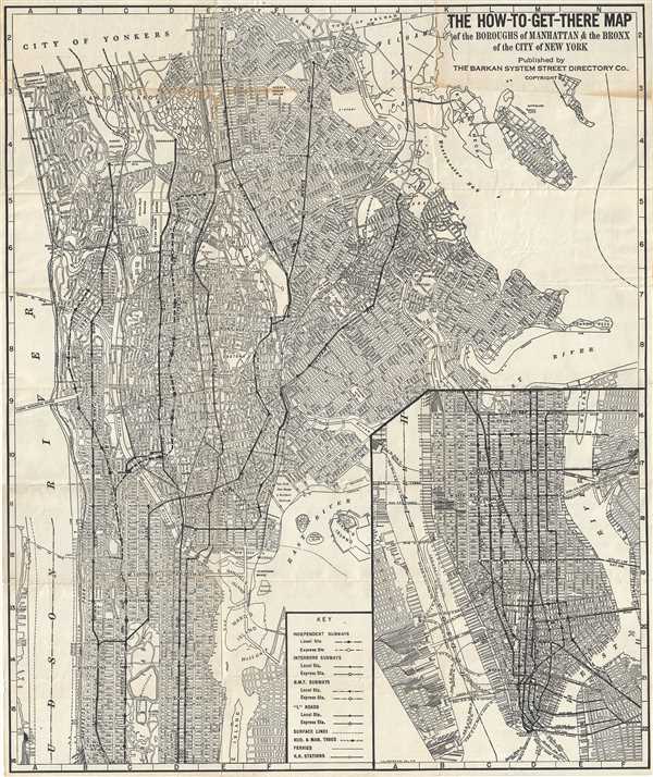
How-To-Get-There Map of the Boroughs of Manhattan and the Bronx of the City of New York.
sold
- Digital Map Information
- Suitable for large format printing
- Full resolution TIFF file
- ICC color profile embedded
- Delivered instantly via download link
This is an excellent map of New York City by the Barkan System Street Directory Company in 1946. The map covers the boroughs of Manhattan and the Bronx in extraordinary detail. In Manhattan, it covers from what is today Inwood Hill Park south to Battery ... (more details)
A set of two maps depicting Ireland during the early 19th century.
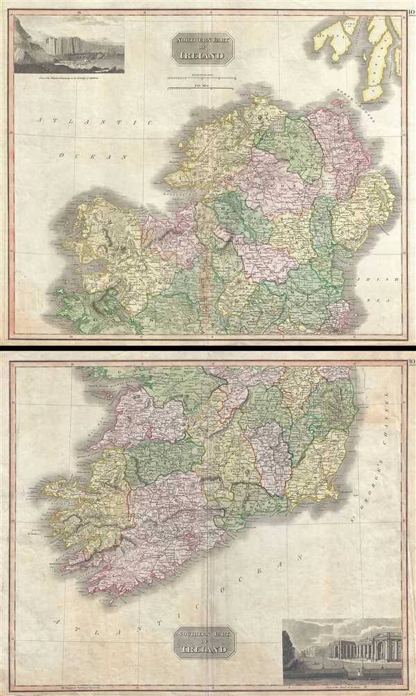
Northern Part of Ireland. Southern Part of Ireland.
sold
- Digital Map Information
- Suitable for large format printing
- DPI: 300
- File Size: 37.75 MB
- File Type: ZIP / TIFF
- ICC color profile embedded
- Delivered instantly via download link
This is an attractive set of the 1817 maps of Ireland by John Thomson. Essentially two separate maps, the first map (image top) depicts Northern Ireland while the lower map depicts the Southern portions of Ireland. The whole is beautifully engraved in ... (more details)
Thomson's map of South America depicting Lake Parima, supposed site of Eldorado.

South America.
sold
- Digital Map Information
- Suitable for large format printing
- DPI: 300
- File Size: 15.36 MB
- File Type: ZIP / TIFF
- ICC color profile embedded
- Delivered instantly via download link
This is John Thomson's fascinating 1817 map of South America. Covering the entire continent from the Caribbean Sea to Tierra del Fuego and the South Georgia Islands, this map reveals the continent on the cusp of its half-century struggle for ... (more details)
Early map of Scandinavia showing Finland as part of Sweden.

Scandinavia, or Sweden, Denmark and Norway.
sold
- Digital Map Information
- Suitable for large format printing
- DPI: 300
- File Size: 16.85 MB
- File Type: ZIP / TIFF
- ICC color profile embedded
- Delivered instantly via download link
This fascinating hand colored 1817 map depicts Sweden, Denmark, and Norway. Modern day Finland, though included, was then part of the Kingdom of Sweden. Relief is shown by hachure with towns, cities, and major topographical features ... (more details)
One of the largest and most impressive 19th century maps of Long Island.

Map of Long Island.
sold
- Digital Map Information
- Suitable for large format printing
- File Size: 7.51 MB
- File Type: ZIP / TIFF
- ICC color profile embedded
- Delivered instantly via download link
A first edition, first issue, of one of the largest and most impressive maps of Long Island, New York to appear in the 19th century. Published in 1873, this magnificent map covers the whole of Long Island as well as parts of ... (more details)
Beautiful view of Germany depicting the Franco-Prussian Theater of War.
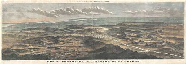
Vue Panoramique du Theatre de la Guerre Le spectateur se suppose place a 64 kilometers au-dessus de Paris, ayant la Suisse a droite, la Belgique a gauche, et Berlin en face.
sold
- Digital Map Information
- Suitable for large format printing
- Full resolution TIFF file
- ICC color profile embedded
- Delivered instantly via download link
This is a beautiful bird’s eye view map of Germany, Belgium and Switzerland appearing in the 1870 issue of Monde Illustre. This magnificent panoramic view illustrates the Theater of War and depicts the region as seen from ... (more details)
Scarce map of Shanghai with view of the Bund.

The New Map of Shanghai. /上海最新地圖 / Shànghǎi zuìxīn dìtú.
sold
- Digital Map Information
- Suitable for large format printing
- File Size: 23.45 MB
- File Type: ZIP / TIFF
- ICC color profile embedded
- Delivered instantly via download link
This is a scarce 1930s World War II era Japanese bi-lingual map of Shanghai, China. Centered on the Whangpoo River, it covers Shanghai in great detail and offers exceptional details regarding topographical elements. Notes ... (more details)
Beautiful map of Brooklyn presented on a north-south projection.
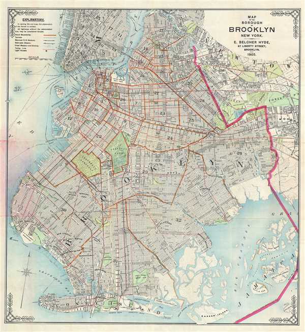
Map of the Borough of Brooklyn New York.
sold
This is an excellent 1905 E. Belcher Hyde map or plan of the borough of Brooklyn, New York. It covers Brooklyn from Jamaica to Bay Ridge and north as far as the Newtown Creek. Includes part of lower Manhattan and Queens. ... (more details)
Historical map detailing the boundaries of the northwestern Texas.
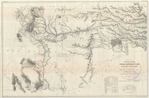
Map of the United States and Texas Boundary Line and Adjacent Territory.
sold
- Digital Map Information
- Suitable for large format printing
- Full resolution TIFF file
- ICC color profile embedded
- Delivered instantly via download link
This is a scarce map issued by the United States General Printing Office detailing of the northwest boundary of Texas. This map, published in 1902, is based upon the original 1858 -1860 surveys, and was not published at ... (more details)
Thomson's map of China featuring the course of the Macartney Embassy.
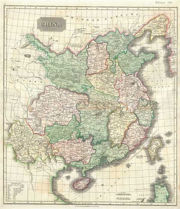
China.
sold
- Digital Map Information
- Suitable for large format printing
- DPI: 300
- File Size: 16.89 MB
- File Type: ZIP / TIFF
- ICC color profile embedded
- Delivered instantly via download link
This fascinating hand colored 1817 Thomson map depicts China with its provinces. Interestingly, the map shows the course of the British 'Macartney Embassy' or 'Mission' of 1793. Escorted by the Royal Navy gunship ... (more details)
Large hand colored map of southern Italy or the Kingdom of the Two Sicilies.

Naples and Sicily.
sold
- Digital Map Information
- Suitable for large format printing
- DPI: 300
- File Size: 17.58 MB
- File Type: ZIP / TIFF
- ICC color profile embedded
- Delivered instantly via download link
This fascinating hand colored 1817 map by Edinburgh cartographer John Thomson depicts southern Italy. It covers from Rome south to the island of Sicily depicting the Kingdom of Naples (a common reference for the ... (more details)
Early 18th century map of Persia and Afghanistan.
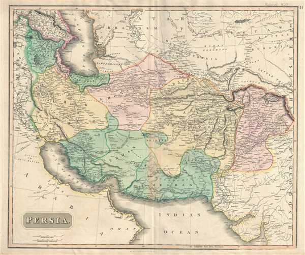
Persia.
sold
- Digital Map Information
- Suitable for large format printing
- DPI: 300
- File Size: 18.03 MB
- File Type: ZIP / TIFF
- ICC color profile embedded
- Delivered instantly via download link
This is a beautiful map of Persia and Afghanistan by Edinburgh cartographer John Thomson dating to 1817. It covers the region during a time it was controlled by the powerful Qajar Dynasty of Shahs. Extends from ... (more details)
A set of two maps depicting India and Nepal.
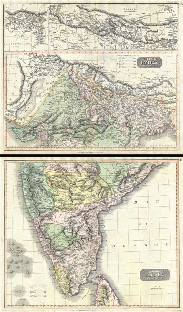
British India, Northern Part. British India, Southern Part.
sold
- Digital Map Information
- Suitable for large format printing
- DPI: 300
- File Size: 37.42 MB
- File Type: ZIP / TIFF
- ICC color profile embedded
- Delivered instantly via download link
This is a fascinating hand colored set of the 1817 maps by Edinburgh cartographer John Thomson depicting India and Nepal. Essentially two separate maps, the first map (image top) depicts northern India and Nepal ... (more details)
One of the rare maps of India to feature maps of the Ganges River.
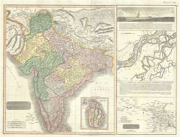
Hindoostan.
sold
- Digital Map Information
- Suitable for large format printing
- DPI: 300
- File Size: 17.79 MB
- File Type: ZIP / TIFF
- ICC color profile embedded
- Delivered instantly via download link
This is the 1817 John Thomson map of India with inset maps of the Ganges River. This magnificent map is the rarest of the Thomson India series, appearing only in the first edition of his atlas. This is one of the finest atlas maps of this region to appear in the early 19th century. (more details)
Rare Japanese woodblock map of Beijing.
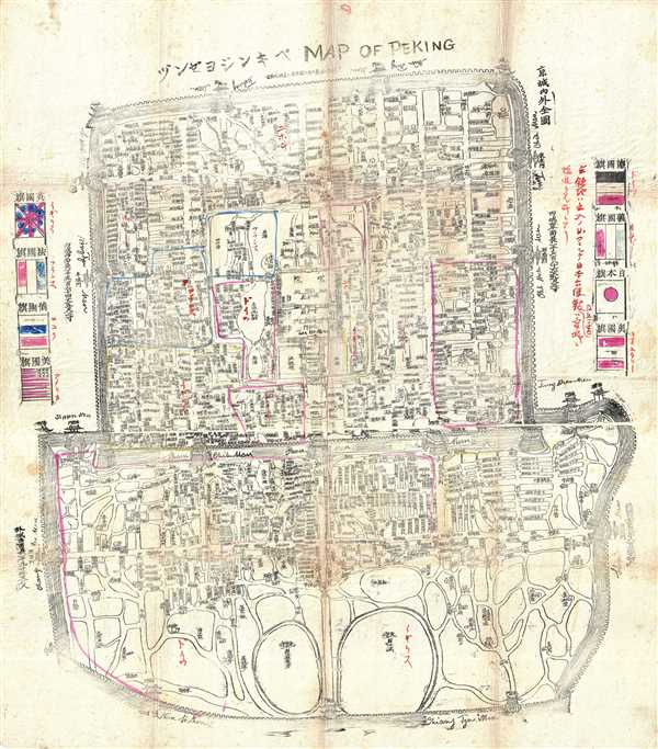
Map of Peking.
sold
- Digital Map Information
- Suitable for large format printing
- Full resolution TIFF file
- ICC color profile embedded
- Delivered instantly via download link
This is an extremely rare c.1900 Japanese woodblock map of Beijing or Peking. Centered on the Forbidden City, the map depicts the city during the Boxer Rebellion (Yihetuan Movement) of 1900. It depicts Beijing ... (more details)
Thomson's map of modern day Burma and Thailand during a period of Burmese ascendency.

Birman Empire.
sold
- Digital Map Information
- Suitable for large format printing
- DPI: 300
- File Size: 13.92 MB
- File Type: ZIP / TIFF
- ICC color profile embedded
- Delivered instantly via download link
An attractive and uncommon 1817 map of Burma and Thailand (Siam). Centered on Rangoon, this map covers from Bhutan and Assam, eastward as far as Vietnam and the Gulf of Tonkin (Vietnam), and south ward as far ... (more details)
One of the iconic maps of the golden age of Pictorial Maps.

A Map and History of Peiping; formerly known as Peking; capital of provinces, princedoms, and kingdoms since 1121 B.C.; in 1264 A.D. the capital of the Mongol Empire of Kublai Khan; made the capital of the Ming Empire and built as it is today by Yung Lo in 1421; continued as the capital of the Chinese Empire through the Ming and Ching Dynasties; and now a city which will live long in the memory of man as one of the greatest the world has ever known. Completed on this fifth day of February in the year of our Lord Nineteen Hundred and Thirty-six.
sold
- Digital Map Information
- Suitable for large format printing
- File Size: 12.67 MB
- File Type: ZIP / TIFF
- ICC color profile embedded
- Delivered instantly via download link
An example of Frank Dorn's iconic 1936 chromolithograph pictorial map of Beijing or Peking, China. It is considered one of the great maps from the Golden Age of Pictorial Cartography. The map captures Beijing in the days leading up to World War II (1939 - 1945) - though by this time, China was already at odds with Japan, and the Second Sino-Japanese War (1937 - 1945), a precursor to WWII in Asia, was brewing. (more details)
Enigmatic early map of China from the late 18th or early 19th centuries.

[China]
sold
- Digital Map Information
- Suitable for large format printing
- Full resolution TIFF file
- ICC color profile embedded
- Delivered instantly via download link
A very unusual an enigmatic early Chinese language grand format manuscript map of China on mulberry paper with old color. This map most likely dates from the late 18th or early 19th century and may be an Edo ... (more details)