
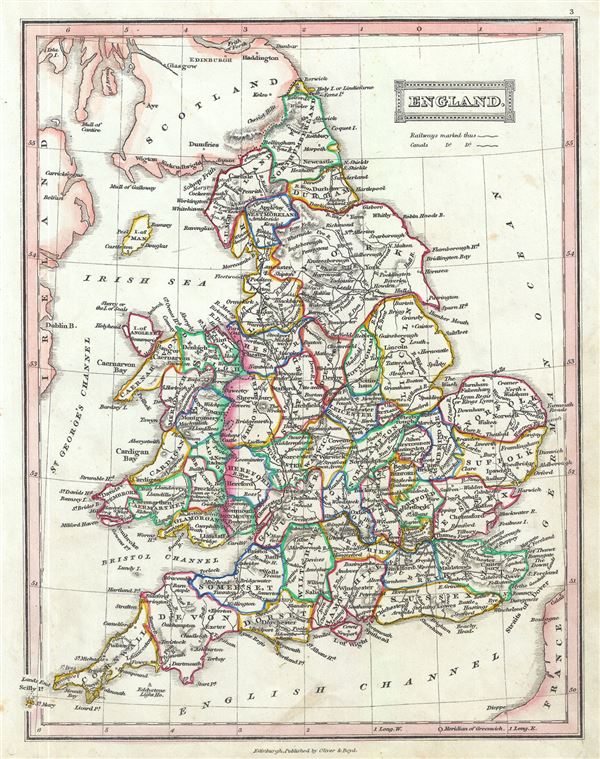
England.
sold
- Digital Map Information
- Suitable for large format printing
- Full resolution TIFF file
- ICC color profile embedded
- Delivered instantly via download link
This is an attractive 1845 map of England and Wales by Thomas Ewing. The map covers both England and Wales from Northumberland to Cornwall, including the Isle of Man. Throughout, the map identifies various cities, towns, rivers, lakes, roadways and an assortment ... (more details)
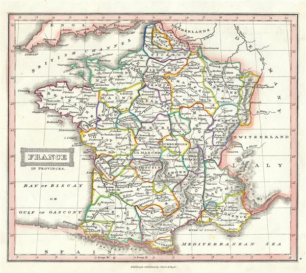
France in Provinces.
sold
- Digital Map Information
- Suitable for large format printing
- Full resolution TIFF file
- ICC color profile embedded
- Delivered instantly via download link
This is a lovely example of Thomas Ewing's 1845 map of France. The map covers the Kingdom of France showing its various divisions according to province. It covers from the Flanders in the north to Roussillon in the south and from Brittany in the west to Alsace ... (more details)
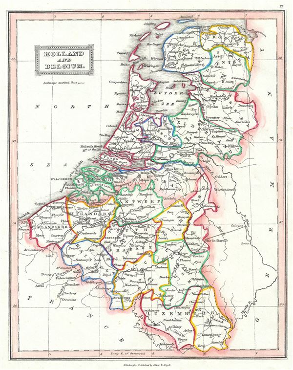
Holland and Belgium.
sold
- Digital Map Information
- Suitable for large format printing
- Full resolution TIFF file
- ICC color profile embedded
- Delivered instantly via download link
This is a lovely example of the 1845 Thomas Ewing map of Holland (The Netherlands) and Belgium. The map covers the United Kingdom of Netherlands including Holland, Belgium and Luxembourg from the North Sea to the Duchy of Luxembourg. Divided and color coded ... (more details)

Hindostan.
sold
- Digital Map Information
- Suitable for large format printing
- Full resolution TIFF file
- ICC color profile embedded
- Delivered instantly via download link
This is a lovely example of the Thomas Ewing's 1845 map of India and Pakistan. It covers the Indian subcontinent from the Indian Caucasus Mountains to the Indian Ocean and includes Ceylon or Sri Lanka and part of Kabul in Afghanistan. The map is coded with ... (more details)
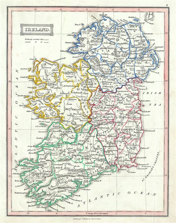
Ireland.
sold
- Digital Map Information
- Suitable for large format printing
- Full resolution TIFF file
- ICC color profile embedded
- Delivered instantly via download link
This is a beautiful example of Thomas Ewing's 1845 map of Ireland. The map shows all of Ireland from Donegal in the north to Cork in the south. After the Norman Invasion the old provincial structure was supplemented with modern system of counties â€' ... (more details)
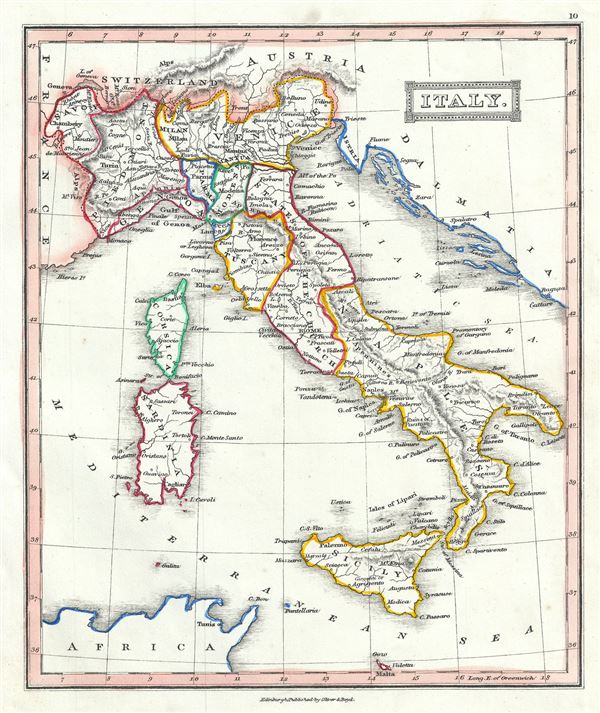
Italy.
sold
- Digital Map Information
- Suitable for large format printing
- Full resolution TIFF file
- ICC color profile embedded
- Delivered instantly via download link
This is an attractive 1845 map of Italy by Thomas Ewing. It covers the pre-Garibaldi Italy split into numerous small duchies and states from Venetian Lombardy south to Sicily and Malta. Also includes the islands of Sardinia and Corsica. The map is ... (more details)
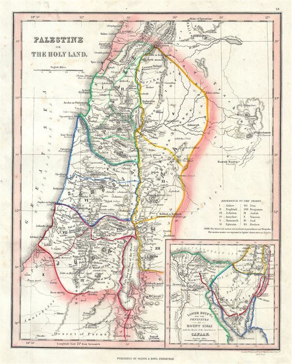
Palestine or the Holy Land.
sold
- Digital Map Information
- Suitable for large format printing
- Full resolution TIFF file
- ICC color profile embedded
- Delivered instantly via download link
This is a scarce 1845 Thomas Ewing map of Ancient Palestine, Israel or the Holy Land. It covers the region as it existed in Biblical times with divisions for each of the Twelve Tribes of Israel and includes the modern day nations of Israel, ... (more details)
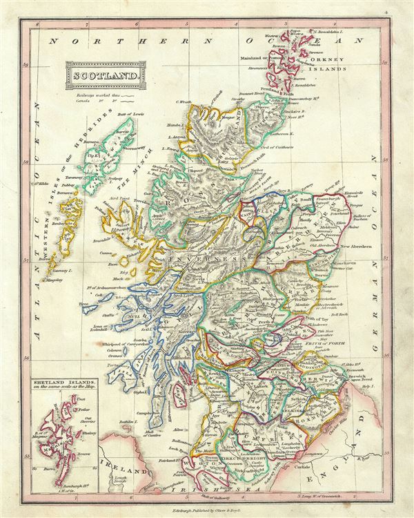
Scotland.
sold
- Digital Map Information
- Suitable for large format printing
- Full resolution TIFF file
- ICC color profile embedded
- Delivered instantly via download link
This is a beautiful example of Thomas Ewing's 1845 map of Scotland. It covers Scotland from the Orkney Islands to Wigton in the South inclusive of the Hebrides. An inset on the top left quadrant details the Shetland Islands. Various ... (more details)
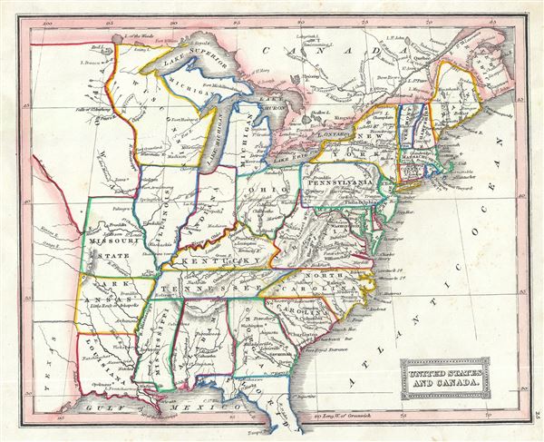
United States and Canada.
sold
- Digital Map Information
- Suitable for large format printing
- Full resolution TIFF file
- ICC color profile embedded
- Delivered instantly via download link
This is a fascinating 1845 Thomas Ewing map of the United States including parts of Canada. The map covers the United States east of the Mississippi as well as the Trans-Mississippi territories of Louisiana, Arkansas and Missouri. ... (more details)
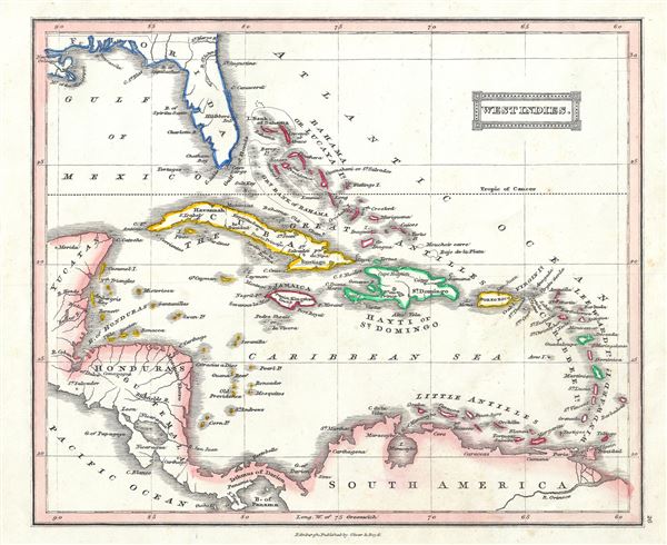
West Indies.
sold
- Digital Map Information
- Suitable for large format printing
- Full resolution TIFF file
- ICC color profile embedded
- Delivered instantly via download link
This is a lovely example of Thomas Ewing's 1845 map of West Indies. Centered on Haiti or Santo Domingo, it covers the Caribbean from Florida to the Bay of Panama and from Yucatan to the Lesser Antilles and Barbados. It includes ... (more details)
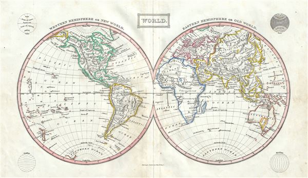
World.
sold
- Digital Map Information
- Suitable for large format printing
- Full resolution TIFF file
- ICC color profile embedded
- Delivered instantly via download link
This is a fine example of Thomas Ewing's 1845 map of the World in two hemispheres. Both the Western and Eastern Hemispheres are drawn and offer a fascinating snapshot of the world during a period of rapid globalization and ... (more details)
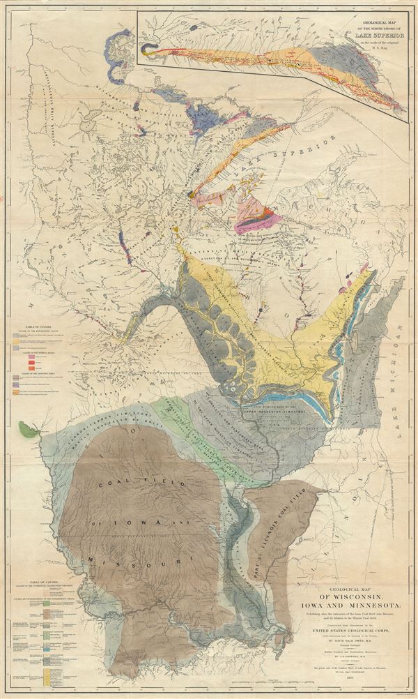
Geological Map of Wisconsin, Iowa and Minnesota: Exhibiting also, the extension of the Iowa Coal-field into Missouri, and its relation to the Illinois Coal-field.
sold
- Digital Map Information
- Suitable for large format printing
- Full resolution TIFF file
- ICC color profile embedded
- Delivered instantly via download link
This is a beautiful large geological map of Wisconsin, Iowa and Minnesota by the United States Geological Corps. It covers from the Missouri River east as far as Lake Michigan and from Osage River north to the Lake of the ... (more details)
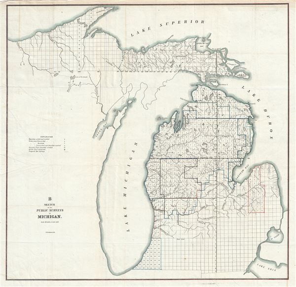
B Sketch of the Public Survey in Michigan.
sold
- Digital Map Information
- Suitable for large format printing
- Full resolution TIFF file
- ICC color profile embedded
- Delivered instantly via download link
This is an attractive example of the 1855 public survey map of Michigan. It covers the entire state of Michigan from Lake Superior to Lake Erie, including the entirety of Lake Michigan. The state of the Land Survey in this ... (more details)

Map of the Routes in India, with tables of distances between the Principal Towns and Military Stations.
sold
- Digital Map Information
- Suitable for large format printing
- Full resolution TIFF file
- ICC color profile embedded
- Delivered instantly via download link
This is an excellent 1857 map of India by William H. Allen and Company. It covers the Indian subcontinent from Pakistan to Sri Lanka. The map is highly detailed, noting military stations, post offices, roads, railways, ... (more details)

General Birds-Eye View of Washington and the Vicinity, Showing the Forts, Camps, Railroads, Rivers, etc.
sold
- Digital Map Information
- Suitable for large format printing
- Full resolution TIFF file
- ICC color profile embedded
- Delivered instantly via download link
This is a stunning 1862 birds-eye view map or view of Washington D. C. and vicinity issued in the January 4, 1862 edition of Harper's Weekly. This view offers a fascinating snapshot of the nation's capitol shortly after ... (more details)
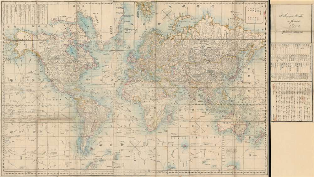
Bankoku Kōkai-zu / 萬国航海圖 / World Navigational Map.
sold
- Digital Map Information
- Suitable for large format printing
- Full resolution TIFF file
- ICC color profile embedded
- Delivered instantly via download link
This is a remarkable 1862 Yokohama Published Japanese large format Japanese map of the world by Edward Schnell and Kango Takeda. This map is based upon an English map drawn by John Purdy and others in 1845. Kango Takeda ... (more details)
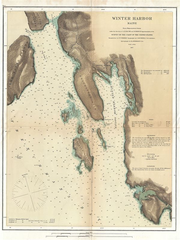
Winter Harbor Maine.
sold
- Digital Map Information
- Suitable for large format printing
- File Size: 7.17 MB
- File Type: ZIP / TIFF
- ICC color profile embedded
- Delivered instantly via download link
This is an uncommon 1867 U.S. Coast Survey map of Winter Harbor Maine. The map covers the eastern shore of Frenchman's Bay and Winter Harbor Sound from Jordan's Island, Halibut Hole, and Iron Bound Island eastward as ... (more details)

Map of Long Island showing the Long Island Railroad and Connections.
sold
- Digital Map Information
- Suitable for large format printing
- Full resolution TIFF file
- ICC color profile embedded
- Delivered instantly via download link
This appealing map of Long Island was issued in 1884 by the Long Island Railroad. It depicts Long Island in full inclusive of Manhattan, Brooklyn, Queens, the Long Island Sound, the southern shore of Connecticut and ... (more details)

The Good Old Game of Innocence Abroad.
sold
This is a charming and unusual 1888 board game by the Parker Brothers. This game, titled Innocence Abroad, was the first game produced under licence by the Parker Brothers. It consists of a game board with a ... (more details)
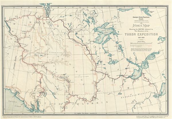
Index Map Shewing the Routes followed by The Members of the Yukon Expedition 1887 - 1888.
sold
This is a scarce 1891 map of the Yukon Expedition in 1887 - 1888 issued by the Geological Survey Department of Canada. It covers from the ruins of Fort Yukon east to Athabasca Lake and from Mackenzie Bay ... (more details)