
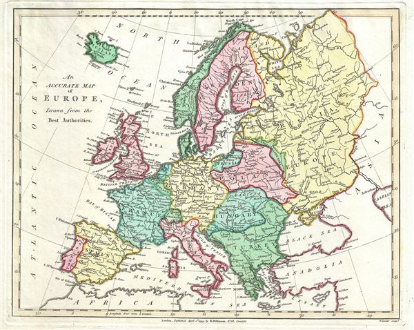
An Accurate Map of Europe, Drawn from the Best Authorities.
sold
- Digital Map Information
- Suitable for large format printing
- Full resolution TIFF file
- ICC color profile embedded
- Delivered instantly via download link
This is Robert Wilkinson's finely detailed 1793 map of Europe. It covers the entire European continent, including Iceland. It also includes western Russia and the Black Sea. Poland is shown with its traditional boundaries though by this point it had gone through ... (more details)

A New Map of Sweden, Denmark and Norway.
sold
- Digital Map Information
- Suitable for large format printing
- Full resolution TIFF file
- ICC color profile embedded
- Delivered instantly via download link
This is a finely detailed 1793 map of Scandinavia, by Robert Wilkinson. It includes Norway, Denmark, Sweden and Finland (then part of Sweden). It features the Lapland region as a whole, including its provinces in Finland and Sweden and shows the adjacent countries ... (more details)
Stunning of upper Manahattan drawn to illustrate the Battle of Harlem Heights.
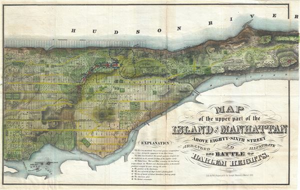
Map of the Upper Part of the Island of Manhattan above eighty-sixth street arranged to illustrate the Battle of Harlem Heights.
sold
- Digital Map Information
- Suitable for large format printing
- Full resolution TIFF file
- ICC color profile embedded
- Delivered instantly via download link
A stunning and rare 1868 Map of the northern part of the island of Manhattan, New York city by W. C. Rogers. The map covers the upper part of Manhattan, above 86th street (including Morningside Heights, Manhattan Valley, Harlem, Inwood, the Upper West Side, the ... (more details)
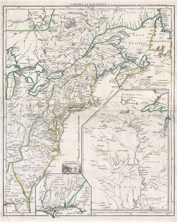
Canada et Louisiane.
sold
- Digital Map Information
- Suitable for large format printing
- DPI: 300
- File Size: 16.58 MB
- File Type: ZIP / TIFF
- ICC color profile embedded
- Delivered instantly via download link
A scarce 1755 map of the eastern part of North America by Georges-Louis Le Rouge. This important map was issued in the second year of the French and Indian War. Centered on the British colonies in North America, the main map covers from Lake Michigan (Chicago) ... (more details)
Uncommon early map of Bermuda.

Mappa Aestivarum Insularum Alias Bermudas Dictarum ad Ostia Mexicane …
sold
- Digital Map Information
- Suitable for large format printing
- Full resolution TIFF file
- ICC color profile embedded
- Delivered instantly via download link
A scarce c. 1630 small format map of Bermuda by Johannes Cloppenburg. Based upon an earlier maps by Gerard Mercator and John Speed, this map shows the whole of Bermuda. Around the edges of the map parts of neighboring islands and the mainland of North America ... (more details)
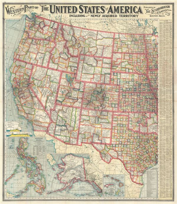
Western Part of The United States of America including all the Newly Acquired Territory.
sold
- Digital Map Information
- Suitable for large format printing
- Full resolution TIFF file
- ICC color profile embedded
- Delivered instantly via download link
This is a large and beautifully detailed 1903 map of the western part of the United States by the Scarborough Company. This pocket map covers the United States westward from North Dakota, South Dakota, Nebraska, Kansas, Oklahoma and Texas and includes parts of ... (more details)
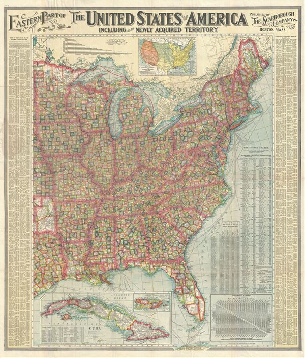
Eastern Part of The United States of America including all the Newly Acquired Territory.
sold
- Digital Map Information
- Suitable for large format printing
- Full resolution TIFF file
- ICC color profile embedded
- Delivered instantly via download link
This is a large and beautifully detailed 1903 map of the eastern part of the United States by the Scarborough Company. This pocket map covers the United States East of Minnesota, Iowa, Missouri, Arkansas and Louisiana, including parts of Nebraska, Kansas, ... (more details)

South America.
sold
- Digital Map Information
- Suitable for large format printing
- DPI: 300
- File Size: 6.05 MB
- File Type: ZIP / TIFF
- ICC color profile embedded
- Delivered instantly via download link
This is a beautiful example of the 1842 Society for the Diffusion of Useful Knowledge or S.D.U.K. map of South America. It covers the entire continent from the Caribbean to Tierra del Fuego and from the Pacific to the Atlantic, including the Falkland ... (more details)
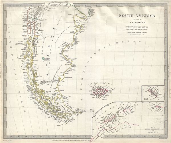
South America Sheet V Patagonia.
sold
- Digital Map Information
- Suitable for large format printing
- DPI: 300
- File Size: 5.18 MB
- File Type: ZIP / TIFF
- ICC color profile embedded
- Delivered instantly via download link
This is a fine example of the 1838 Society for the Diffusion of Useful Knowledge or S.D.U.K. map of Patagonia or modern day Argentina and Chile, including the Falkland Islands and Tierra del Fuego. Towns, rivers, mountains, lakes and other ... (more details)

South America Sheet III South Brazil with Paraguay and Uruguay.
sold
- Digital Map Information
- Suitable for large format printing
- DPI: 300
- File Size: 7.39 MB
- File Type: ZIP / TIFF
- ICC color profile embedded
- Delivered instantly via download link
This is a fine example of the 1837 Society for the Diffusion of Useful Knowledge or S.D.U.K. map of Uruguay, Paraguay and Southern Brazil. It covers from San Salvador south as far as Buenos Aires. The map also notes part of the Rio Grande ... (more details)
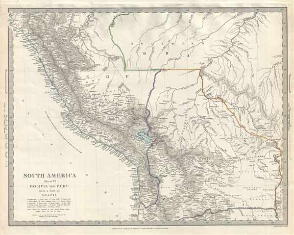
South America Sheet VI Bolivia and Peru with a Part of Brazil.
sold
- Digital Map Information
- Suitable for large format printing
- DPI: 300
- File Size: 6.32 MB
- File Type: ZIP / TIFF
- ICC color profile embedded
- Delivered instantly via download link
This is a fine example of the 1844 Society for the Diffusion of Useful Knowledge or S.D.U.K. map of Bolivia and Peru. It covers Peru, Bolivia and part of Brazil. Throughout, the map identifies various cities, towns, rivers, mountain ... (more details)
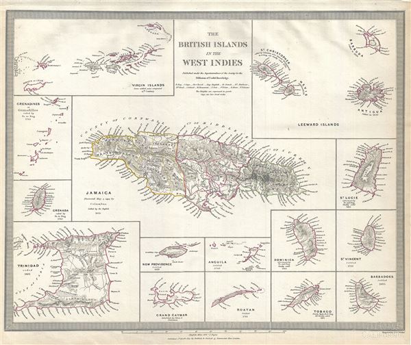
The British Islands in the West Indies.
sold
- Digital Map Information
- Suitable for large format printing
- DPI: 300
- File Size: 6.06 MB
- File Type: ZIP / TIFF
- ICC color profile embedded
- Delivered instantly via download link
This is a fine 1835 example of the Society for the Diffusion of Useful Knowledge or S.D.U.K. map of the British Islands in the West Indies. Essentially fifteen maps on one sheet and centered on a large map of Jamaica, it covers the ... (more details)

The Antilles or West India Islands.
sold
- Digital Map Information
- Suitable for large format printing
- DPI: 300
- File Size: 4.97 MB
- File Type: ZIP / TIFF
- ICC color profile embedded
- Delivered instantly via download link
This is a beautiful 1835 map of the West Indies and Caribbean by the Society for the Diffusion of Useful Knowledge or S.D.U.K. It covers from Florida to the Spanish Main and from Guatemala to the Lesser Antilles and Trinidad. It ... (more details)

Western Australia Containing the Settlements of Swan-River and King George's Sound. Van-Diemen Island.
sold
- Digital Map Information
- Suitable for large format printing
- DPI: 300
- File Size: 5.71 MB
- File Type: ZIP / TIFF
- ICC color profile embedded
- Delivered instantly via download link
This is a scarce and beautiful 1833 Society for the Diffusion of Useful Knowledge or S.D.U.K.'s historic map of Western Australia and Tasmania or Van Diemen's Land. Essentially two maps on one sheet, the leftmost map details ... (more details)

South Africa.
sold
- Digital Map Information
- Suitable for large format printing
- DPI: 300
- File Size: 6.98 MB
- File Type: ZIP / TIFF
- ICC color profile embedded
- Delivered instantly via download link
This is a scarce 1834 map of South Africa by the Society for the Diffusion of Useful Knowledge or S.D.U.K. It covers modern day South Africa from Delagoa Bay (modern day Maputo Bay) to Luderitz Bay, originally named Angra ... (more details)

The Island of New Zealand.
sold
- Digital Map Information
- Suitable for large format printing
- DPI: 300
- File Size: 4.66 MB
- File Type: ZIP / TIFF
- ICC color profile embedded
- Delivered instantly via download link
This is a beautiful 1838 map of New Zealand by the Society for the Diffusion of Useful Knowledge or S.D.U.K. It covers the entire island country from Cape Reinga (C. Maria Van Diemen) to Stewart Island. Various cities, ... (more details)
Uncommon map showing Jefferson's proposed states and the first map to name Michigan as a body of land.
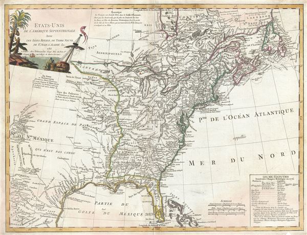
Etats-Unis De L'Amerique Septentrionale Avec Les Isles Royale, De Terre Neuve, De St. Jean, L'Acadie.
sold
- Digital Map Information
- Suitable for large format printing
- DPI: 300
- File Size: 18.14 MB
- File Type: ZIP / TIFF
- ICC color profile embedded
- Delivered instantly via download link
An uncommon and important 1785 Charles Delamarche and Robert de Vaugondy map of the fledgling United States shortly after the end of the American Revolutionary War. This map is important as the first to describe the ... (more details)
Unusual German map illustrating the outbreak of the American Revolutionary War to a French Audience.

Carte Nouvelle de L'Amerique Angloise contenant tout ce que les Anglois possedent sur le Continent de L'Amerique Septentrionale savoir le Canada, la Nouvelle Ecosse ou Acadie, les treize Provinces unies
sold
- Digital Map Information
- Suitable for large format printing
- DPI: 300
- File Size: 68.49 MB
- File Type: ZIP / TIFF
- ICC color profile embedded
- Delivered instantly via download link
An uncommon 1776 Mathais Albrecht Lotter map of the United States on the cusp of the American Revolutionary War. Focused on the 13 original British Colonies, this map covers from Florida to Newfoundland and t Hudson ... (more details)

A Map of the Principal Rivers shewing their Courses, Countries, and Comparative Lengths.
sold
- Digital Map Information
- Suitable for large format printing
- DPI: 300
- File Size: 5.65 MB
- File Type: ZIP / TIFF
- ICC color profile embedded
- Delivered instantly via download link
This curious comparative rivers chart published in 1834 by the Society for the Diffusion of Useful Knowledge or S.D.U.K. is somewhat unique in that it imagines all of the great rivers of the world letting out into a ... (more details)

North America Sheet XIII Parts of Louisiana, Arkansas, Mississippi, Alabama and Florida.
sold
- Digital Map Information
- Suitable for large format printing
- DPI: 300
- File Size: 6.75 MB
- File Type: ZIP / TIFF
- ICC color profile embedded
- Delivered instantly via download link
This is an uncommon 1833 edition of the Society for the Diffusion of Useful Knowledge or S.D.U.K. map of Mississippi, Louisiana and Alabama. It depicts a major portion of the states of Louisiana, Mississippi and ... (more details)